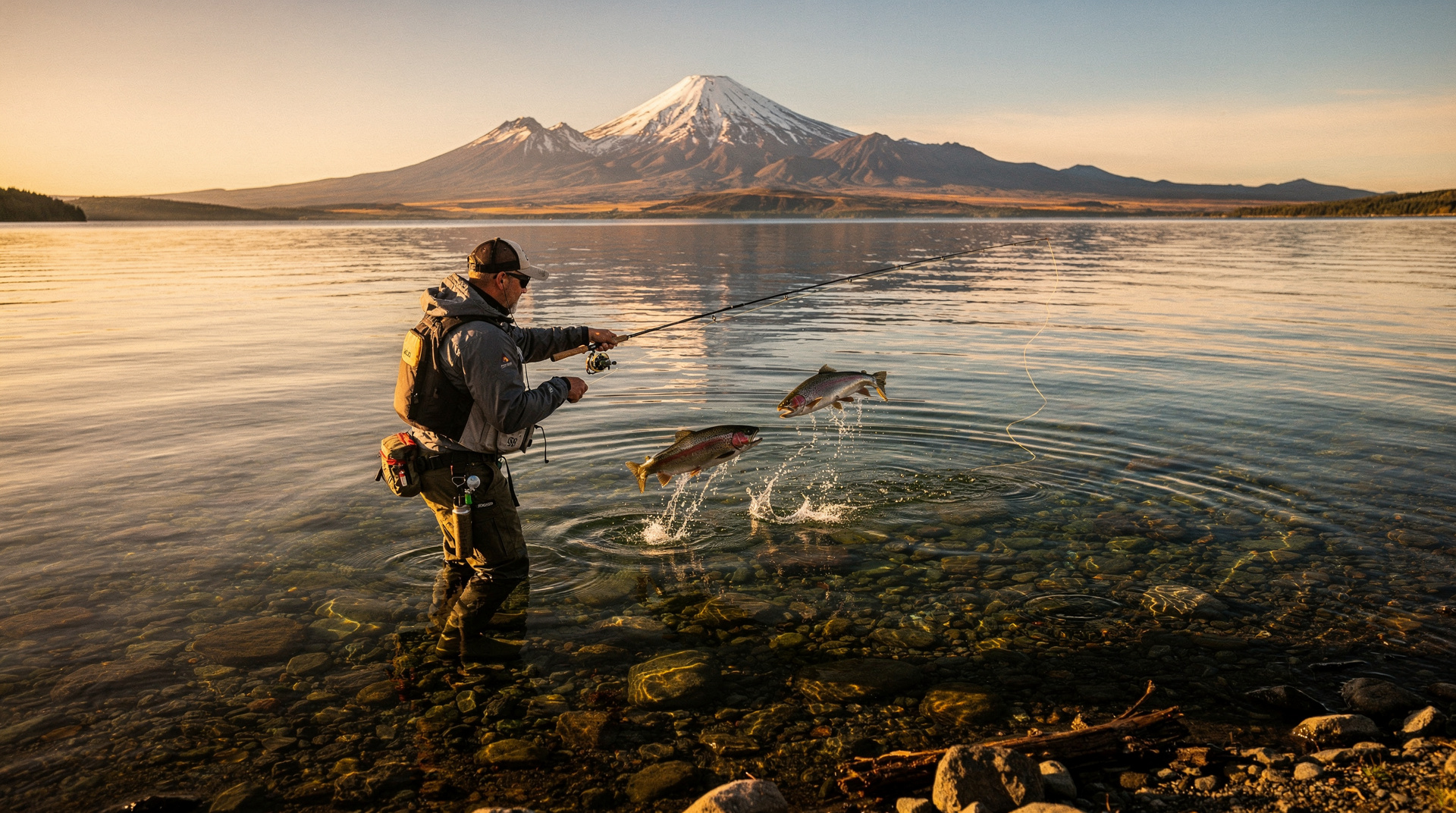
Tongariro National Park
Honest Tongariro guide: Alpine Crossing hike, Mt Ruapehu ski, Ngauruhoe, shuttle logistics, real prices NZD/USD/EUR, and what to expect on the track.
Quick facts
- Distance from Taupo
- 75 km — 1 hour to National Park Village
- Alpine Crossing length
- 19.4 km point-to-point — allow 6–9 hours
- Currency
- NZ$ — USD ~$0.60 / EUR ~€0.55
- Best for
- Best one-day hike in NZ, volcanic landscape, ski Mt Ruapehu
- Season warning
- Alpine Crossing is alpine terrain — weather changes fast; mandatory self-rescue gear in winter
Tongariro National Park in one paragraph
Popular experiences here
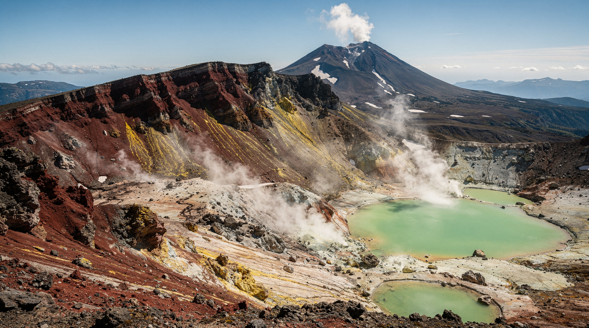
Tongariro is New Zealand’s oldest national park and a dual UNESCO World Heritage Site — both for its natural volcanic landscape and for its significance to Maori as sacred ancestral mountains. The three peaks at its centre — Tongariro, Ngauruhoe, and Ruapehu — are active volcanoes. The Tongariro Alpine Crossing, a 19.4-kilometre one-way track that traverses the saddle between Tongariro and Ngauruhoe past active craters, emerald lakes, and the Red Crater, is consistently rated as one of the best day hikes in the world. In winter, the same mountains are ski fields. The landscape is raw, volcanic, and unlike anything else on Earth.
Why Tongariro deserves its UNESCO status
The cultural significance of Tongariro cannot be overstated. For Ngati Tuwharetoa, the paramount hapu of the Taupo region, the mountains are tupuna — ancestors. The volcanic peaks were gifted to the New Zealand government in 1887 by paramount chief Te Heuheu Tukino IV (Horonuku) as the only way to protect them from being alienated by private purchasers. This act created New Zealand’s first national park and one of the first in the world. The mountains are tapu (sacred); visitors are guests, not conquerors.
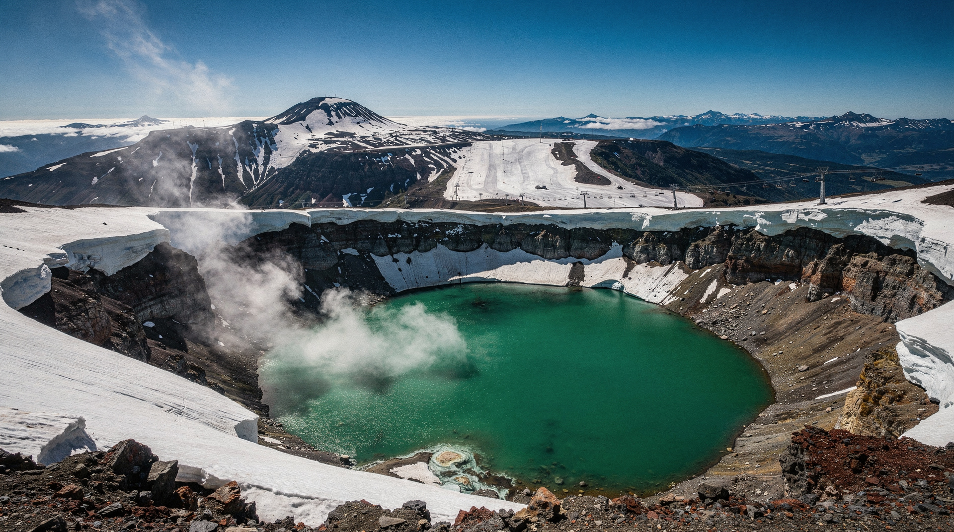
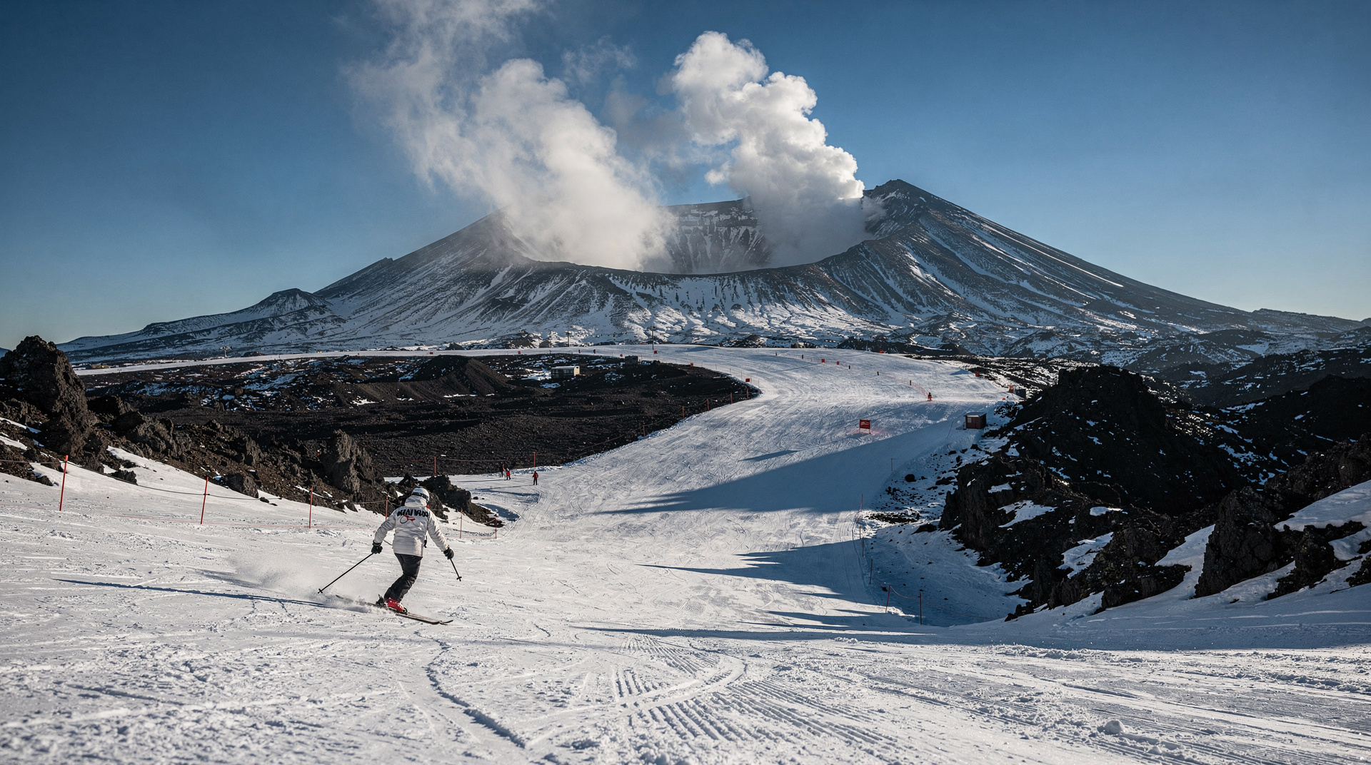
The volcanic activity is real and ongoing. Mount Ruapehu erupted significantly in 1995 and 1996; a smaller eruption in 2006 generated lahars (volcanic mudflows). The Crater Lake on Ruapehu’s summit is a hot acid lake (temperature and pH monitored continuously by GNS Science). Mount Tongariro’s Te Maari craters erupted in 2012. The volcanic hazard is managed by information systems — eruption warning sirens at visitor areas — but the geology is very much alive.
The Tongariro Alpine Crossing: what to expect
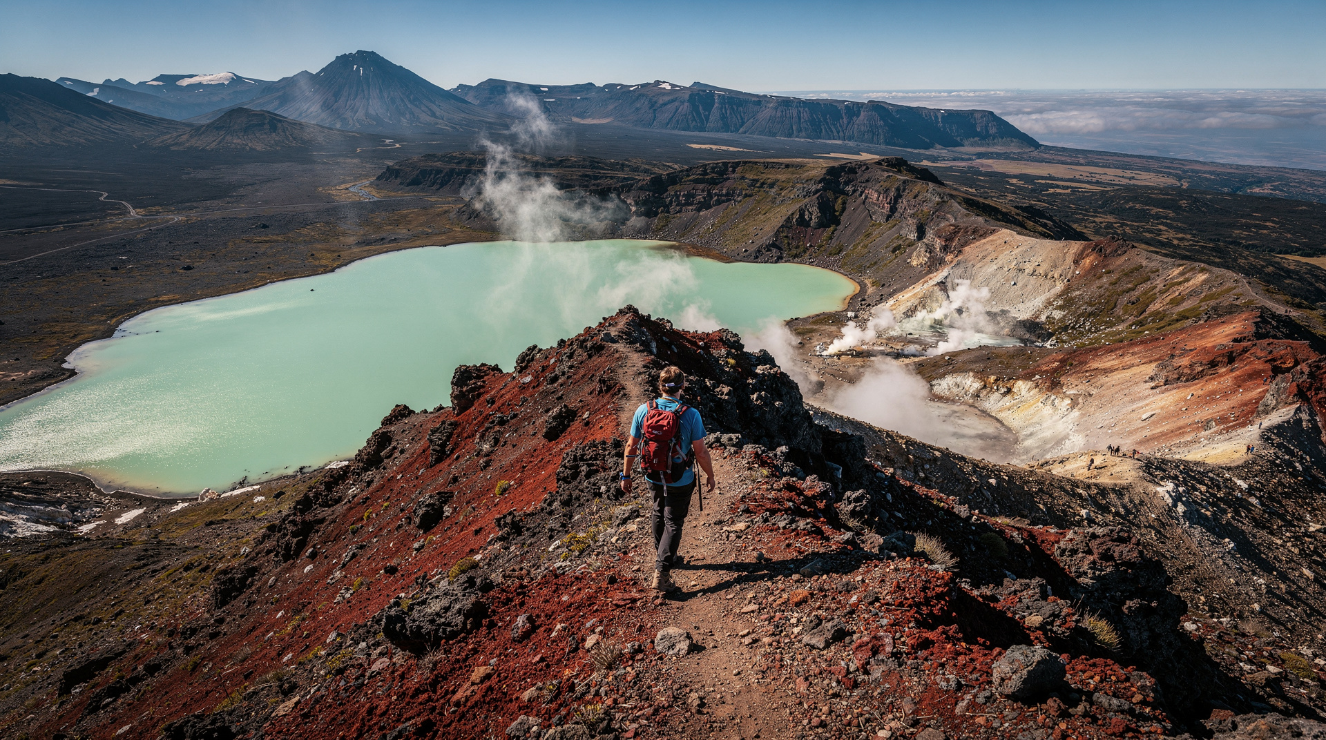
The Crossing begins at Mangatepopo car park on SH48 and ends at Ketetahi car park, 19.4 km to the northeast. It is a one-way track requiring a shuttle service. The full crossing takes between 6 and 9 hours depending on fitness, group pace, and conditions.
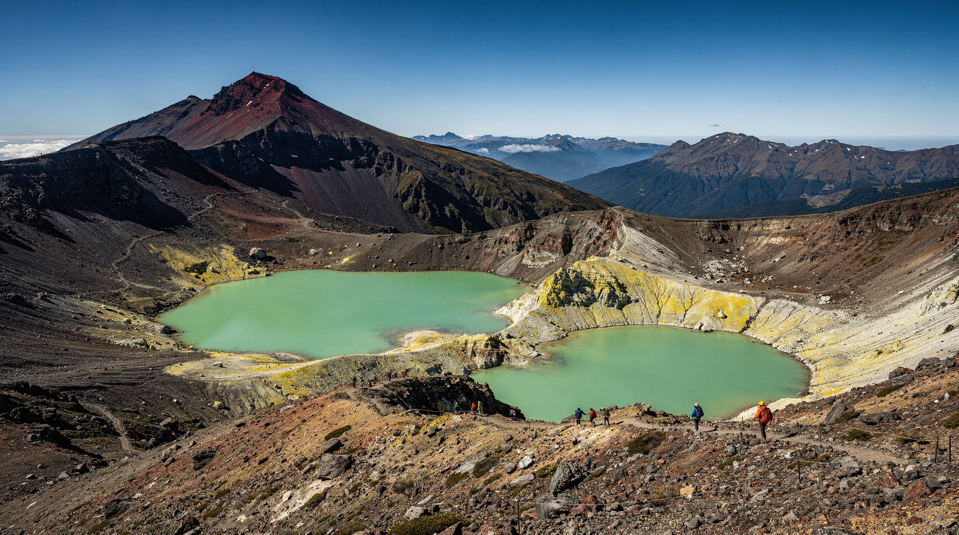
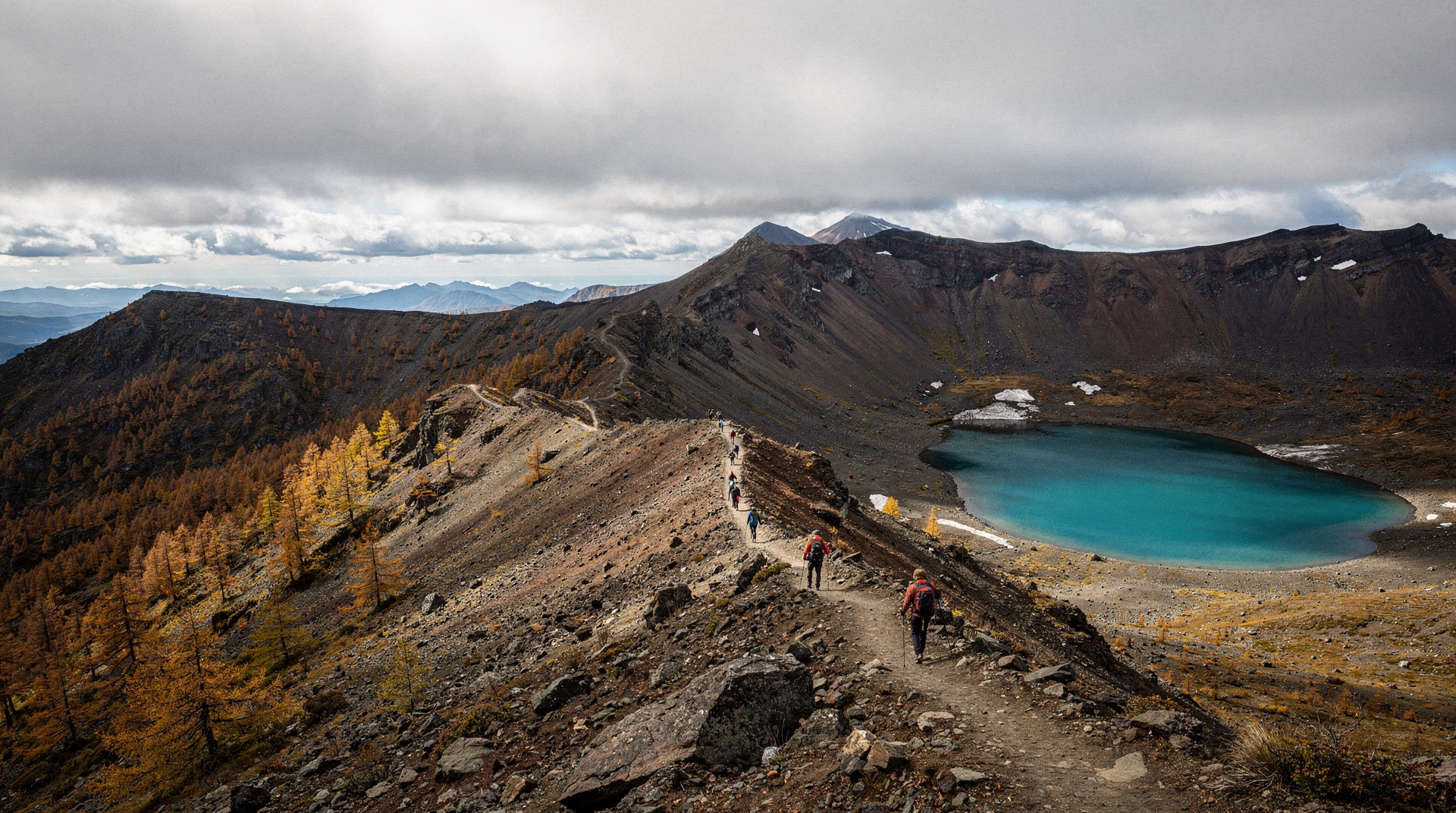
The track climbs through ancient lava flows and volcanic soils to Mangatepopo Valley, then steeply up the Devil’s Staircase to the South Crater plateau. The most dramatic section follows: the Red Crater (active fumaroles, vents, and rust-coloured rock), the Emerald Lakes (three mineral-tinted craters), and the Oturere Valley lava field descent. The Ketetahi section was partially re-routed after the 2012 Te Maari eruption; hikers no longer pass directly below the active crater.
Critical logistics: This is alpine terrain, not a gentle nature walk. Weather changes rapidly, particularly in spring and autumn. In summer (December to February), the track is extremely popular — up to 1,500 people cross in peak conditions, creating genuine trail congestion. Book your shuttle service and accommodation several weeks ahead for summer. In October, November, March, and April, conditions are variable but crowds are smaller.
Mandatory requirement from May to October: Mountain safety rangers check hikers at the Mangatepopo end. In shoulder and winter season, additional gear is required (crampons, ice axe) on the Crossing. The DOC website publishes current conditions — check on the day before departing.
Shuttle options: Private vehicles cannot park at the Mangatepopo trailhead — a mandatory Ketetahi parking scheme means all hikers must use shuttles for at least one end. Shuttles depart from National Park Village, Whakapapa Village, Turangi, and Taupo.
Tongariro Alpine Crossing with Shuttle Transfers
Shuttle transfer for the Alpine Crossing — pickup from National Park Village to Mangatepopo trailhead, return pickup at Ketetahi. Mandatory for the crossing.
From NZD 35–45 / USD 21–27 / EUR 19–25
For those wanting shuttle service from Turangi, the Tongariro Alpine Crossing mountain shuttle from Turangi is the relevant option.
Guided vs self-guided hiking
The Crossing is entirely self-guided if you choose — the track is well-marked, signposted, and managed by DOC. However, a guided experience adds considerably to the volcanic and Maori cultural context.
Tongariro Alpine Crossing: Premium Guided Hike
Premium guided Alpine Crossing: geological interpretation, Maori cultural context, and safety management from an experienced local guide. Full 19.4 km crossing.
From NZD 180–220 / USD 108–132 / EUR 99–121
Highly recommended for first-time visitors or those unfamiliar with alpine conditions.
For visitors who want a shorter, less strenuous taste of the volcanic landscape, the Tongariro Volcanic Explorer half-day guided walk covers the Mangatepopo Valley and lower volcanic fields in 4 hours without the full 19.4 km commitment. NZD 95–115 / USD 57–69 / EUR 52–63.
The Tongariro alpine half-day guided group walk is a similar shorter option through the lower volcanic terrain. Good for those with limited time or fitness concerns.
Mount Ruapehu: ski season
Mt Ruapehu (2,797 m) hosts two ski areas: Whakapapa on the northern slopes (larger, more infrastructure, family-oriented, accessible from Whakapapa Village via SH48) and Turoa on the southern slopes (wider open terrain, accessed from Ohakune). Both are operated by Ruapehu Alpine Lifts.
Ski season runs approximately June to October, weather dependent. Lift passes NZD 119–149 / USD 71–89 / EUR 65–82 for a full day depending on conditions. Ski rental packages NZD 55–75 / USD 33–45 / EUR 30–41. Lessons available at both mountains.
The summit Crater Lake is not accessible to skiers and is separated from the ski areas; DOC hazard monitoring covers the entire mountain.
Ohakune (17 km south of Turoa ski area) is the most popular ski town in the North Island, with a lively winter scene entirely unlike its sleepy summer character. Accommodation fills rapidly in July school holidays — book 6–8 weeks ahead.
The Tongariro Northern Circuit
For multi-day hikers, the Tongariro Northern Circuit is one of New Zealand’s 11 Great Walks: a 3–4 day loop passing through the same alpine volcanic landscape as the Crossing, with additional sections including the Oturere Valley and Waihohonu Hut. DOC hut passes required; book at least 3–6 months ahead for peak season (October to April). Huts NZD 40–55 / USD 24–33 / EUR 22–30 per night. Off-season (May–September), huts are open but unserviced, and conditions may require crampons.
Where to stay near Tongariro
National Park Village (3 km from Whakapapa Village): The closest settlement to both the Alpine Crossing shuttles and Whakapapa ski field. Accommodation ranges from ski lodges to backpacker hostels. The Plateau Lodge and Discovery Lodge are reliable mid-range options at NZD 140–220 / USD 84–132 / EUR 77–121. Backpacker accommodation (Ruapehu Mountain Lodge, YHA National Park) from NZD 35–55 / USD 21–33 / EUR 19–30 dorm beds.
Whakapapa Village (DOC-managed): Limited accommodation including the Skotel Alpine Resort (NZD 160–260 / USD 96–156 / EUR 88–143) and the historic Chateau Tongariro Hotel (NZD 250–380 / USD 150–228 / EUR 138–209 — a heritage property with an excellent position at 1,100 m altitude overlooking the volcanic plateau).
Ohakune (ski season base): A livelier town with better dining and nightlife in winter. Good motel and lodge options at NZD 120–200 / USD 72–120 / EUR 66–110.
Taupo (75 km): For visitors who want better facilities and don’t mind the extra 30 minutes to the crossing shuttles. See the Taupo guide.
What to eat
Food options near the park are limited. Whakapapa Village has the Chateau Tongariro dining room (formal, reliable) and a basic cafe. National Park Village has the Station Cafe (good coffee, solid burgers), and Tussock Pizza in the evening. Ohakune has a much better restaurant scene in winter, including Powderkeg Restaurant and Bar.
Pre-purchase your tramping food and snacks in Taupo, Turangi, or Ohakune before heading to the park — the small general store at National Park has limited, expensive provisions.
Skip / worth it / splurge
- Attempting the Alpine Crossing in marginal weather without alpine experience — the rescue rate for poorly prepared hikers is significant and ruins the experience for you and others
- The full crossing if you’re not physically fit — the 19.4 km with 760 m of ascent and 1,150 m of descent is demanding; the half-day volcanic explorer option is a better fit for moderate fitness
- The full Alpine Crossing on a clear day — one of the most extraordinary landscapes you’ll walk through anywhere on Earth
- A guided crossing for the geological and cultural interpretation — the experience is richer with context
- Helicopter transfer to the Red Crater or summit lookout (when available) for a perspective most hikers don’t see
Cost breakdown
Tongariro National Park activity costs
| Item | NZD | USD | EUR | Verdict |
|---|---|---|---|---|
| Alpine Crossing shuttle transfers Mandatory — no parking at Ketetahi end | 35–45 | 21–27 | 19–25 | |
| Premium guided Alpine Crossing Includes geological + cultural context | 180–220 | 108–132 | 99–121 | |
| Half-day volcanic explorer walk Best option for moderate fitness | 95–115 | 57–69 | 52–63 | |
| Whakapapa or Turoa ski lift pass Season June–October | 119–149 | 71–89 | 65–82 | |
| Ski rental package Available at both mountains | 55–75 | 33–45 | 30–41 | |
| Chateau Tongariro Hotel (per night) Heritage property, 1,100 m altitude | 250–380 | 150–228 | 138–209 |
How Tongariro fits in your itinerary
On a 7-day North Island itinerary, Tongariro works as a one-night stay — arrive afternoon, early morning shuttle to the Crossing (5am pickup for a 6am trailhead start to beat crowds), back to National Park Village by 3–4pm, then drive to Wellington (2.5 hours to Palmerston North, another 1.5 to Wellington).
On a 14-day New Zealand itinerary, Tongariro can justify two nights — one for the Crossing and one for ski (in winter), a short walk up Whakapapa Valley, or the Crater Lake guided walk.
See the Taupo guide for the natural preceding night before the Crossing.
Lord of the Rings and the mountains
The Tongariro volcanic landscape served as Peter Jackson’s Mordor in the Lord of the Rings trilogy. Mount Ngauruhoe, the perfectly symmetrical cone visible from the Crossing, was used as Mount Doom — though the filming took place on the lower slopes and against a blue screen, with the summit digital. The volcanic plateau seen from Mangatepopo Valley (the start of the Crossing) and the Oturere Valley lava fields (the descent section) formed the visual basis for the desolation of the Mordor plain.
Interestingly, Ngati Tuwharetoa asked that Ngauruhoe’s actual name and sacred status be acknowledged in any association with the films, rather than it being permanently referred to as “Mount Doom” in promotional material. The mountain retains its own identity and significance independent of any film franchise.
Visitors who walk the Crossing without the LOTR context often find it more powerful, not less — the volcanic landscape stands entirely on its own merits and doesn’t need a fantasy overlay to be extraordinary.
The Tongariro Northern Circuit in detail
The Tongariro Northern Circuit is the Great Walk version of the Crossing area — a 43-km, 3–4 day loop that covers the Crossing section but extends further around the mountain, taking in the Oturere Valley, the Waihohonu Hut area, and the northern side of the volcano.
Day 1 (Whakapapa Village to Mangatepopo Hut): 9 km, 3 hours, gentle farm and stream terrain Day 2 (Mangatepopo to Oturere): 14 km, 6–7 hours — includes the full Alpine Crossing section Day 3 (Oturere to Waihohonu): 9 km, 3 hours — through the spectacular Oturere lava field Day 4 (Waihohonu to Whakapapa): 11 km, 4 hours — through tussock grassland
DOC hut passes are required: NZD 40–55 / USD 24–33 / EUR 22–30 per night per hut. Booking opens 1 June for the upcoming October–April season. Peak dates (particularly the school holiday weeks in January) sell out within days of opening. Set a calendar reminder for 1 June if you want specific dates.
The Circuit gives a fundamentally different experience from the day Crossing — the extended time allows the volcanic landscape to reveal its subtleties. The Oturere lava field in particular (accessible only on the Circuit or a long side trip from the Crossing) is one of the most eerie and beautiful landscapes in New Zealand.
Winter at Tongariro: ski season details
Whakapapa ski area (on the northern slopes of Mt Ruapehu):
- 43 groomed trails across beginner, intermediate, and advanced terrain
- 15 lifts including high-speed chair
- Altitude: 1,627–2,300 m
- Nearest accommodation: Whakapapa Village (5 min drive) and National Park Village (20 min)
- Full-day lift pass NZD 119–149 / USD 71–89 / EUR 65–82
- Rental packages from NZD 55 / USD 33 / EUR 30
Turoa ski area (on the southern/western slopes of Mt Ruapehu, accessed from Ohakune):
- 500 hectares of open terrain; longer runs than Whakapapa
- Known for powder skiing in good conditions
- 8 km of vertical drop from the high alpine (2,322 m) to the base
- Nearest accommodation: Ohakune (17 km)
- Full-day lift pass same as Whakapapa; rental packages comparable
The two ski areas are managed by the same company but are separate mountains — you cannot ski between them in a day. Whakapapa suits beginners and families with young children (more beginner terrain, better ski school facilities); Turoa suits intermediate to advanced skiers seeking longer runs and wider terrain.
Key dates: Season opens mid-June (weather dependent), typically closes late October. July school holidays are the busiest period — book lift passes and accommodation well ahead. August and September often have the best snow conditions and fewer crowds.
Frequently asked questions about Tongariro National Park
Is the Tongariro Alpine Crossing the best day hike in New Zealand?
Consistently rated as one of the top day hikes in the world, the Crossing’s combination of active volcanic craters, emerald lakes, and dramatic ridgeline walking is singular. For sheer scenery per kilometre walked, it surpasses any other single-day hike in New Zealand. The Routeburn and Milford Tracks are multi-day and arguably more sustained, but for a single day, yes — the Crossing is the answer.
How difficult is the Tongariro Alpine Crossing?
Moderate to demanding, depending on conditions. The total distance (19.4 km), elevation gain (760 m), and descent (1,150 m) require reasonable fitness. The steepest sections (Devil’s Staircase up to South Crater) are short but sharp. In good conditions in summer, fit non-hikers complete it; in alpine conditions (snow, ice, high wind) it requires experience and appropriate gear.
What gear do I need for the Tongariro Alpine Crossing?
At minimum: waterproof jacket and trousers, warm mid-layer, sturdy walking shoes (trail runners are acceptable in summer; ankle-supporting boots are better), sun protection, 2–3 litres of water, and substantial food for 6–9 hours. In spring or autumn: add hat, gloves, and warm thermal layer. October to November and March to April: check conditions carefully; crampons may be required. The DOC website has a gear checker tool.
Can I drive myself to the Tongariro Alpine Crossing?
You can drive to within 7 km of the Mangatepopo trailhead, but the Ketetahi end of the track does not have accessible car parking during the operating season. The mandatory shuttle system means all hikers must use official shuttle services for at least one end of the track. It is possible to self-drive to the Mangatepopo end and take a shuttle back from Ketetahi.
Is Tongariro suitable for children?
The full Alpine Crossing is generally not recommended for children under 10 due to length, terrain, and the descent difficulty. The volcanic landscape walks around Whakapapa Village are suitable for families. The Taranaki Falls walk (2 hours return from Whakapapa Village) is an excellent family-friendly hike.
What is the guided walk on Mt Ruapehu Crater Lake?
The Tongariro National Park guided walk to Mt Ruapehu Crater Lake accesses the summit area of Ruapehu and the Crater Lake itself (a unique hot acid lake) with a qualified guide. This is a demanding ascent of 5–7 hours requiring good fitness and appropriate gear; it is not part of the standard Alpine Crossing route.
Top experiences: Tongariro Alpine Crossing
See all →Guides for Tongariro National Park
Mt Ruapehu — North Island ski and volcanic guide
Mt Ruapehu guide: Whakapapa and Turoa ski fields, active crater lake, Tongariro walks. North Island's ski capital — 2765m active volcano. Access and costs.
Skiing Mt Ruapehu — Whakapapa and Turoa on an active volcano
Mt Ruapehu ski guide: Whakapapa and Turoa fields on an active volcano in Tongariro NP. Restructuring context, prices NZD/USD/EUR, and volcanic risk explained.
Tongariro Alpine Crossing
Honest Tongariro Crossing guide: 19.4km, 7-9 hours, shuttle logistics, gear, and why winter without a guide has killed people.
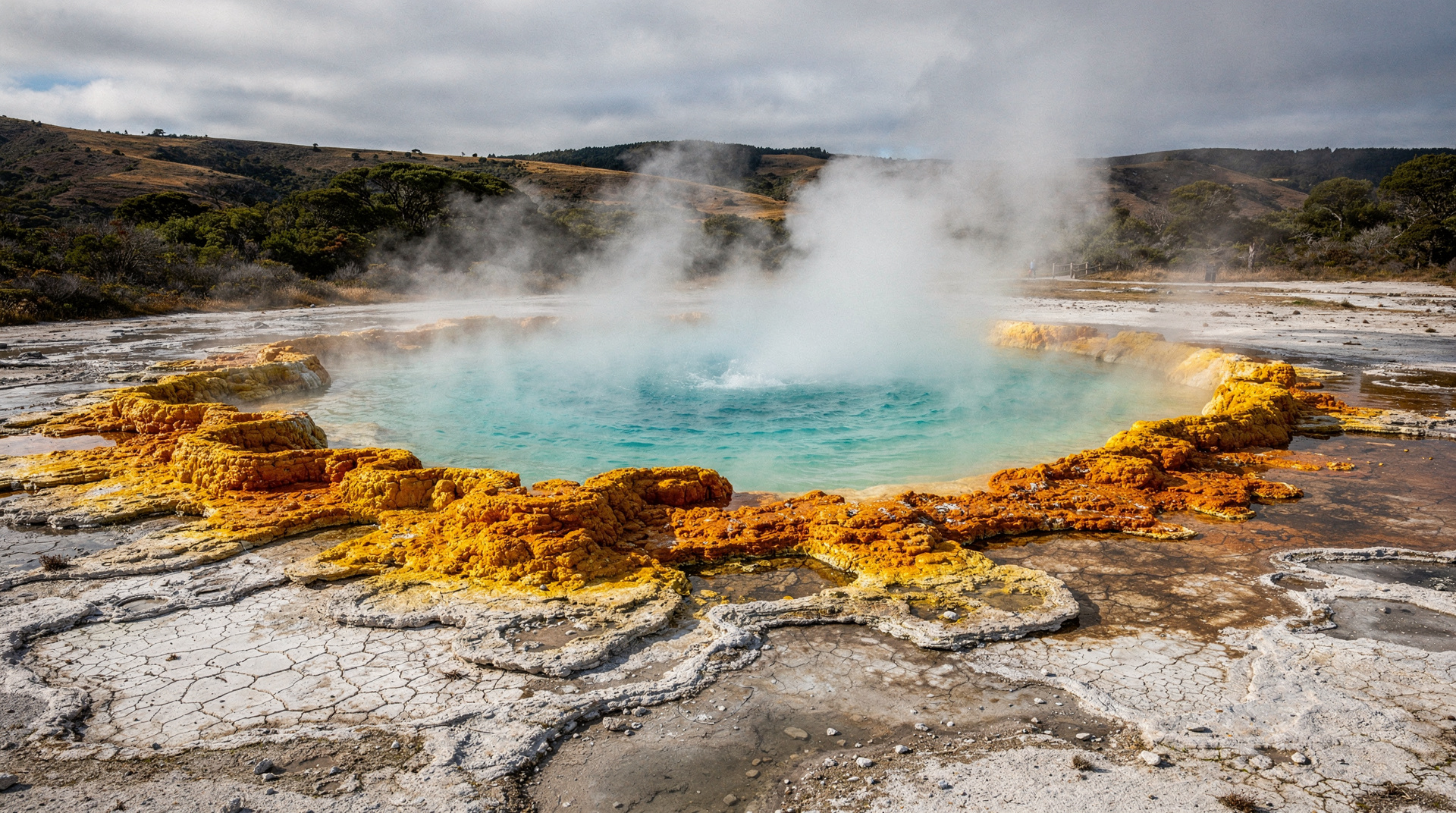
Tongariro volcanic craters and geothermal features
Tongariro's Emerald Lakes, Red Crater, and Blue Lake are NZ's finest volcanic landscape. Geothermal features guide, access, viewpoints, and safety tips.
Related guides
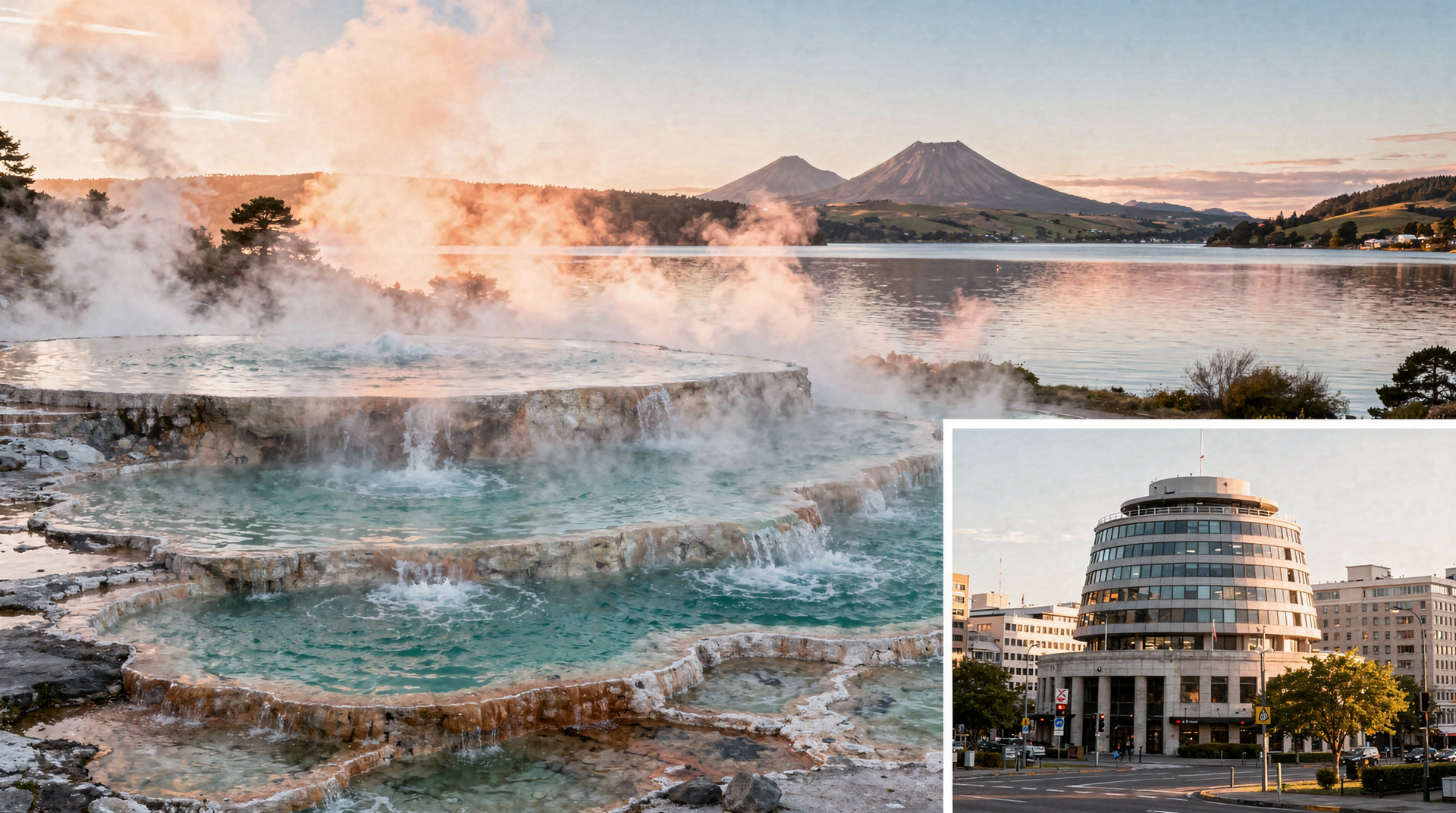
Taupo
Honest Taupo guide: Huka Falls jet boat, tandem skydive, Lake Taupo Maori rock carvings, Tongariro access, real prices NZD/USD/EUR.
Rotorua
Honest Rotorua guide: Te Puia, Wai-O-Tapu, Polynesian Spa, Maori hangi, real prices NZD/USD/EUR, tourist traps to avoid, and best 2 days.
Waikato
Honest Waikato guide: Hobbiton Movie Set, Waitomo glowworm caves, Hamilton Gardens, Raglan surf. Real NZD/USD/EUR prices, what's worth your time.
Tongariro Alpine Crossing
Honest Tongariro Crossing guide: 19.4km, 7-9 hours, shuttle logistics, gear, and why winter without a guide has killed people.
Tongariro volcanic craters and geothermal features
Tongariro's Emerald Lakes, Red Crater, and Blue Lake are NZ's finest volcanic landscape. Geothermal features guide, access, viewpoints, and safety tips.
Mt Ruapehu — North Island ski and volcanic guide
Mt Ruapehu guide: Whakapapa and Turoa ski fields, active crater lake, Tongariro walks. North Island's ski capital — 2765m active volcano. Access and costs.
7-day North Island itinerary — the essential highlights
Auckland → Bay of Islands → Hobbiton → Waitomo → Rotorua → Taupo → Tongariro → Wellington. 7 days, both car and costs covered honestly.
The Tongariro Crossing in shoulder season — a hard-won lesson
Doing the Tongariro Alpine Crossing in April: what the weather actually does, what the shuttle logistics look like, and what I got wrong.
Last reviewed: