Cape Reinga
Cape Reinga honest guide: Te Rerenga Wairua spiritual significance, 90-Mile Beach, sandboarding, self-drive vs tour, real costs NZD/USD/EUR.
Quick facts
- Distance from Paihia
- Approx 200 km — 3.5 hours driving each way
- Distance from Auckland
- Approx 430 km — 5.5 hours driving each way
- Currency
- NZ$ — USD ~$0.60 / EUR ~€0.55
- Best for
- Spiritual significance, dramatic scenery, 90-Mile Beach, sandboarding
- Skip if
- You have less than 6 days in NZ — other destinations offer more variety per hour of travel
Cape Reinga in one paragraph
Cape Reinga — Te Rerenga Wairua in te reo Maori — is the northernmost accessible point of the North Island and one of the most spiritually significant places in New Zealand. For Maori, this is where the spirits of the dead depart for Hawaiki, the ancestral homeland. The old pohutukawa tree clinging to the cliff edge at the cape is the literal point of departure. Even for non-Maori visitors, the sight of the Tasman Sea and the Pacific Ocean meeting in swirling confluence below the lighthouse has an undeniable drama. Getting here requires effort — either a long day’s drive from Paihia or an even longer one from Auckland — but those who make the journey consistently rate it as a highlight.
The spiritual significance of Te Rerenga Wairua
The name Te Rerenga Wairua translates as “the leaping-off place of spirits.” In Maori cosmology, when a person dies their wairua (spirit) travels to Cape Reinga and descends the roots of the ancient pohutukawa tree into the sea, then follows a course to Three Kings Islands and finally across the ocean to Hawaiki. The site was considered so tapu (sacred) that for centuries few people went there, and it remains deeply meaningful for iwi of Northland, particularly Ngati Kuri, who are the kaitiaki (guardians) of the area.
This context matters for how you visit. The cape is managed by the Department of Conservation, entry is free, but visitors are asked to respect its significance — walking off the designated paths near the pohutukawa tree is inappropriate. Guided tours from Paihia generally include good interpretation of the site’s meaning.
Getting to Cape Reinga
Guided day tour from Paihia is the most practical option for most visitors. Tour operators depart Paihia early morning, travel north via Ninety Mile Beach (driving on the beach itself, which is classified as a public road), allow 1–2 hours at the cape and lighthouse, include sandboarding on the Te Paki dunes, and return via SH1 through Kaitaia.
The Cape Reinga and 90-Mile Beach tour from Paihia is the most established option and covers the key experiences efficiently. For a more detailed experience with lunch included, the Cape Reinga and Ninety Mile Beach trip with lunch from Paihia is a good step up. A third option, the Cape Reinga day trip from Paihia, Kerikeri, or Kaitaia , allows pickup from multiple Northland towns.
Tour prices run approximately NZD 120–170 / USD 72–102 / EUR 66–94 depending on operator and inclusions.
Self-driving is feasible but has important considerations. 90-Mile Beach (actually 88 km) is a designated road and legal to drive, but is tidal — vehicles have been washed out by unexpected king tides, and the sand can bog 2WD vehicles. Unless you have a 4WD and local knowledge, take a guided tour for the beach section. SH1 from Kaitaia north to Cape Reinga itself is sealed and manageable in any vehicle.
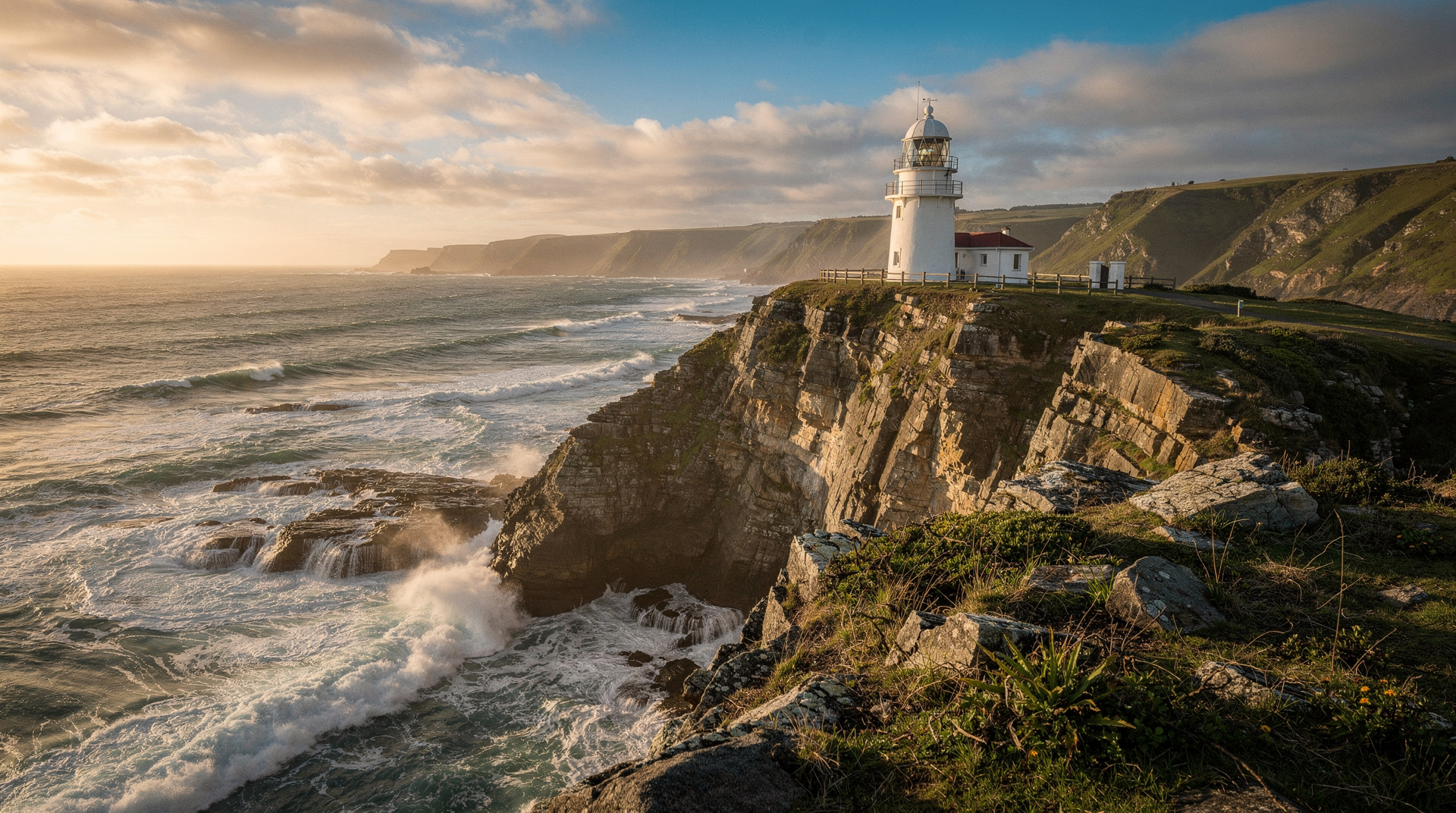
What to expect at the cape
The viewing area at Cape Reinga lighthouse is a 15-minute walk from the car park. The lighthouse itself is distinctive — small, red-topped, perched on a headland. From the lookout you can see the white-water line where the two seas meet in rough conditions; in calm conditions the confluence is less dramatic but the panorama over three points of land is still striking. The old pohutukawa tree clings to the cliff below the path — you’ll see it clearly from the viewing platform.
Allow 60–90 minutes at the cape itself: time to walk to the lighthouse and back, explore the viewing areas, and absorb the atmosphere without rushing. The car park has basic toilets and a small information display.
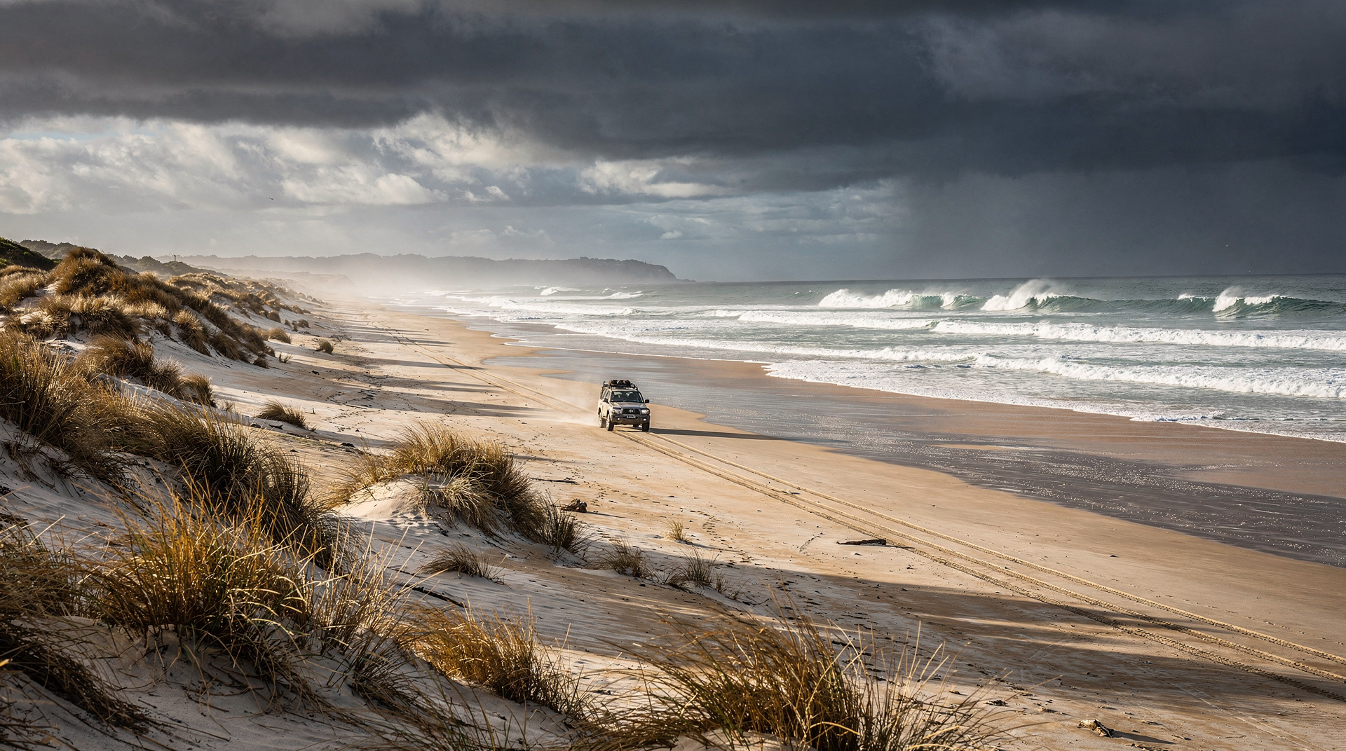
90-Mile Beach and Te Paki dunes
The drive along 90-Mile Beach (entering at Ahipara at the southern end or Te Paki at the north) passes high dunes and an open surf beach on the Tasman Sea side. At low tide the hard-packed sand is fast and smooth for driving; at high tide the beach narrows considerably.
Te Paki sand dunes are the highlight for many visitors. These are significant dunes — up to 150 metres of loose sand — and boogie-boarding and sandboarding down them on boards provided by the tour operator is genuinely fun and accessible for all fitness levels. This activity is typically included in guided day tours.
Kauri Coast (optional extension)
If you’re driving north from Auckland, the Kauri Coast west of SH1 deserves mention. The Waipoua Forest holds some of New Zealand’s largest remaining ancient kauri trees, including Tane Mahuta — estimated at 1,200–2,500 years old and the largest known living kauri. A short walk from the SH12 carpark. Note: kauri trees are under threat from kauri dieback disease (Phytophthora agathidicola). Clean your footwear thoroughly at the stations provided. This is not optional — dieback is spreading and the cleaning stations are a necessary conservation measure.
Where to base yourself
There is very limited accommodation near Cape Reinga itself. Most visitors stay in:
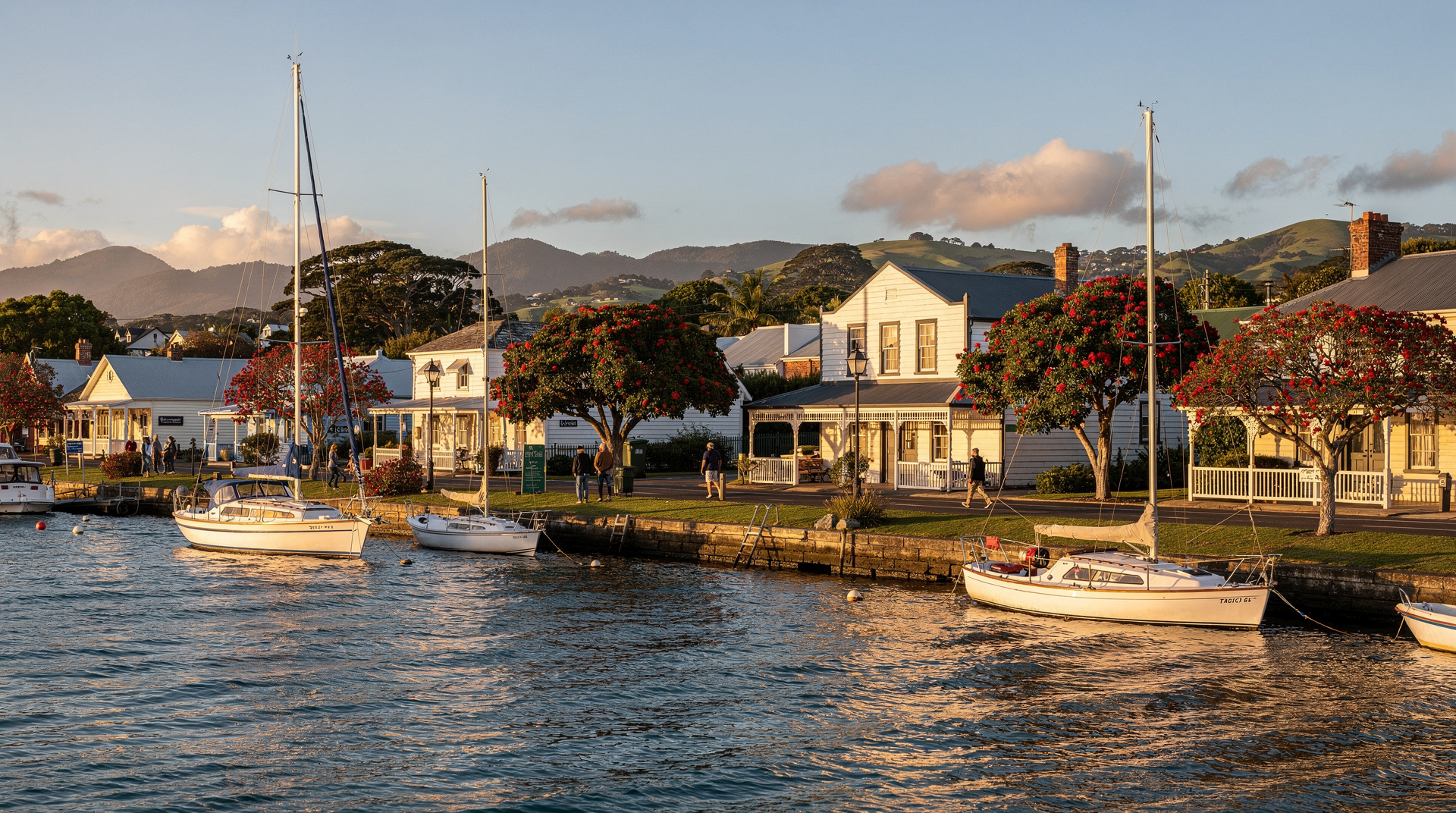
Paihia (Bay of Islands): Best base for a day trip with a guided tour. Two nights in Paihia allows the Cape Reinga day trip plus a Bay of Islands cruise — see the Bay of Islands guide.
Kaitaia: The town closest to Cape Reinga (about 100 km south). Functional rather than attractive; useful if you want to be closer to the cape and avoid the full drive from Paihia. Budget motels from NZD 100–150 / USD 60–90 / EUR 55–83.
Ahipara: A small surf community at the southern end of 90-Mile Beach. Basic accommodation from NZD 80–140 / USD 48–84 / EUR 44–77; excellent for surfers and those who want a quiet escape.
Skip / worth it / splurge
- Skip: Driving 90-Mile Beach in a 2WD rental car without local knowledge — the risk of getting bogged in soft sand or cut off by tide is real
- Worth it: Guided day tour from Paihia including beach driving and Te Paki dunes — the logistics are handled and the context is better
- Worth it: Spending time at Te Rerenga Wairua itself, not just photographing the lighthouse — sit quietly and understand the place
- Splurge: Private guided tour for a small group — the interpretation of Maori spiritual significance is considerably deeper
Connecting Cape Reinga to the broader Northland experience
A dedicated Northland road trip — sometimes called the Twin Coast Discovery Highway — loops north from Auckland on the east coast (via Whangarei, Bay of Islands, Paihia, Kerikeri) and returns on the west coast (via Kaitaia, Waipoua Kauri Forest, Dargaville, Matakohe, Helensville). Cape Reinga sits at the northern apex of this loop.
Done at a comfortable pace, the Twin Coast Discovery Highway takes 5–7 days from Auckland and back. This approach allows you to visit Cape Reinga without retracing your steps — you drive north on SH1 and the east coast route, loop to the cape, then return south via the west coast Kauri Highway. The Hokianga Harbour and Tane Mahuta kauri tree on the return leg make the western route more than just a retracing.
If you’re only making a single visit to Northland (Bay of Islands plus Cape Reinga), the standard approach is to base in Paihia for 2–3 nights and take a guided Cape Reinga day trip. See the Bay of Islands guide for details on Paihia accommodation.
How Cape Reinga fits in the itinerary
Cape Reinga works as a day trip from the Bay of Islands on day 2 of a Northland stay. If you’re following the 7-day North Island itinerary, the day pattern might look like: Arrive Paihia (afternoon), Waitangi Treaty Grounds (morning day 2), Cape Reinga day trip (day 3), drive south toward Hobbiton (day 4).
If visiting from Auckland directly (without sleeping at the Bay of Islands), the round trip is approximately 9–10 hours of total travel. That’s a long day from Auckland — better to base at Paihia overnight.
The drive north: what to see between Auckland and Cape Reinga
Most visitors who drive to Cape Reinga make the trip from Paihia (Bay of Islands), which is the most practical base. But if you’re driving north from Auckland without stopping at the Bay of Islands, or if you’re doing a dedicated Northland road trip, the route offers several worthwhile stops.
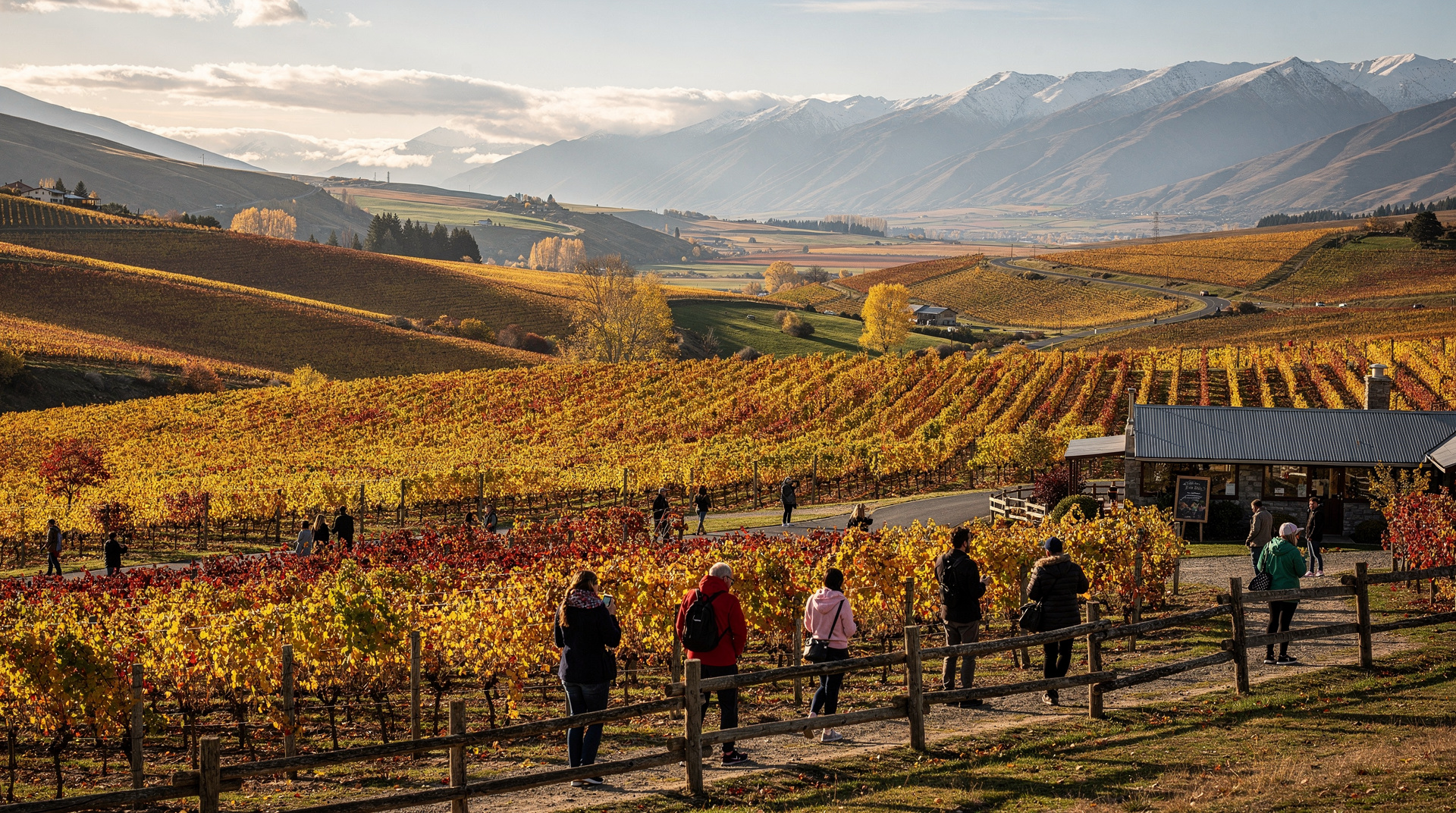
Warkworth and Matakana (north of Auckland, 1 hour): Matakana has developed into a genuine artisan food and wine destination in the last decade. The Matakana Village Farmers’ Market (Saturday mornings) is excellent. Several small wineries (Heron’s Flight, Brick Bay Wines) are worth a visit.
Mangawhai Heads (1.5 hours from Auckland via SH16): A beach town with good surf and a developing food scene. Mangawhai is where Aucklanders escape; in summer it’s crowded but charming.
Waipoua Kauri Forest and Tane Mahuta (3.5 hours from Auckland, west of SH12): The most direct access to ancient kauri. Tane Mahuta is an obligatory stop — at 51.5 metres tall and with a girth of 13.8 metres, this tree is estimated at 1,200–2,500 years old. The short walk from the carpark (5 minutes return) is entirely accessible. Follow all biosecurity instructions — kauri dieback disease is a genuine ecological emergency. Clean boots thoroughly at every station.
Rawene (ferry across the Hokianga Harbour): The small heritage town of Rawene and the short Hokianga vehicle ferry are a scenic detour for those not in a rush. The Hokianga Harbour north side (Opononi, Omapere) has impressive sand dunes accessible by sandboard.
Kaitaia (2.5 hours from Paihia, 4.5 hours from Auckland): The northernmost town of any size, primarily useful as a practical stop for fuel and food before the final run to Cape Reinga.
What to expect at the Three Kings Islands lookout
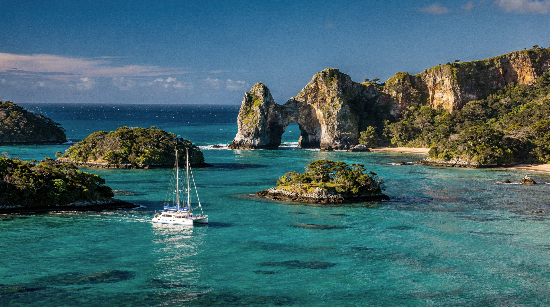
From the cape, on a clear day, you can see the Three Kings Islands (Manawatawhi) approximately 55 km to the northwest. These islands, which represent the final resting point in the spirit’s journey to Hawaiki according to Maori cosmology, are uninhabited conservation reserves — no public access. The Three Kings are home to unique plant species found nowhere else on Earth, including the Three Kings vine and several endemic endemic plant species discovered only in the 20th century.
The visual connection between the cape and these islands — seeing both the departure point and the first waypoint of the spiritual journey — gives the viewing experience at Cape Reinga a narrative dimension that pure coastal scenery alone wouldn’t provide.
Travelling beyond Cape Reinga: Spirits Bay and the Far North
Most visitors stop at Cape Reinga and turn back. If you have a second day in the far north, Spirits Bay (Kapowairua) is worth knowing about.
Located 20 km east of Cape Reinga on an unsealed road (4WD advisable), Spirits Bay is a protected cove within Te Paki Recreation Reserve managed by DOC. Free camping is available (book at DOC website in advance). The bay has turquoise water, white sand, and the peculiar quality of stillness that comes from being genuinely remote. Swimming is excellent in calm conditions.
The camping at Spirits Bay is for visitors comfortable with basic facilities (long-drop toilets, no power, no showers). It is worth the self-sufficiency trade-off for the experience of watching the stars from one of the darkest sky zones in New Zealand.
Frequently asked questions about Cape Reinga
Is Cape Reinga actually the northernmost point of New Zealand?
Technically no — the Surville Cliffs further east are fractionally further north, but they are inaccessible. Cape Reinga is the northernmost accessible point and the most significant culturally and geographically. The distinction is academic for visitors.
Can I drive to Cape Reinga myself?
Yes — SH1 is sealed all the way to the car park, and any standard rental car can make the journey. The challenge is 90-Mile Beach: driving the beach requires 4WD or extensive local knowledge of tides. For most visitors, a guided tour or driving up and back via SH1 (avoiding the beach) is the sensible choice.
What is the weather like at Cape Reinga?
The Far North has a subtropical climate — generally warm from October to April, windier in winter. The cape itself is often breezy due to the exposed headland position. In summer expect 22–28°C / 72–82°F; in winter 14–18°C / 57–64°F. Check wind forecasts — the Tasman-Pacific confluence is less dramatic on very calm days but the cape is still worth visiting.
Is Cape Reinga suitable for children?
Yes — the walk to the lighthouse is manageable for most children, and the sandboarding on Te Paki dunes is a highlight for kids. Bring sun protection and water; facilities at the cape are minimal (toilets, no cafe).
How important is Maori context for understanding Cape Reinga?
Very. The physical beauty of the location can be appreciated without background knowledge, but the spiritual significance of Te Rerenga Wairua is what makes the place genuinely memorable. A guided tour with Maori interpretation, or reading about the wairua journey beforehand, deepens the experience significantly. The Maori culture overview guide provides useful background.
What is the drive along 90-Mile Beach like?
Driving 90-Mile Beach (accessed at Ahipara at the south or Te Paki streams at the north) is an unusual experience — the hard-packed sand at low tide is effectively a road, and the experience of driving on a beach that stretches to the horizon in both directions is distinctive. The speed limit is 100 km/h on the beach (same as a state highway) but most vehicles travel much slower due to sand conditions and the surreal quality of the location. Note that 90-Mile Beach is NOT actually 90 miles long — it is 88 km (approximately 55 miles). The name came from an early surveying error or overestimate.
Can I see dolphins near Cape Reinga?
Common dolphins and bottlenose dolphins are occasionally seen on the Cape Reinga day trip, particularly on the boat section if operators use a water crossing rather than a purely road-based itinerary. However, the Cape Reinga day trip is not primarily a marine wildlife experience — for dedicated dolphin swimming, the Bay of Islands is the appropriate base. If both experiences are on your list, plan 2 nights at Paihia: day 1 for the dolphin eco-cruise, day 2 for the Cape Reinga tour.
How is the weather at Cape Reinga in winter?
The Far North has a mild subtropical climate; winter temperatures are 10–17°C / 50–63°F even in the coldest months (July–August). Rain is more common in winter, and the cape can be very windy. The landscape is greener in winter, and the sand dunes at Te Paki are still accessible for sandboarding. Guided day tours from Paihia continue year-round, though some operators reduce frequency in low season. Confirm tour schedules with operators before committing to a winter visit.
Is Cape Reinga accessible for visitors with limited mobility?
The car park is sealed; the path to the lighthouse viewing area is paved but involves gentle gradients. Most of the main viewing areas are accessible with a standard wheelchair or for visitors who are steady on their feet but cannot do extended walking. The sandboarding on Te Paki dunes requires the ability to walk across sand and climb the dune — not accessible for visitors with significant mobility limitations. The 90-Mile Beach section of a guided tour is all vehicle-based and fully accessible.
Top experiences: Cape Reinga New Zealand
See all →Related guides
Northland
Honest Northland planner: Bay of Islands, Cape Reinga, 90 Mile Beach, Paihia, Russell, Whangarei. Real NZD/USD/EUR costs, what's worth your time.
Bay of Islands
Honest Bay of Islands guide: Hole in the Rock cruise, dolphin swimming, Waitangi Treaty Grounds, Cape Reinga, real costs NZD/USD/EUR.
Russell
Russell: New Zealand's first capital, once called the 'hell hole of the Pacific', now a charming waterfront village in the Bay of Islands. NZD/USD/EUR costs.
90 Mile Beach — Cape Reinga and Northland's wild coast
90 Mile Beach is 88 km of wild Northland surf coast. Why rental cars can't drive it, tour access, sand dune boarding, and Cape Reinga — prices NZD/USD/EUR.
Bay of Islands day trip from Auckland — honest advice
Honest guide to a Bay of Islands day trip from Auckland: 3.5-4 hour drive each way, what you can realistically see, and why 2 nights is the right call.
Best day trips from Auckland
Six great day trips from Auckland: Waiheke, Hobbiton, Waitomo, Coromandel, Rotorua and more — with drive times, GYG tours, and honest advice.
7-day North Island itinerary — the essential highlights
Auckland → Bay of Islands → Hobbiton → Waitomo → Rotorua → Taupo → Tongariro → Wellington. 7 days, both car and costs covered honestly.
The best shoulder season itinerary for New Zealand — 14 days in autumn
A 14-day New Zealand itinerary designed for March and April: fewer crowds, better light, lower prices, and the same landscapes everyone comes for.
Last reviewed: