Routeburn Track — Great Walk on the Fiordland-Otago divide
How long is the Routeburn Track and how do I book it?
32km, typically 2-3 days. Book DOC huts at doc.govt.nz from June for the Great Walk season (October-April). Huts cost NZD 102/night. One-way track between the Divide (on the Milford Sound highway) and Glenorchy — transport logistics required at both ends. Challenging but one of NZ's finest alpine walks.
The alpine crossing that rivals Milford
Popular experiences here
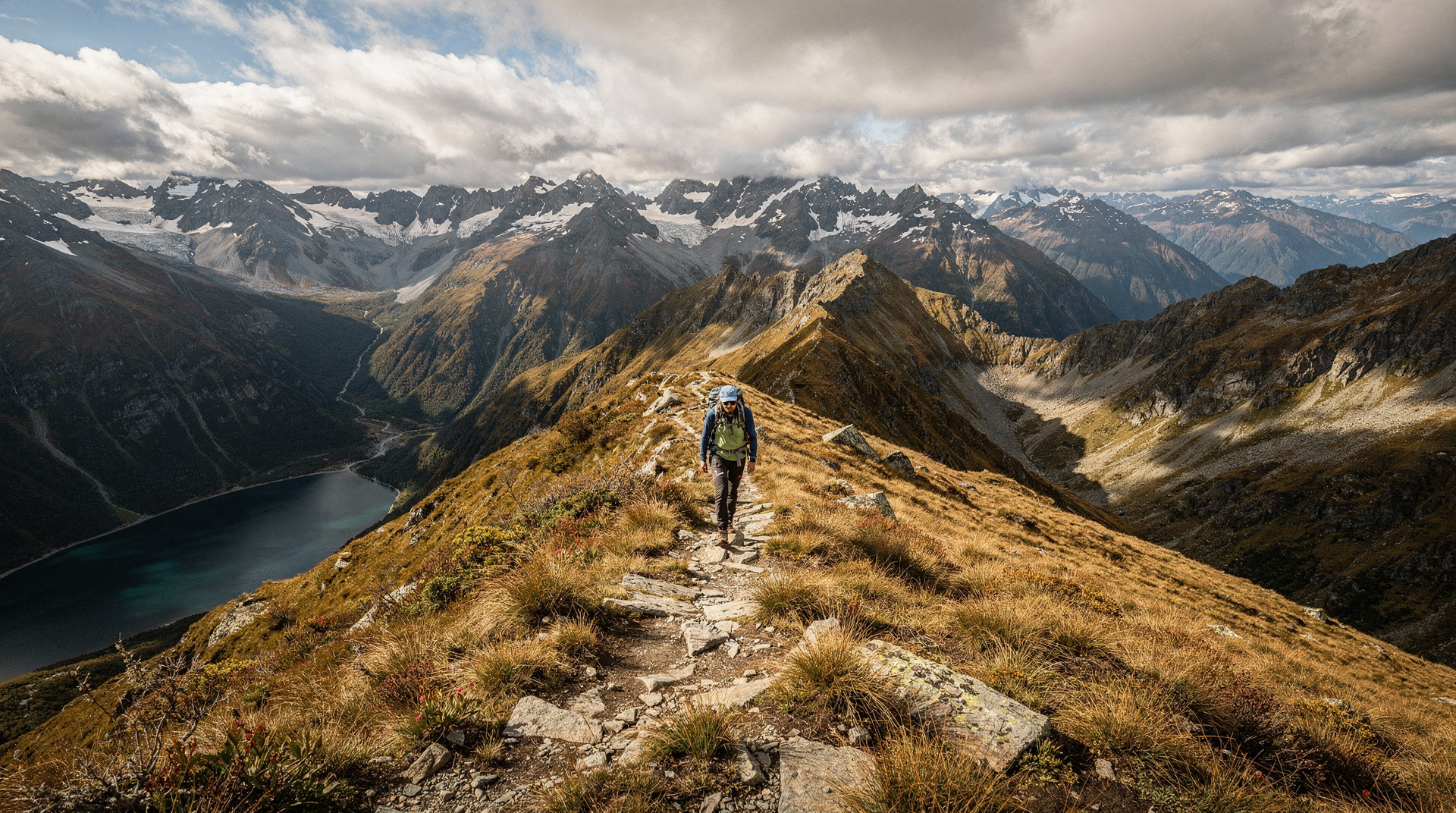
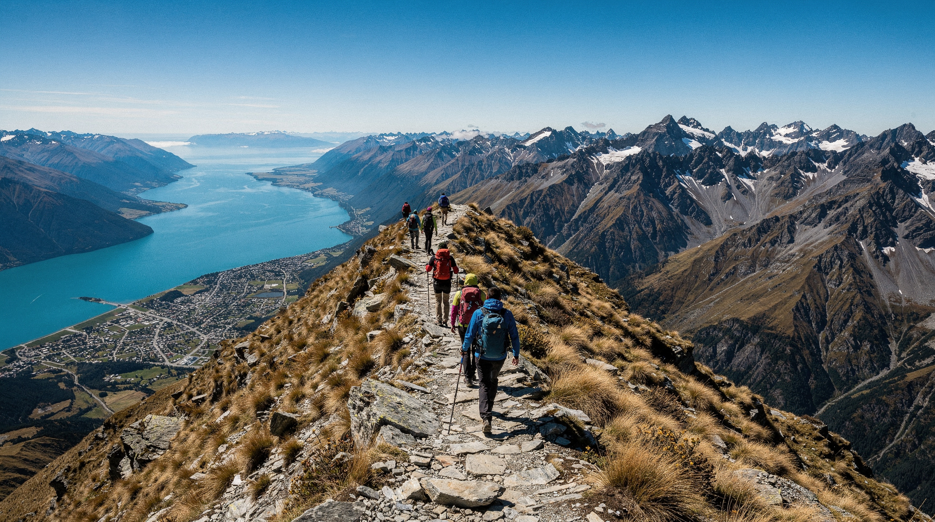
The Routeburn Track covers 32 km through arguably New Zealand’s most dramatic alpine scenery — climbing from the beech forests of Glenorchy into the exposed passes of the Fiordland-Otago divide, then descending into the Hollyford Valley. Unlike the Milford Track’s one-way management system, the Routeburn can be walked in either direction; unlike most other Great Walks, it traverses a true mountain pass rather than following a valley or coastline.
The Routeburn is shorter and more committing than the Milford Track. At 32 km in 2-3 days rather than 53.5 km in 4 days, the daily distances are longer. The terrain above the bushline is genuinely alpine — exposed, prone to rapid weather changes, and occasionally requiring route-finding in cloud.
It is also consistently described by experienced hikers as one of the finest multi-day walks in the world. The claim holds up.
Quick stats
| Detail | Value |
|---|---|
| Total distance | 32 km |
| Total climb | ~1120m |
| Duration | 2-3 days |
| Hut fee (Great Walk season) | NZD 102/night (USD 61 / EUR 56) |
| Season | October to April |
| Direction | Either direction (Glenorchy or the Divide) |
| Booking | doc.govt.nz, opens June |
The huts
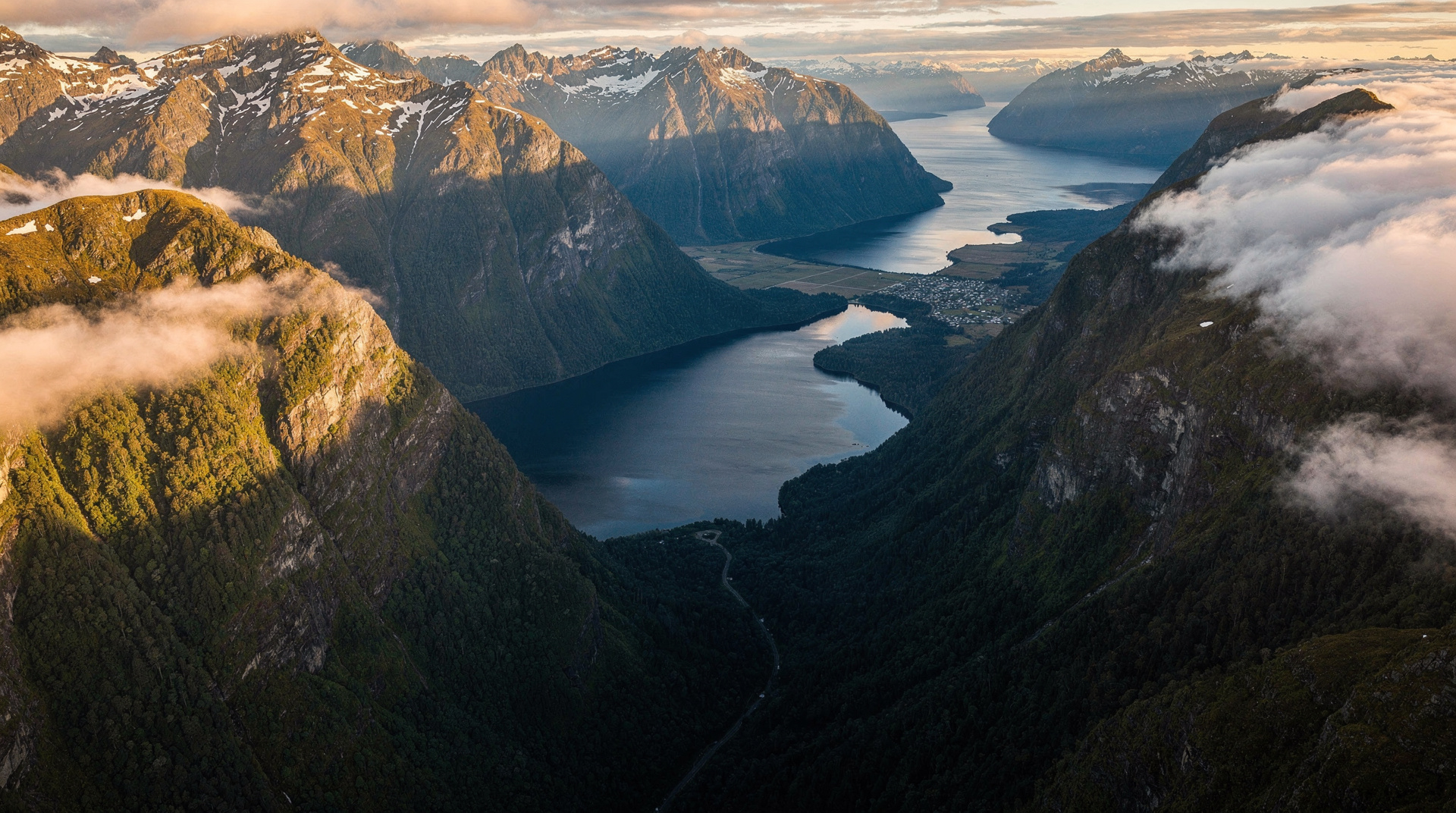
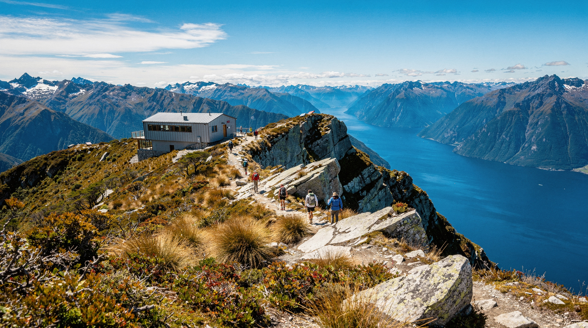
Lake Mackenzie Hut (60 bunks): At the heart of the track, above the bushline at 1000m. Views over Lake Mackenzie, Darran Mountains, and — on clear days — the Tasman Sea. The most spectacular hut location on the Routeburn.
Routeburn Falls Hut (48 bunks): Above Routeburn Falls at 1000m, near the head of the valley. Access to the alpine zone is a 15-minute walk from the hut. Spectacular mountain views.
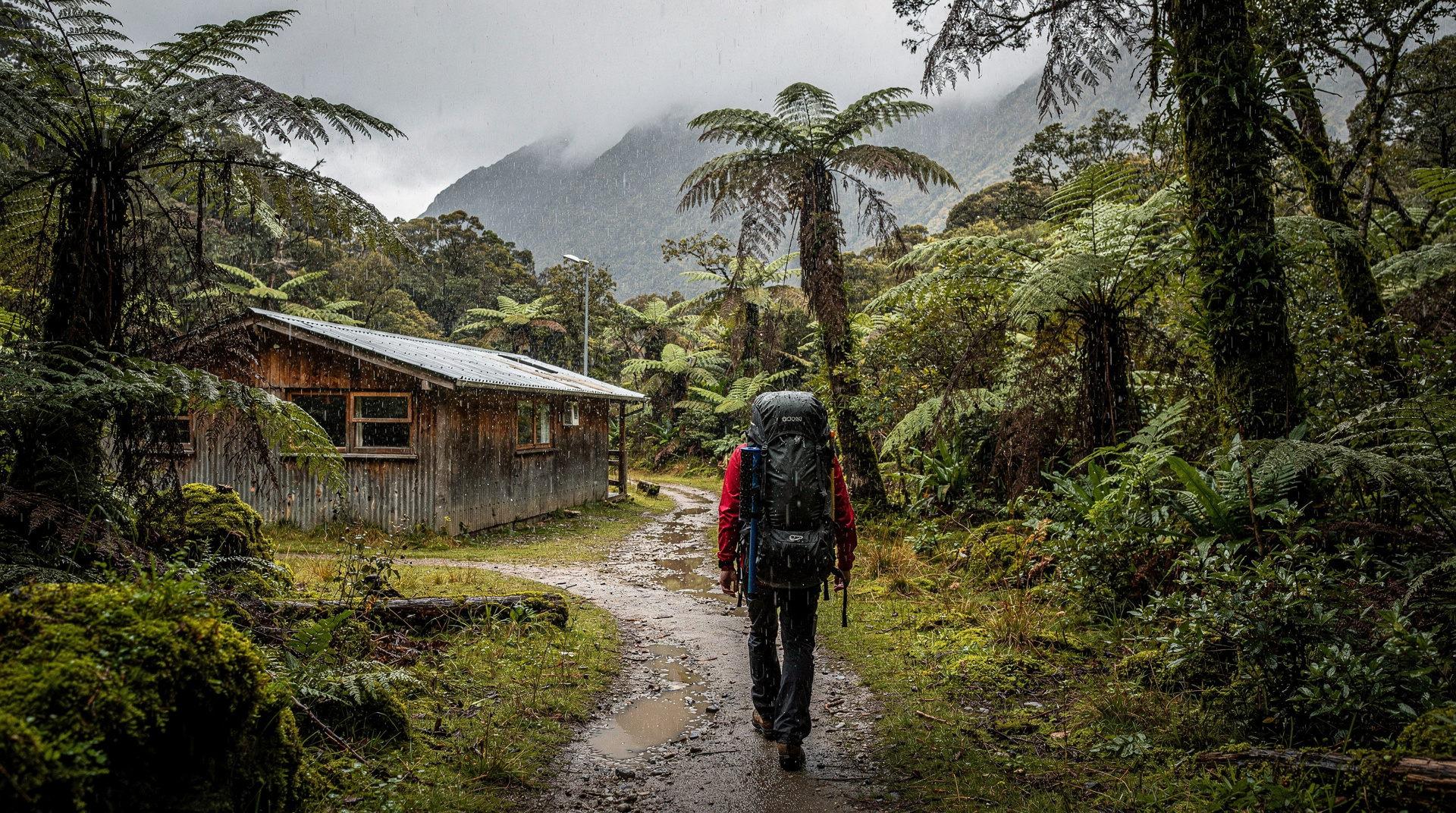
Routeburn Flats Hut (20 bunks): Lower elevation option on the valley floor. Less dramatic views but protected from alpine weather.
Walking from the Glenorchy end (recommended)
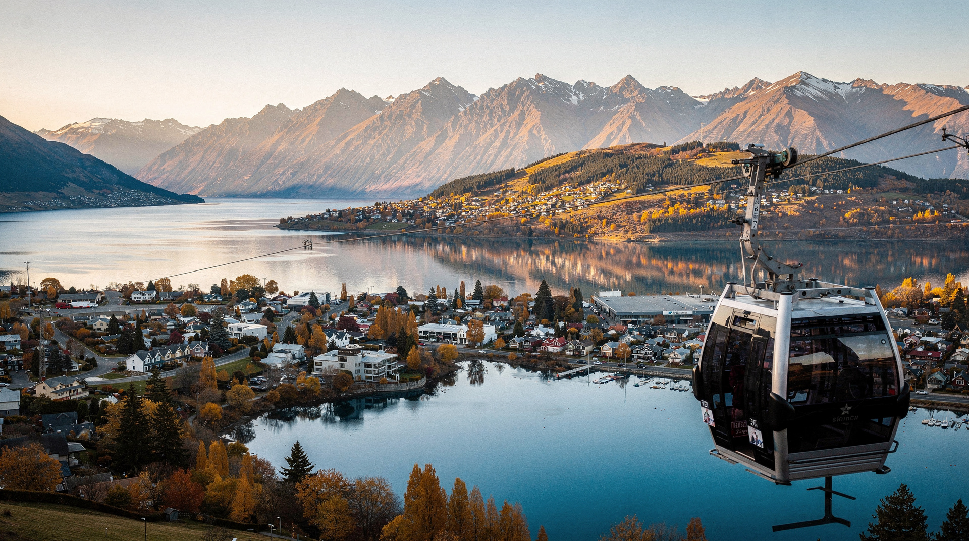
Starting from Routeburn Shelter near Glenorchy (46 km north of Queenstown) allows most walkers to finish at the Divide, take a bus back to Te Anau or Queenstown, and keep transport logistics straightforward.
Day 1 (Glenorchy start) — Routeburn Shelter to Lake Mackenzie Hut (20.5 km, 7-8 hours): A full day that climbs from beech forest to the alpine zone. Harris Saddle at 1255m is the high point — a ridge walk with views into both Fiordland and Otago. The descent to Lake Mackenzie Hut involves crossing exposed terrain; in poor weather, this section requires navigational confidence.
Day 2 — Lake Mackenzie Hut to the Divide (11.5 km, 4 hours): Shorter and more dramatic — the track descends through the forest to the Hollyford Valley. The Divide road end connects to the Milford Sound highway (SH94), from where buses run to Te Anau and Queenstown.
For a 3-day itinerary, spend the first night at Routeburn Falls Hut (10.5 km from the shelter) before continuing to Lake Mackenzie (10 km) and the Divide.
Transport logistics: the essential detail
The Routeburn is a one-way track with two road ends that are 3+ hours apart. You cannot simply drive to one end and walk back. Options:
Option 1 (most common): Drive or shuttle from Queenstown to Glenorchy. Walk to the Divide. Bus from the Divide back to Queenstown via Te Anau.
Option 2: Bus from Queenstown to the Divide. Walk to Glenorchy. Arrange shuttle or pick up from Glenorchy.
Option 3: Fly from Queenstown to the Glenorchy area by helicopter, walk to the Divide, bus back.
The Glenorchy + Paradise tour visits the departure point before your walk — excellent for orienting yourself to the Routeburn’s southern end. ✓ Worth it
From Queenstown: Lord Of The Rings Tour to Glenorchy
Glenorchy and Paradise valley tour from Queenstown — see the Routeburn's southern trailhead in context.
From NZD 85–115 / USD 51–69 / EUR 47–63
Transport companies (including TrackNet) run dedicated Routeburn shuttle services from Queenstown. Book these at the same time as your DOC huts — they fill up in peak season.
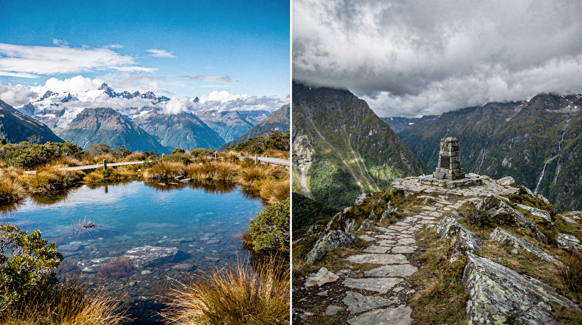
The alpine environment: what to expect
The Routeburn spends more time above the bushline than any other New Zealand Great Walk. From Harris Saddle to Lake Mackenzie, the track traverses fully exposed alpine terrain at 1000-1255m. This means:
Weather: The Fiordland-Otago divide catches weather systems from both directions. Visibility can drop to near zero rapidly. Rain is frequent. Snow is possible in October, November, March, and April. The track is not suitable for winter use without alpine experience.
Kea: The alpine parrots will find your pack, your boots, and anything edible you’ve left outside the hut. Secure everything.
Birdlife: In the forest sections, South Island robins and riflemen are common. Above the bushline, New Zealand falcon (kārearea) are occasionally seen hunting.
Avalanche risk: The basin below Lake Mackenzie carries avalanche risk in winter. The track stays clear of the main avalanche paths, but off-track travel is not recommended.
What to pack
The alpine exposure makes the Routeburn’s gear requirements more serious than most Great Walks:
- Full waterproofs (jacket + trousers — not optional)
- Warm insulation layer (down or synthetic, compressible)
- Gloves and hat (even in summer, Harris Saddle can be cold and windy)
- Trekking poles (especially useful on the Harris Saddle section in wind)
- Sleeping bag liner (huts provide mattresses)
- 2-3 days of food
- Navigation backup (printed map — phone signal is absent on the alpine sections)
Cost breakdown (NZD / USD / EUR)
Cost breakdown
Prices approximate 2026. DOC hut fees at NZD 102/night.
| Item | NZD | USD | EUR | Verdict |
|---|---|---|---|---|
| 2-night hut (independent) | NZD 204 | USD 122 | EUR 112 | ✓ Worth it |
| 3-night hut (independent) | NZD 306 | USD 184 | EUR 168 | ✓ Worth it |
| Shuttle Queenstown to Glenorchy | NZD 35–50 | USD 21–30 | EUR 19–28 | |
| Bus Divide to Queenstown/Te Anau | NZD 40–65 | USD 24–39 | EUR 22–36 | |
| Guided walk (3 days, all-in) Private lodges, meals, and guide staff included | NZD 2,100–2,600 | USD 1,260–1,560 | EUR 1,155–1,430 | ★ Splurge |
Frequently asked questions
How does the Routeburn compare to the Milford Track?
The Milford Track is longer (53.5 km vs 32 km), has more controlled logistics (fixed daily distances, one-direction only booking), and finishes at Milford Sound itself. The Routeburn is more committing on a per-day basis, has longer exposed alpine sections, and offers arguably more consistent alpine scenery. Both are exceptional. See Routeburn vs Milford Track.
Can I do the Routeburn as a day walk?
Some experienced walkers do the Glenorchy-to-Lake Mackenzie section as a very long day (20.5 km, 7-8 hours) and return, but this is demanding and doesn’t allow for the full experience. The track is designed as a multi-day walk.
What’s the weather like in October or April?
Shoulder season conditions are variable. Snow on Harris Saddle is possible in both months. The track is open and manageable, but requires more conservative gear (microspikes in case of ice). DOC hut wardens will advise on current conditions. Some walkers find October and April more dramatic than January — the mountain colours and light quality are different.
Is there a guided option?
Yes. Routeburn Guided Walk (Ultimate Hikes) operates private lodges along the track and provides guide staff, equipment, and meals. More expensive but removes all logistics complexity and offers a completely different standard of comfort. Book directly with Ultimate Hikes.
Related guides and reading
- Milford Track guide — the longer Fiordland Great Walk
- Kepler Track guide — easier to book, Te Anau base
- Routeburn vs Milford Track comparison
- Glenorchy and Paradise — the southern end of the track
- Day hikes around Queenstown
- Fiordland National Park guide
Related guides
Fiordland
Honest Fiordland planner: Milford Sound vs Doubtful Sound, Te Anau base, Milford Track booking, real NZD/USD/EUR costs and what most guides won't tell you.
Queenstown
The honest Queenstown planner: bungy, jet boat, ski, scenic flights — real prices in NZD/USD/EUR, what to skip and what's worth your money.
Milford Track — the world's finest walk
Milford Track: 53.5km, 4 days, one direction only, NZD 102/night huts. Book 6 months ahead. The most famous Great Walk in NZ — worth every step.
Kepler Track — Fiordland Great Walk full guide
Kepler Track: 60km circuit, 3-4 days, starts/ends at Te Anau. Book from June, NZD 102/night huts. Fiordland's most accessible Great Walk — full guide.
Routeburn Track vs Milford Track
Routeburn Track vs Milford Track honest comparison: scenery, difficulty, booking and which Great Walk is worth your time. Clear verdict with real prices.
Day hikes around Queenstown — six best options
Six best day hikes near Queenstown: Ben Lomond (1748m), Queenstown Hill, Tiki Trail, Moke Lake loop, Bob's Peak, Deer Park Heights. Distances, times, costs.
Last reviewed: