Day hikes around Wanaka — five best options
What can I hike near Wanaka when Roy's Peak is closed for lambing?
Roy's Peak is closed 1 October to 10 November annually for lambing. Alternatives: Diamond Lake and Rocky Mountain (9km, 4 hours, year-round), Isthmus Peak on Lake Hawea (16km, similar effort, year-round), or Mt Iron (3.5km loop, 1.5 hours, always open). All provide excellent lake views.
Walking Wanaka: beyond Roy’s Peak
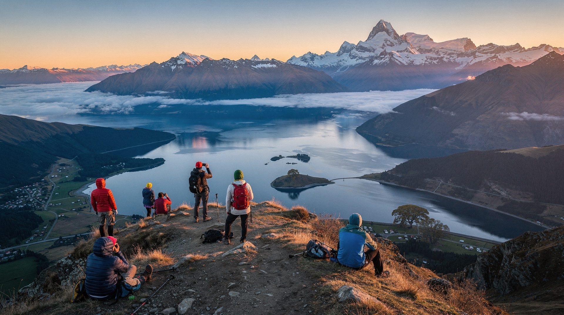
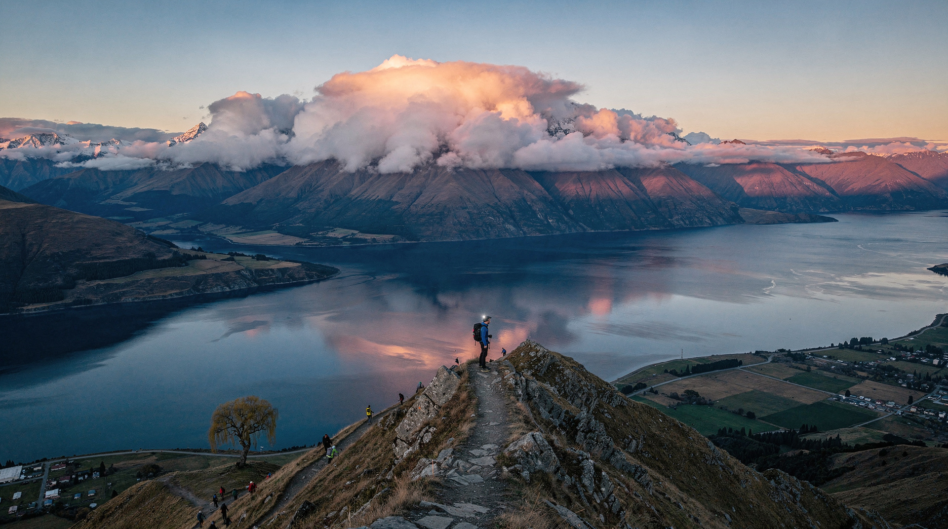
Most visitors arrive in Wanaka with Roy’s Peak on their list. Roy’s Peak is genuinely excellent — but it’s closed for lambing every October-November, it fills with crowds in peak January, and it’s not the only outstanding walk in the area.
Wanaka sits in the centre of one of New Zealand’s most scenic walking regions: glacially carved valleys, schist ridges, three major lakes (Wanaka, Hawea, Dunstan), and views of Mt Aspiring/Tititea to the northwest. The hikes here range from 1.5-hour lake-level strolls to full-day ridge traverses that rival Roy’s Peak in effort and reward.
This guide covers five walks beyond Roy’s Peak (detailed separately in the Roy’s Peak guide).
1. Diamond Lake and Rocky Mountain loop
Distance: 9 km return | Ascent: 500m | Time: 3.5-4.5 hours | Difficulty: Moderate | Year-round: Yes
Diamond Lake is the most satisfying half-day walk near Wanaka — compact enough to complete before lunch, varied enough to be genuinely interesting throughout. The DOC track starts 21 km northwest of Wanaka on Mt Aspiring Road, climbs to a rocky viewpoint, and loops through regenerating native bush.
Route: Diamond Lake (1.5 km, easy flat loop around the lake itself) → climb to Rocky Mountain viewpoint (500m ascent, 3 km from lake) → return via alternate track. Total loop approximately 9 km.
From Rocky Mountain, the view encompasses Lake Wanaka, the full Clutha valley, and the Matukituki valley toward Mt Aspiring. This is arguably the best easy-moderate view walk in the Wanaka area — the effort-to-reward ratio is excellent.
Why it’s the best Roy’s Peak alternative: Open year-round, accessible, varied terrain (lake circuit + ridge walk), and the views are 80% as good with 40% of the effort.
Access: Car required — 21 km from Wanaka town on Mt Aspiring Road. The road is sealed. Car park at Diamond Lake trailhead. No shuttle service.
2. Isthmus Peak track
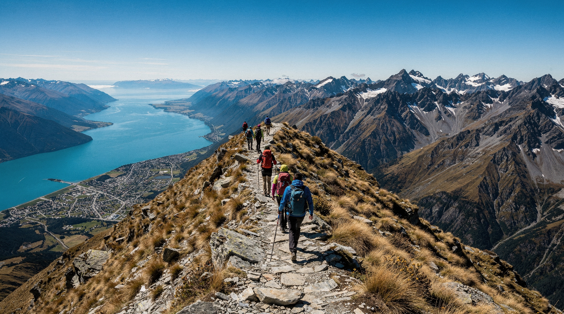
Distance: 16 km return | Ascent: 1200m | Time: 5-7 hours | Difficulty: Challenging | Year-round: Yes
Isthmus Peak on Lake Hawea is Wanaka’s second major summit walk — similar scale to Roy’s Peak but on the opposite lake, less crowded, and offering a different perspective. The track climbs from the Lake Hawea township (15 km from Wanaka) to a 1385m summit with views over both Lake Hawea and Lake Wanaka simultaneously.
The name refers to the narrow land bridge between the two lakes, visible from the summit — the only place in New Zealand where you can see two major glacial lakes from a single viewpoint.
Key differences from Roy’s Peak:
- No lambing closure
- Views are unique (two lake perspective)
- Less photographed — no iconic Instagram viewpoint, no queue
- Track surface is farmland and then open tussock — similar to Roy’s Peak in character
- 15-minute drive from Wanaka adds minor logistics
Access: Drive 15 km from Wanaka to Lake Hawea township. Park at the trailhead on the lake road. The track begins immediately.
3. Mt Iron
Distance: 3.5 km loop | Ascent: 240m | Time: 1.5-2 hours | Difficulty: Easy | Year-round: Yes
Mt Iron is Wanaka’s town walk — the prominent rocky ridge immediately east of the town centre. The track forms a loop that can be started from either side, climbing 240m to a summit at 548m with views over Wanaka township and the lake.
This is not a wilderness walk — the track is well-marked, the terrain is easy, and the summit is accessible to virtually any age and fitness level. It’s useful as:
- A warm-up or acclimatisation walk before Roy’s Peak or Isthmus Peak
- A family walk with younger children
- An evening walk in summer (summit sunset is excellent)
- A short walk when weather limits longer options
Access: Walk from Wanaka town centre (1 km to the trailhead). No transport required.
4. Treble Cone access road walk
Distance: 4-10 km (varies) | Ascent: up to 600m | Time: 2-5 hours | Difficulty: Easy to moderate | Summer only
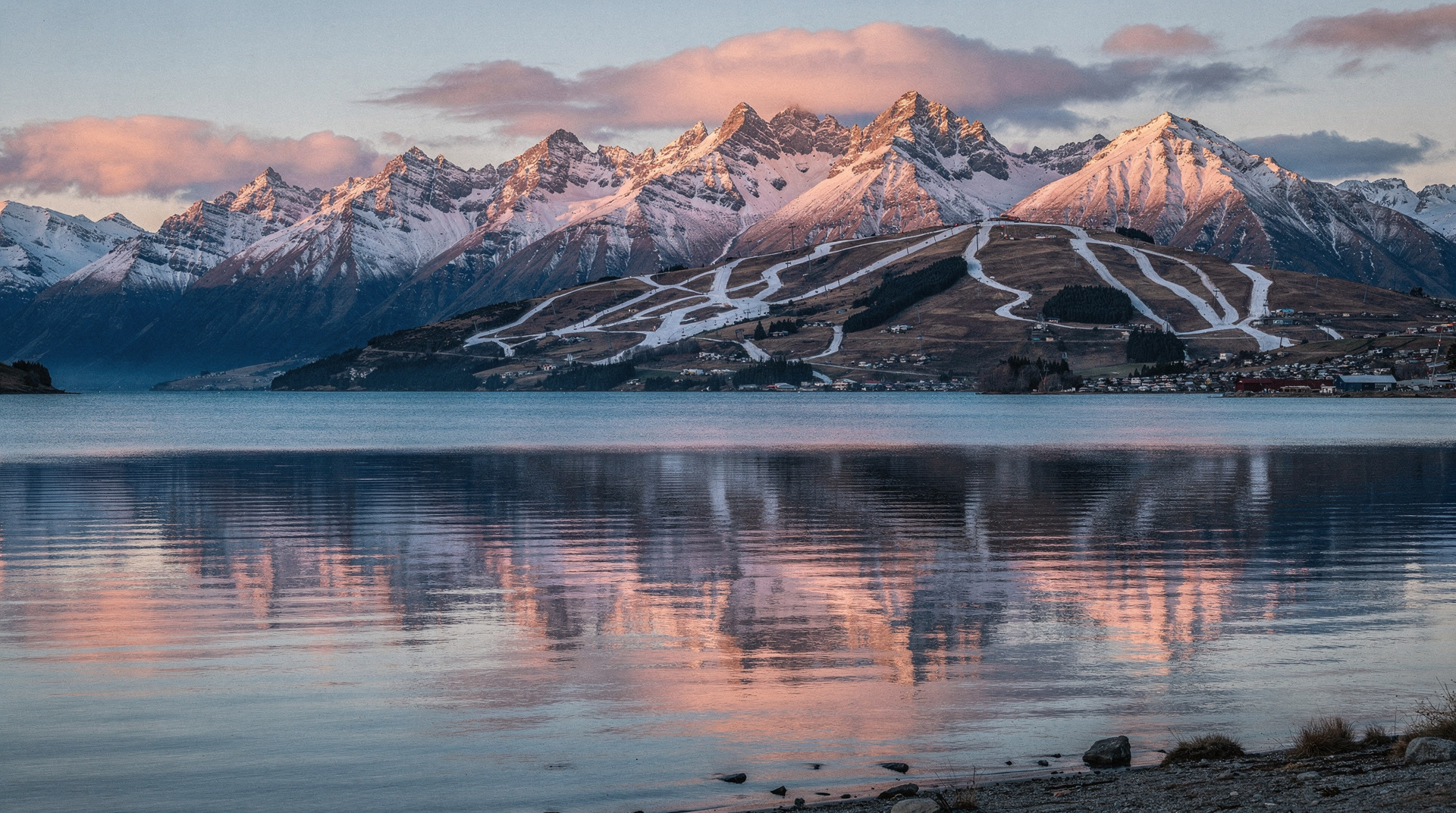
In summer (the ski field is closed November-June), the Treble Cone access road and surrounding ski field terrain becomes a de facto walking area with excellent high-altitude views. The ski field sits at 1380-1960m — accessing the upper field in summer requires driving the ski access road (5 km gravel, 4WD recommended or hire-car risk) and then walking the ski runs.
This is not a marked DOC track — it’s informal hiking on ski terrain. The views from the upper Treble Cone area over Lake Wanaka and the Matukituki Valley are outstanding. In summer, the ski area is completely empty; the combination of high-altitude access and solitude is genuinely unusual.
Not suitable for: Inexperienced walkers, bad weather, poor visibility. The ski terrain is not signposted for hikers and route-finding requires map-reading ability.
5. Waterfall Creek and Glendhu Bay walkway
Distance: 12 km one way (Wanaka to Glendhu Bay) | Ascent: minimal | Time: 3-4 hours one way | Difficulty: Easy | Year-round: Yes
This lakeside walkway follows the northern shore of Lake Wanaka from the town centre to Glendhu Bay (12 km northwest). The track alternates between maintained path, gravel road sections, and lake shore walking. The terrain is easy throughout and the views across the lake are consistently good.
Most walkers do this as an out-and-back (choosing a turnaround point) or one-way (requiring transport back from Glendhu Bay). The full one-way walk ends at the Glendhu Bay DOC campground.
Best for: Families, walkers who want distance without elevation, and those wanting a quiet lake-level experience without crowds.
Combining walks with Wanaka activities
Morning Diamond Lake + afternoon kayak: Diamond Lake and the lake circuit done by noon, with an afternoon kayak on Lake Wanaka. The Wanaka: Full-Day or Half-Day Guided Kayak Tour explores Lake Wanaka’s bays and islands by kayak. NZD 120-155 / USD 72-93 / EUR 66-85.
Isthmus Peak + Wanaka wine: The Isthmus Peak track starts at Lake Hawea, which is between Wanaka and the Cardrona/Gibbston wine areas. The Wanaka: E-Bike Ride, Wine Tour, and Lunch Combo pairs an e-bike wine tour with the afternoon after a morning walk. NZD 185-225 / USD 111-135 / EUR 102-124.
Mt Iron + paragliding: A quick 2-hour Mt Iron walk, followed by a tandem paraglide from the Treble Cone area. The Wanaka: Tandem Paragliding Experience offers tandem paragliding with mountain views. NZD 225-265 / USD 135-159 / EUR 124-146.
Practical information
Trailhead access: Most Wanaka walks require a car or taxi for trailhead access. Wanaka town is walkable and has bike hire, but the distances to Diamond Lake (21 km), Isthmus Peak (15 km), and Treble Cone (19 km) require motorised transport.
Weather: Wanaka weather is more stable than Fiordland but less reliable than the Queenstown area in summer. The high-altitude walks (Isthmus Peak, Roy’s Peak) are weather-sensitive — strong winds and cloud reduce summit views significantly.
Water: Carry at least 1.5 litres for any half-day walk, 2.5+ litres for Isthmus Peak or Roy’s Peak. No water on the ridgeline walks above 800m.
Cost breakdown (NZD / USD / EUR)
| Walk | NZD | USD | EUR |
|---|---|---|---|
| Diamond Lake (DOC track) | Free | Free | Free |
| Isthmus Peak | Free | Free | Free |
| Mt Iron | Free | Free | Free |
| Roy’s Peak (farmland fee) | 5-10 | 3-6 | 2.8-5.5 |
| Transport to Diamond Lake (taxi) | 30-45 each way | 18-27 | 17-25 |
Frequently asked questions
When is Roy’s Peak closed?
Roy’s Peak is closed every year from 1 October to 10 November for lambing. Diamond Lake and Isthmus Peak are the best alternatives during this period.
Can I hike from Wanaka to Queenstown?
There’s no walking track between Wanaka and Queenstown, but the Clutha Gold Trail is a multi-day cycling and walking track that passes through Cromwell and the Dunstan valley. Walking between the towns is not practical — they’re 1 hour apart by car.
What’s the best walk for sunrise?
Mt Iron is the most accessible for an early start from town. For a proper sunrise summit, Roy’s Peak (in season) or Isthmus Peak require leaving at 3-4am to summit at first light.
Are there walks suitable for people with mobility limitations?
The Waterfall Creek walkway (flat lakeside path) is accessible for those with limited mobility. Most Wanaka walks involve significant uneven terrain.
Related guides and reading
Related guides
Wanaka
Honest Wanaka guide: Roy's Peak, Cardrona ski, lake kayaking — real NZD/USD/EUR costs and the honest Queenstown vs Wanaka verdict.
Roy's Peak — Wanaka's iconic ridgeline hike
Roy's Peak: 16km return, 1250m climb, 5-7 hours. The most photographed view in Wanaka — and one of the most crowded. Honest guide with tips to beat queues.
Lake Wanaka — guide to Queenstown's quieter rival
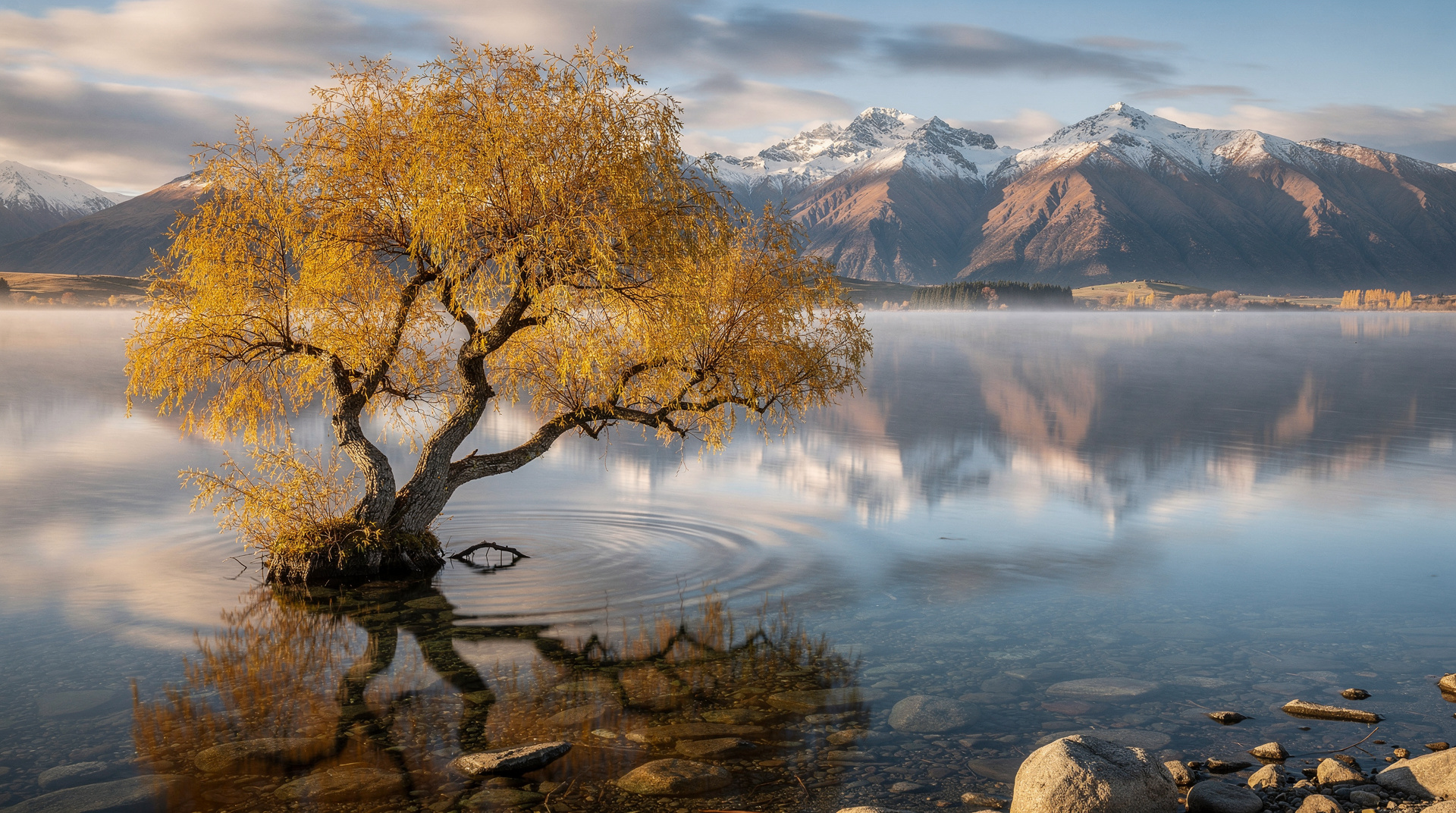
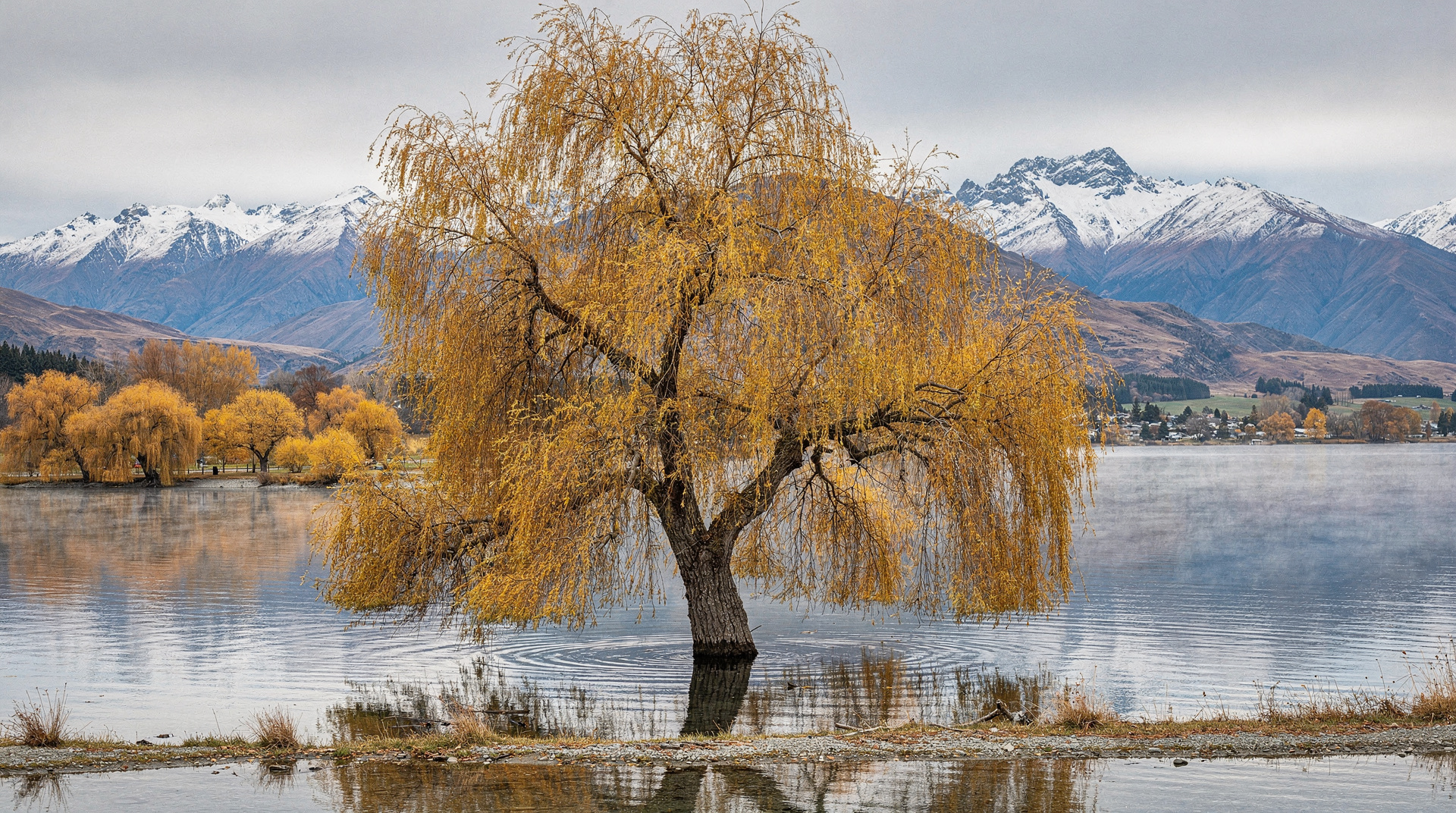
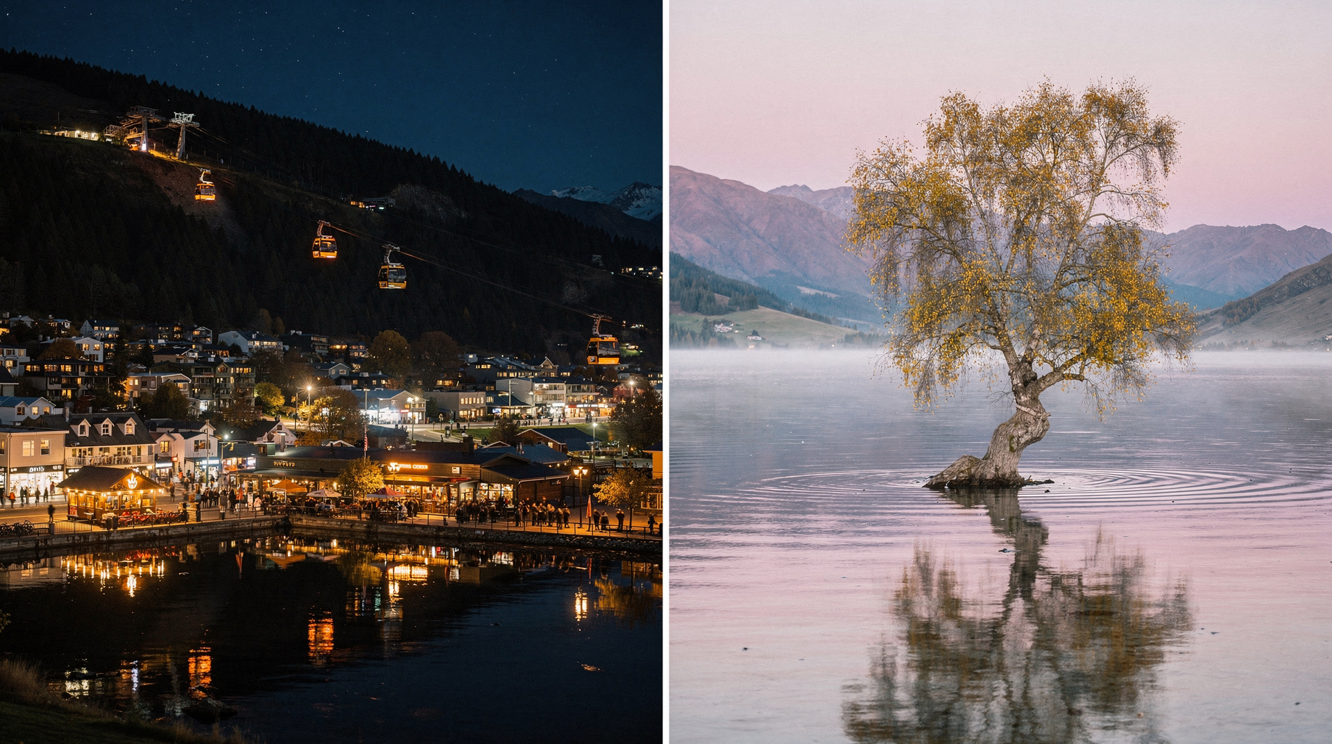
Lake Wanaka guide: 192 sq km glacial lake, the famous willow tree, kayak, paddleboard, hiking, cruises. Wanaka town, Mou Waho Island, water activities guide.
Queenstown vs Wanaka
The honest Queenstown vs Wanaka comparison: prices, crowds, ski, hikes, vibe — with a clear verdict for adventure, families, couples and budget travelers.
Day hikes around Queenstown — six best options
Six best day hikes near Queenstown: Ben Lomond (1748m), Queenstown Hill, Tiki Trail, Moke Lake loop, Bob's Peak, Deer Park Heights. Distances, times, costs.
The Remarkables — Queenstown's ski field guide
The Remarkables ski guide: lift passes, terrain, access, summer hiking. Queenstown's iconic ski backdrop. NZD 139-165 day pass. Honest 2026 guide.
Last reviewed: