Roy's Peak — Wanaka's iconic ridgeline hike
How hard is Roy's Peak Wanaka?
16km return, 1250m of elevation gain, 5-7 hours. Challenging. A relentlessly steep zigzag climb up a farm track to a ridgeline at 1578m with panoramic views over Lake Wanaka. Closed 1 October to 10 November for lambing. The iconic Instagram viewpoint is 200m before the summit — worth going all the way.
Wanaka’s defining climb
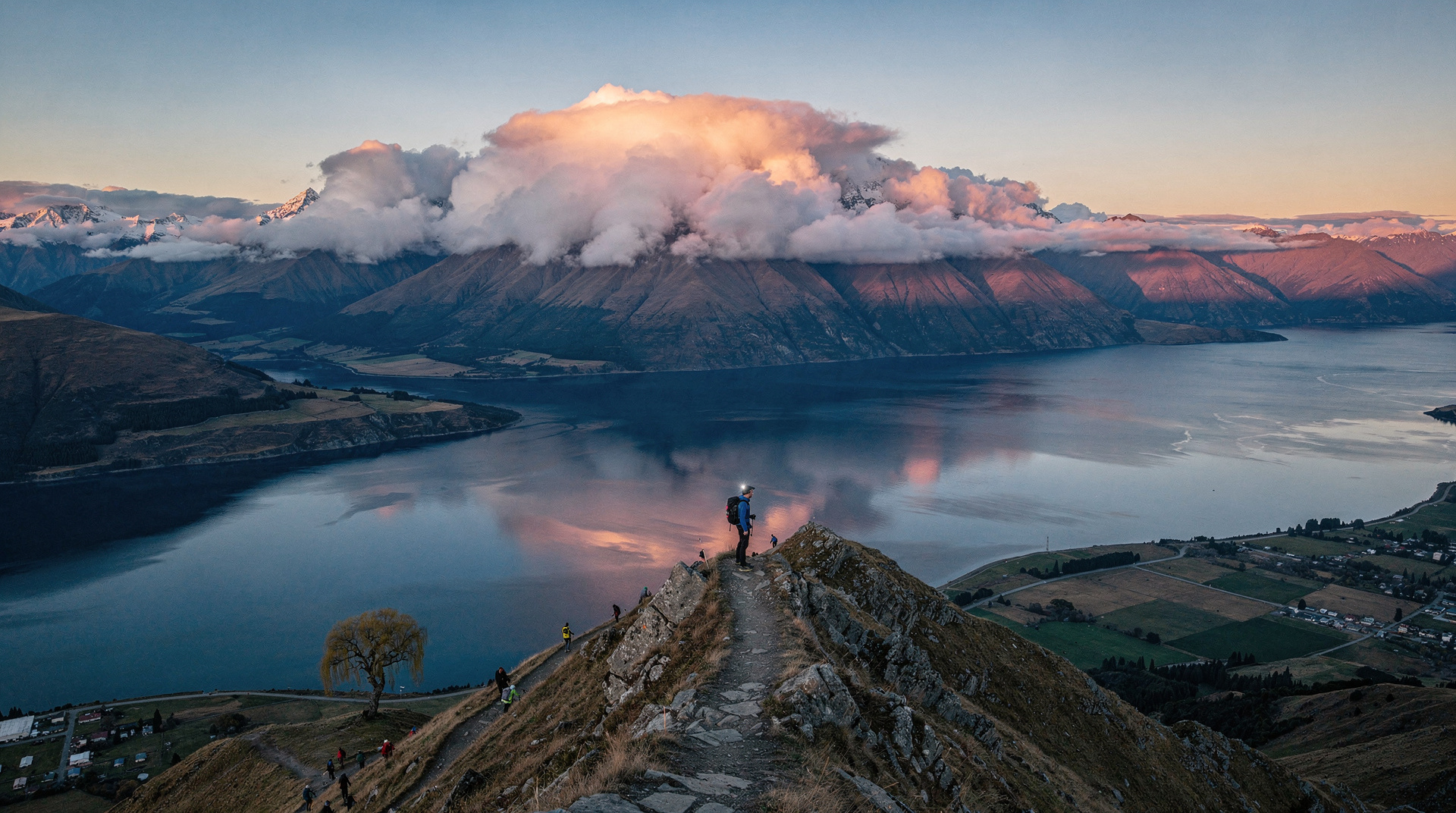
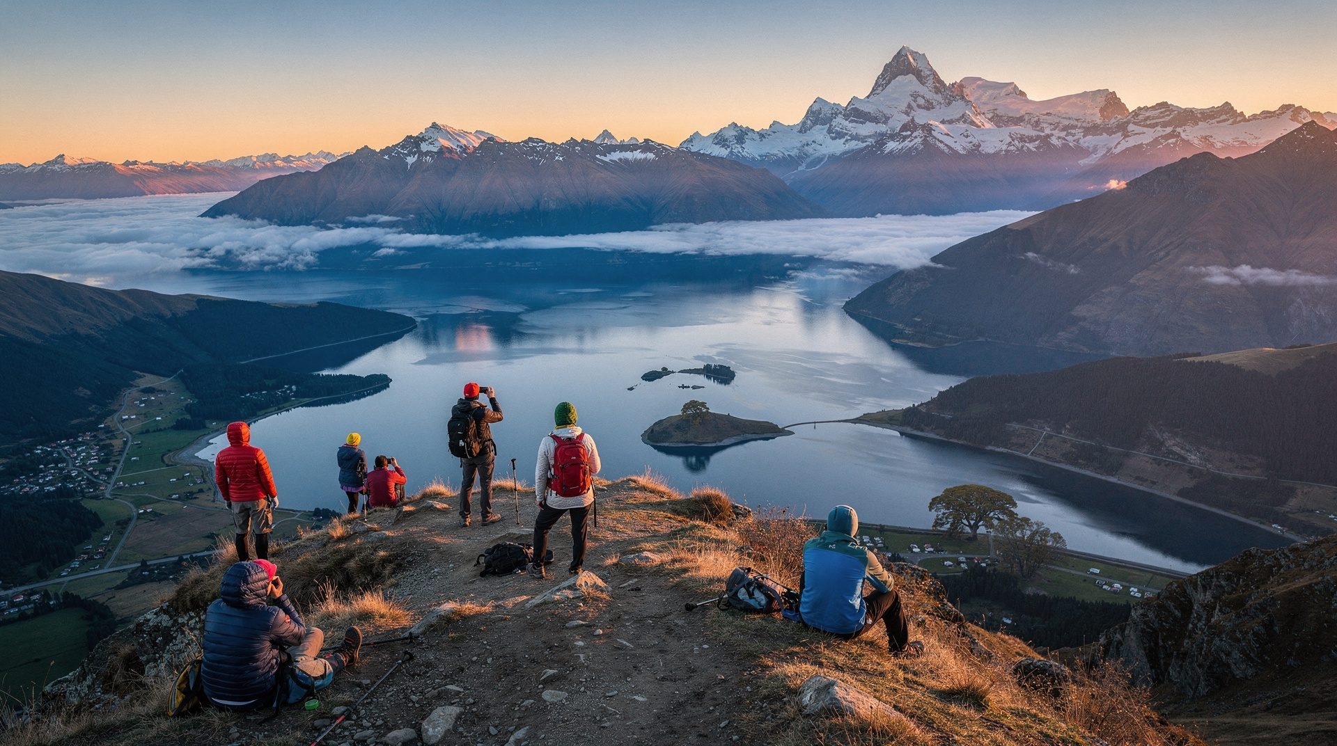
Roy’s Peak is Wanaka’s calling card. The ridgeline photograph — looking down across a rocky outcrop toward the braided shoreline of Lake Wanaka and the Clutha Valley beyond — has been shared so many times that most visitors to Wanaka arrive having already seen it. The climb to get there is harder than that photograph suggests.
At 1250m of total elevation gain over 8 km, Roy’s Peak is a sustained, unforgiving ascent. There’s no dramatic crux — just a long zigzag up open farmland and tussock grassland, exposed to sun, wind, and whatever weather Lake Wanaka has decided to produce that day. The payoff at the summit (and the photographic viewpoint 200m below it) is everything the images promise.
This is also one of the busiest day walks in the South Island. In peak summer, queues at the famous viewpoint ledge run 30-45 minutes. This guide tells you how to avoid them.
Quick stats
| Detail | Value |
|---|---|
| Distance | 16 km return |
| Total climb | 1250m |
| Summit elevation | 1578m |
| Average time | 5-7 hours return |
| Difficulty | Challenging |
| Cost | Free (private farmland with public access) |
| Seasonal closure | 1 October to 10 November (lambing) |
| Start point | Mt Aspiring Road, 6km from Wanaka |
Trailhead access
The trailhead is on Mt Aspiring Road, approximately 6 km from Wanaka town centre. There is a car park with a fee box — pay NZD 5-10 / USD 3-6 / EUR 2.8-5.5 for the day. No public transport reaches the trailhead. Options from Wanaka:
- Drive: 10 minutes from town, easy to find. In high season, arrive by 7am to guarantee a car park space.
- Cycle: The road is paved and manageable for fit cyclists, adding 12 km to your day.
- Taxi/rideshare: Wanaka taxis can drop at the trailhead; agree on a return pickup time.
The route
Lower section (0-3 km, zigzag farm track)
The track starts immediately steep through sheep and cattle farmland. Open-wire gates mark property boundaries — leave them as you find them. The views over Lake Wanaka begin almost immediately, which is both motivating and a useful excuse to stop and recover on the ascent.
The zigzag pattern means each section is short, but there’s no flat relief — the track simply switches direction every 100-200m and continues climbing. This is the section that surprises people who underestimate the hike.
Middle section (3-6 km, tussock ridgeline)
The farmland gives way to open tussock grassland above the bushline. The zigzag eases slightly in gradient but the exposure increases — any wind feels stronger here, and there’s minimal shelter from the sun. The panorama behind you over Lake Wanaka and its islands is consistently spectacular from this point.
The photographic viewpoint and summit (6-8 km)
A rocky ledge approximately 200m below the true summit has become the iconic Roy’s Peak viewpoint — the spot photographed in every sunrise and golden hour image. In peak season, a queue forms here for solo and couple photographs. The summit itself, a further 200m beyond, is rarely crowded and offers even better 360-degree views including Mt Aspiring/Tititea to the northwest.
Do not stop at the viewpoint and turn around. The summit is worth the extra 10 minutes.
Difficulty: what this hike actually requires
Rating: Challenging.
Roy’s Peak is not technically difficult — no scrambling, no exposure, no equipment beyond good footwear. But it is relentlessly steep, long, and exposed. The 1250m of elevation gain is the key number: that’s more climbing than many mountains where the trail is considered hard. Spread over 8 km, each kilometre involves approximately 156m of gain on average — significantly steeper than most day walks.
Minimum fitness baseline: if you can walk 10+ km with 500m of elevation on rough terrain without difficulty, Roy’s Peak is manageable. If you’ve been mostly on flat terrain for the past several weeks, the first 3 km will be harder than expected.
Critical considerations:
- Bring at least 2 litres of water — no water sources on the mountain
- Start before 8am to avoid peak midday heat and the viewpoint queue
- The descent is longer on the knees than the ascent; trekking poles are useful
- Do not attempt in thunderstorm conditions — the exposed ridgeline is dangerous in lightning
Seasonal closure and timing
Lambing closure: 1 October to 10 November. The track crosses private farmland, and the landowner closes it every year for lambing season. There are no exceptions — attempts to bypass the closure result in the landowner withdrawing access permanently. Respect the closure.
Best months: December-March for long days and stable weather. February and March are often the best combination of settled weather and slightly reduced crowds compared to January.
April-September: Still hikeable outside the closure period. Winter provides extraordinary views when the surrounding ranges are snow-covered, but ice underfoot requires care and the ridgeline wind can be severe. Check conditions before departing.
Crowds: January is the busiest month. Weekdays are quieter than weekends. The most effective strategy for avoiding the viewpoint queue is starting before 7am — you’ll reach the viewpoint by 10am, before the main wave arrives.
Photography tips
The famous viewpoint photograph requires:
- A small rocky ledge that fits 1-2 people comfortably
- Clear background (the lake and valley visible behind)
- Morning light hits the ledge from the east — golden hour and early morning are ideal
In peak season, the queue at the ledge is real. Most people wait 20-30 minutes. Options:
- Arrive at the viewpoint before 9:30am (requires starting before 6:30am)
- Wait your turn — most groups are quick once they’re in position
- Use the alternative view 50m before the ledge — slightly different angle, no queue
The summit area above the main viewpoint offers excellent photography without queues at any time of day.
What to pack
- 2+ litres of water (non-negotiable — no water on the mountain)
- Substantial food (5-7 hour effort requires real calories)
- Waterproof jacket (the ridge is exposed to weather)
- Sunscreen and sunglasses (no shade above the lower farmland)
- Warm layer (summit can be 10-15°C colder than town)
- Trekking poles (useful for descent)
- Trail runners or walking shoes with grip
- Camera and charged phone
Cost breakdown (NZD / USD / EUR)
| Item | NZD | USD | EUR |
|---|---|---|---|
| Track (farmland access) | 5-10 | 3-6 | 2.8-5.5 |
| Parking | Included | — | — |
| Transport from town | Variable | — | — |
Alternatives from Wanaka
If Roy’s Peak is closed (lambing season) or the weather doesn’t cooperate, Wanaka offers strong alternatives:
Diamond Lake and Rocky Mountain (9 km return, 4 hours, moderate): A shorter loop with lake views that include the characteristic braided outlet. Accessible year-round.
Isthmus Peak Track (16 km return, 1200m, 6-8 hours): On the opposite side of Lake Hawea, similar scale to Roy’s Peak but less crowded. Slightly harder conditions in some weather.
Mt Iron (3.5 km loop, 1.5 hours, easy-moderate): The accessible 548m summit above Wanaka town — good views, minimal effort, always open.
For guided hiking experiences in the wider Wanaka-Queenstown area, the Wanaka: Waterfall Climb and Canyon Tour (heli-canyon) combines helicopter access and canyoning in an alpine setting. NZD 450-550 / USD 270-330 / EUR 248-303.
The Wanaka: Scenic Hot Air Balloon Flight offers an aerial perspective over Lake Wanaka at dawn that puts the Roy’s Peak view in broader geographic context. NZD 395-445 / USD 237-267 / EUR 217-245.
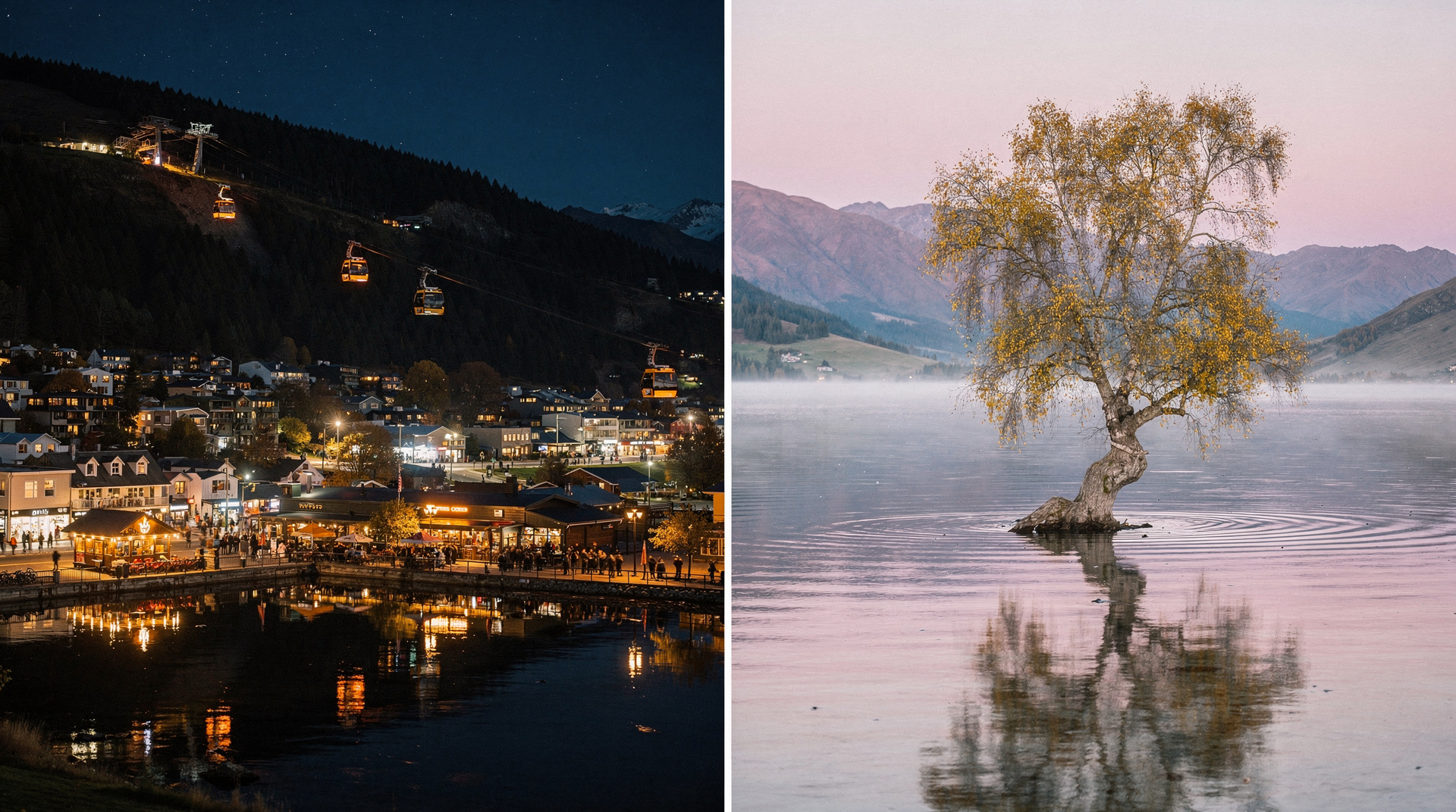
Where to eat and recover in Wanaka
After 1250m of climbing, you’ve earned a substantial meal. Wanaka options:
- Francesca’s Italian Kitchen: Post-hike pasta and pizza on the lakefront. NZD 20-35 / USD 12-21 / EUR 11-19 per main.
- Federal Diner: Excellent brunch, consistently good coffee. Queues on weekend mornings.
- Ritual Cafe: Specialty coffee, good for the pre-dawn start breakfast.
- Wanaka Hotel bar: Cold beer with lake views — exactly right after Roy’s Peak.
Frequently asked questions
Can I do Roy’s Peak as a day trip from Queenstown?
Yes, but it’s a long day. Wanaka is 1 hour from Queenstown — departing by 5:30am allows you to start the hike by 7am and return to Queenstown by late afternoon. More comfortable as an overnight in Wanaka. See the Queenstown vs Wanaka comparison.
Is Roy’s Peak suitable for beginners?
It is not the ideal first serious hike. The sustained gradient and 1250m of climbing make it harder than it looks on paper. The Tongariro Alpine Crossing and Roy’s Peak are two of NZ’s most hiked trails — both require real fitness. Roy’s Peak has the advantage of being well-marked and not requiring any shuttle logistics.
What happens if it rains on my hike day?
Light rain makes the track muddy and the grass slippery but is manageable with waterproofs. Significant rain with wind on the exposed ridgeline is genuinely miserable and potentially dangerous. If the forecast shows heavy rain or thunderstorms, the Diamond Lake track is a lower-elevation alternative.
Is there a guided option for Roy’s Peak?
Not commonly — it’s a straightforward track that doesn’t require guiding. Local operators offer private guiding for custom itineraries that may include Roy’s Peak alongside other Wanaka adventures.
Related guides
- Lake Wanaka complete guide
- Day hikes around Wanaka
- Queenstown vs Wanaka — choosing your South Island base
- The Remarkables ski area guide — the mountains across the valley
- Wanaka destination guide
Related guides
Wanaka
Honest Wanaka guide: Roy's Peak, Cardrona ski, lake kayaking — real NZD/USD/EUR costs and the honest Queenstown vs Wanaka verdict.
Queenstown
The honest Queenstown planner: bungy, jet boat, ski, scenic flights — real prices in NZD/USD/EUR, what to skip and what's worth your money.
Lake Wanaka — guide to Queenstown's quieter rival
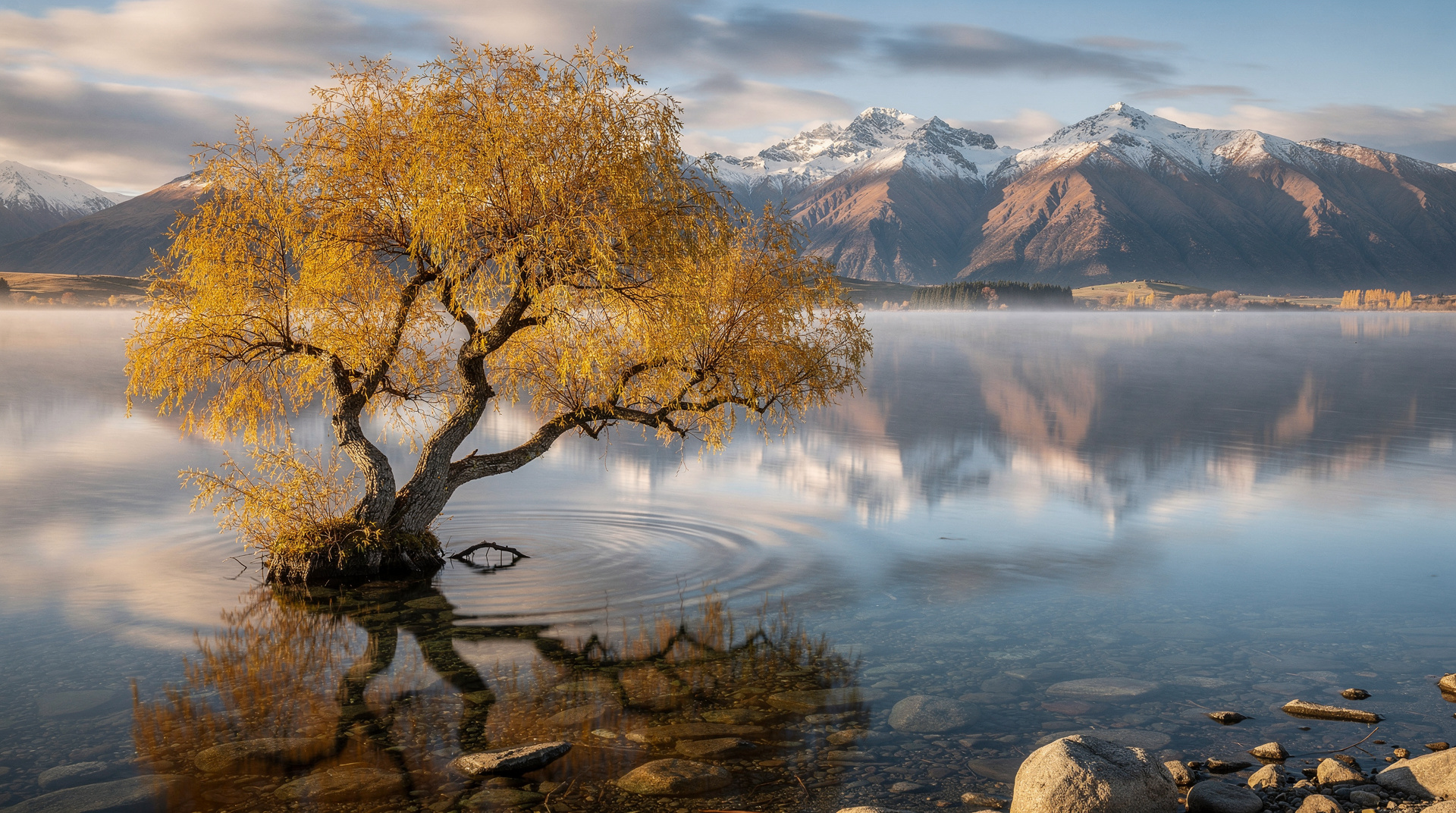
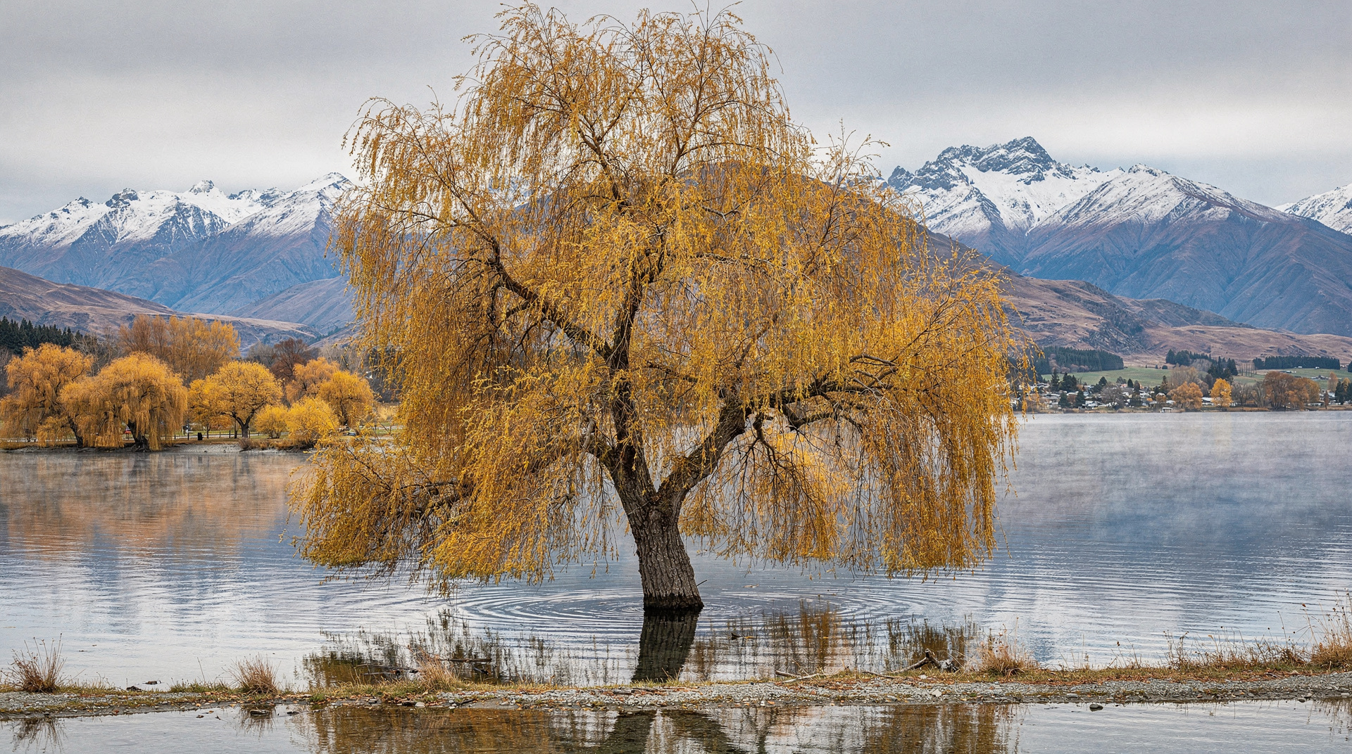
Lake Wanaka guide: 192 sq km glacial lake, the famous willow tree, kayak, paddleboard, hiking, cruises. Wanaka town, Mou Waho Island, water activities guide.
Day hikes around Wanaka — five best options
Five best day hikes near Wanaka: Roy's Peak (closed Oct-Nov), Diamond Lake, Isthmus Peak, Mt Iron, Roys Peak alternatives. Distances, times, difficulty ratings.
Queenstown vs Wanaka
The honest Queenstown vs Wanaka comparison: prices, crowds, ski, hikes, vibe — with a clear verdict for adventure, families, couples and budget travelers.
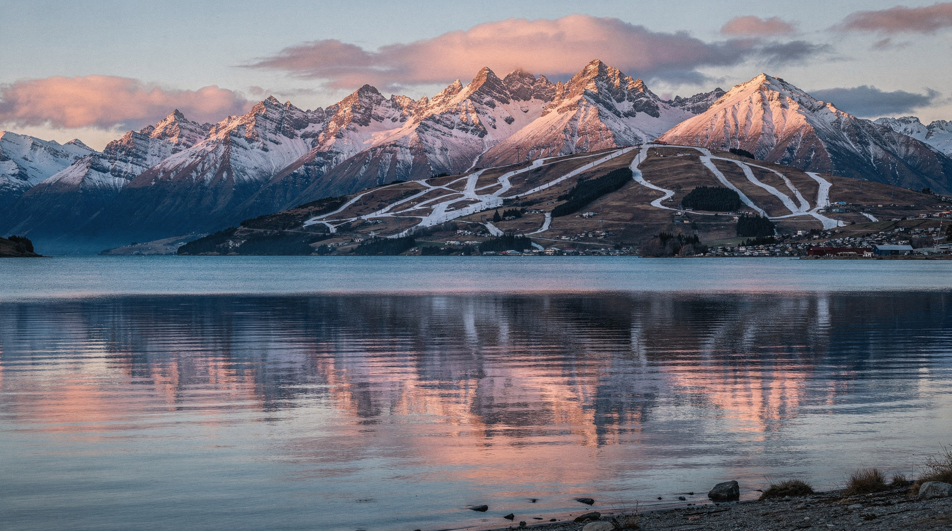
The Remarkables — Queenstown's ski field guide
The Remarkables ski guide: lift passes, terrain, access, summer hiking. Queenstown's iconic ski backdrop. NZD 139-165 day pass. Honest 2026 guide.
Last reviewed: