Southern Alps — overview of New Zealand's mountain spine
What are the Southern Alps and why do they matter for NZ travel?
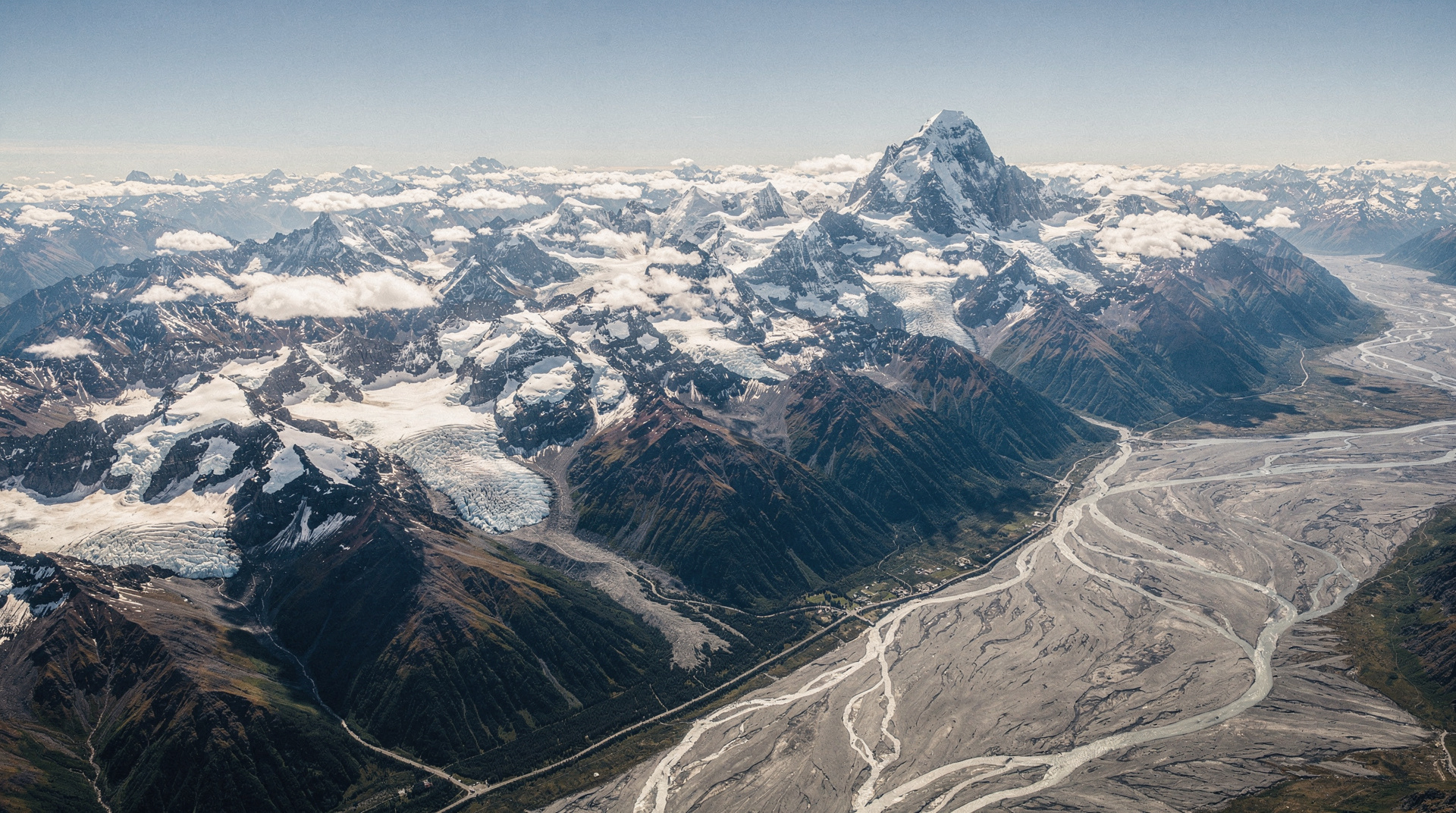
The Southern Alps (Te Tiritiri o te Moana in Maori — the sparkling peaks of the sea of cloud) run 500km along the South Island's spine, separating the wet West Coast from the dry Canterbury/Otago plains. Aoraki/Mt Cook (3724m) is the highest peak. They create New Zealand's most dramatic scenery: Franz Josef, Fox glaciers, Milford Sound, and the Canterbury Plains were all shaped by them.
The backbone of the South Island
The Southern Alps (Te Tiritiri o te Moana — “the sparkling peaks above the sea of cloud”) run 500 kilometres along the South Island’s western spine, from Nelson in the north to Fiordland in the south. They are geologically young mountains — the result of the ongoing collision between the Pacific and Australian tectonic plates — which is why they rise so steeply and erode so quickly. The average rate of uplift (currently approximately 10mm per year in the central ranges) is counterbalanced by equally rapid erosion, producing the chaotic, heavily glaciated terrain that defines the Alps today.
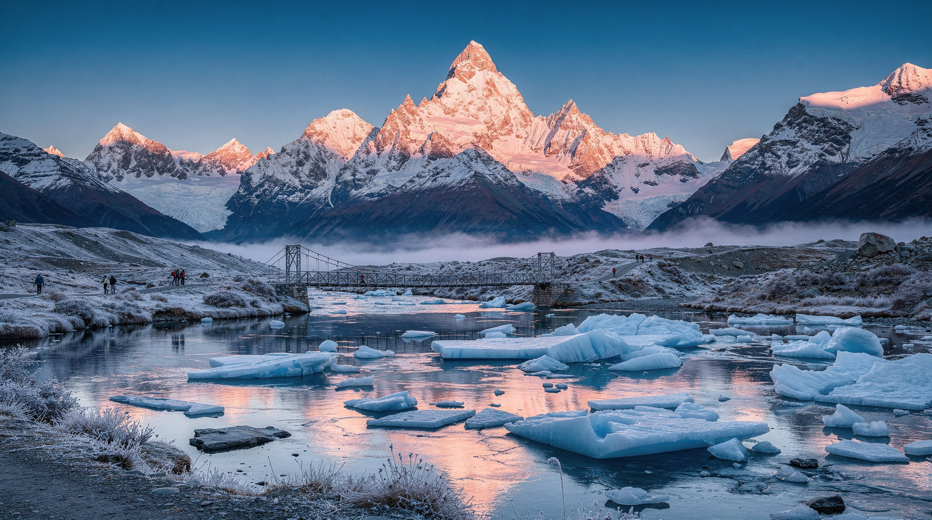
Aoraki/Mt Cook at 3,724m is the high point, surrounded by 18 other peaks over 3,000m in the main divide section. These mountains are the primary reason for New Zealand’s dramatic landscape contrast: the Alps intercept moisture from the Tasman Sea, delivering extraordinary rainfall to the West Coast (Milford Sound: 6,800mm annually) while creating a rain shadow that keeps Canterbury and Otago dry and warm.
Key sections of the Alps
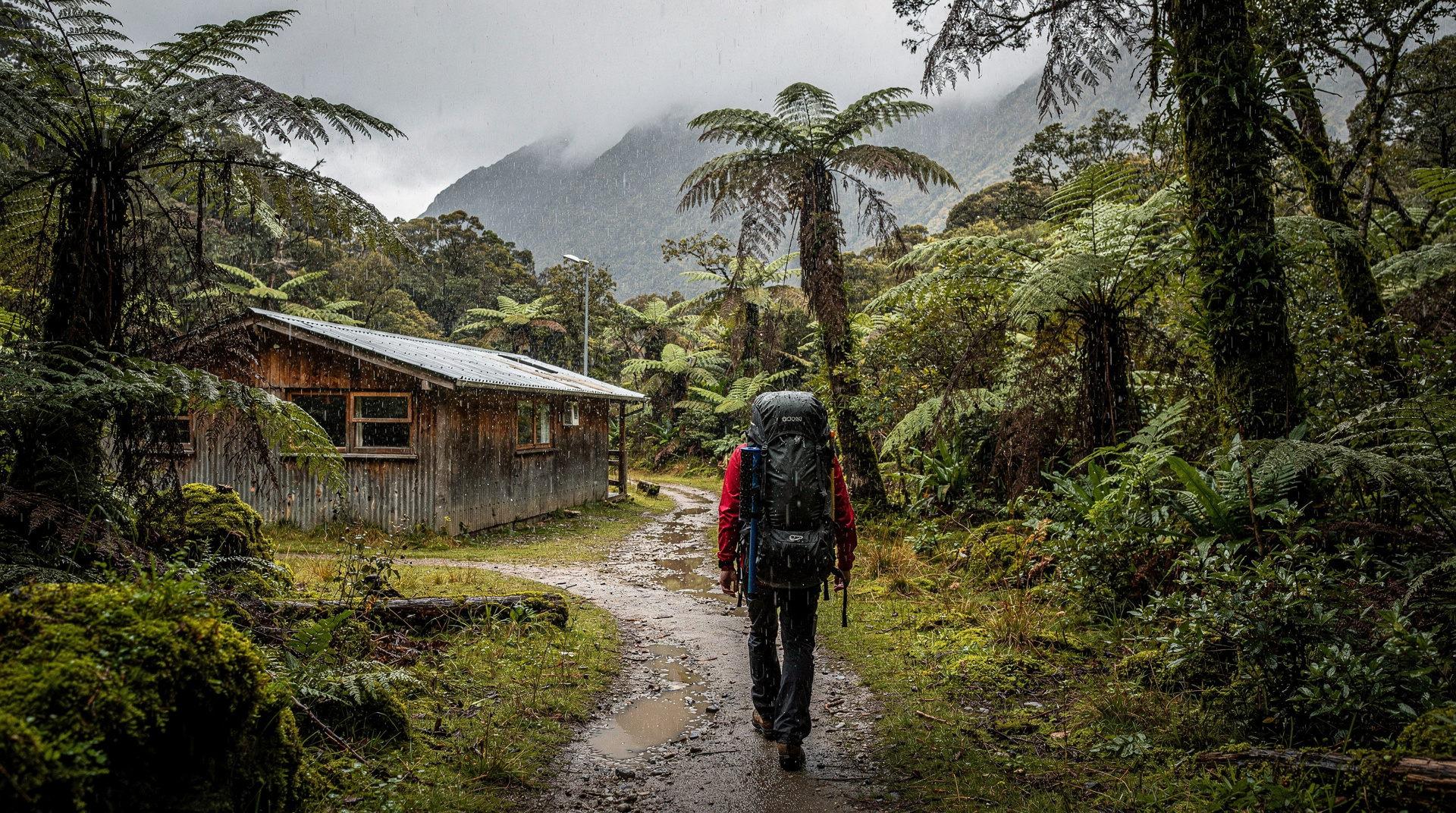
Northern Alps (Nelson-Kahurangi): Lower elevation, more accessible. The Heaphy Track traverses the Kahurangi National Park ranges — the northernmost alpine section of New Zealand’s mountain chain.
The Main Divide (Mt Cook area): The highest and most glaciated section. Aoraki/Mt Cook dominates, flanked by Mt Tasman (3,497m), Mt Dampier (3,440m), and seventeen other 3,000m+ peaks. The Tasman Glacier (29 km, New Zealand’s longest) and the Hooker, Murchison, and Mueller glaciers all drain from this section.
Arthur’s Pass and the central divide: The TranzAlpine railway crosses here — the Waimakariri and Otira Gorge sections. Walking access via Arthur’s Pass village (90 km from Christchurch) provides some of the most accessible alpine terrain in New Zealand.
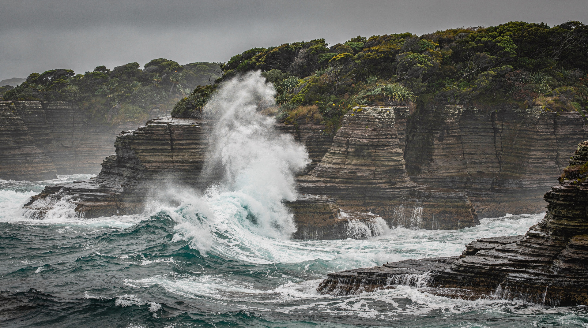
Southern Alps (Fiordland): The alps submerge into the sea in the southwest, creating the fiords. The Milford Track, Routeburn, and Kepler Tracks all traverse this section. The combination of glacial valleys, vertical rock walls, and tidal inlets is unique in the world.
The glaciers: what’s happening now
New Zealand’s Southern Alps glaciers are actively retreating. The Tasman Glacier has retreated approximately 5 km since 1970, with the terminal lake growing from non-existence to a 7 km lake in that period. Hooker Glacier has retreated similarly. Franz Josef and Fox Glaciers on the West Coast have shown complex behaviour (advancing in 2000-2008, then retreating sharply from 2009 onward).
This matters for visitors for two reasons:
-
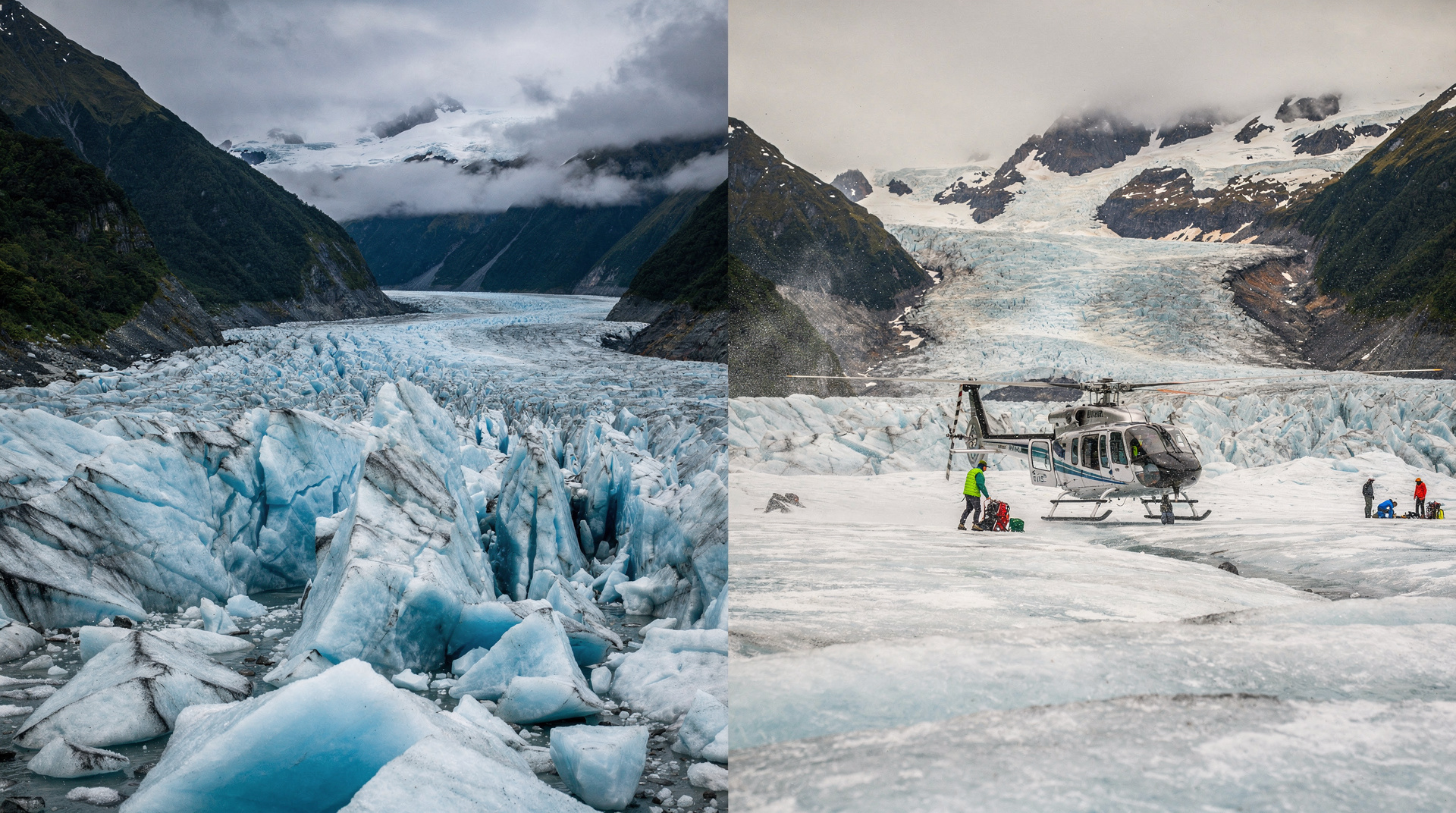
Timing: The glacier experiences available today — heli-hike on the Tasman, ice climbing on Franz Josef — will be significantly reduced or inaccessible within 20-30 years. The glacier terminus is retreating beyond helicopter landing range. Visit now if the glacier experience matters to you.
-
Safety: As glaciers retreat, they expose unstable rock and create new hazard zones. The glacier experience has changed from “walk to the terminal face” to “helicopter to the upper reaches” specifically because the lower glacier is now dangerously unstable. This is not adventure tourism operator conservatism — it is genuine hazard management.
The Mount Cook: 3 Hour Heli Hike to the Tasman Glacier accesses the stable upper Tasman Glacier with a guide, away from the deteriorating terminal area. NZD 475-545 / USD 285-327 / EUR 261-300.
The Franz Josef: Half-Day Glacier Helicopter and Hiking Tour accesses the upper Franz Josef Glacier ice field — the lower glacier walking tours that were standard until the 2010s are no longer available due to ice quality deterioration. NZD 385-445 / USD 231-267 / EUR 212-245.
How the Alps shape New Zealand weather
The North-South alignment of the Alps creates New Zealand’s most important climatic division:
West of the Alps: 4,000-8,000mm of annual rainfall. Dense native rainforest, almost permanent cloud on the ranges. The West Coast is the most biodiverse region in the country — and frequently the wettest.
East of the Alps: 400-700mm of annual rainfall. Dry, sunny Plains and Otago basin. The Canterbury Plains exist because 10,000 years of river sediment from the Alps has built the flat land that feeds New Zealand.
This means that a single day of driving — through the TranzAlpine railway corridor or via Haast Pass — produces a dramatic climate and vegetation transition. The Arthur’s Pass drive from Christchurch in dry sunshine to the Hokitika coast in rain within 3 hours is among the world’s most compressed climate transitions.
Crossing the Alps: the passes
Arthur’s Pass (920m): The main cross-island highway (SH73) and the TranzAlpine railway corridor. The easiest crossing, closest to Christchurch. The alpine village at the pass has several walks, including the dramatic Dobson Nature Walk and the more challenging Avalanche Peak (6 hours return, challenging).
Haast Pass (563m): The southernmost highway crossing (SH6), connecting Wanaka to the West Coast. The lowest pass but the most remote — the West Haast valley is one of New Zealand’s few genuinely wild highway corridors.
Lewis Pass (864m): Northernmost highway crossing (SH7), connecting Canterbury to the West Coast at Greymouth. Less dramatic than Arthur’s Pass but the most efficient route between Christchurch and Nelson.
Homer Tunnel (through Fiordland): The 1.3 km tunnel through the Darran Mountains on the Milford Sound road — not a pass but the only mechanical crossing through Fiordland’s main divide.
Experiencing the Alps by transport
TranzAlpine railway: 5-hour scenic train from Christchurch to Greymouth. Crosses the Southern Alps via the Waimakariri Gorge and the Otira Gorge — one of the most dramatic railway journeys in the world. Day return from Christchurch (NZD 179 one way) or combine with West Coast overnight. Detailed coverage in the TranzAlpine vs Coastal Pacific comparison.
Ski plane access: From the Mt Cook area, ski plane access to the Tasman Glacier plateau and other high-alpine areas offers a view of the mountain system that no road or track can replicate. The Mount Cook: Ski Plane and Helicopter Glacier Combo Flight combines ski plane and helicopter for two perspectives. NZD 595-665 / USD 357-399 / EUR 327-366.
Franz Josef helicopter: The Franz Josef Town: 3-Glacier Helicopter Ride with Landing provides a high-altitude landing on the Franz Josef neve — the upper ice field that feeds the glacier. NZD 325-385 / USD 195-231 / EUR 179-212.
The Alps and Maori history
The Southern Alps were crossed by Ngāi Tahu along established routes (ara) primarily for access to pounamu (greenstone/jade), found on the West Coast rivers. These were not casual journeys — the mountain crossings (particularly through the Haast and Otira corridors) were significant undertakings with specific protocols and protocols for safe passage.
Several of the Southern Alps passes retain Maori names that reflect their use: Haast Pass is also Tioripatea (the flat crossing), Otira Gorge was a known ara.
Cost breakdown: accessing the Alps (NZD / USD / EUR)
| Experience | NZD | USD | EUR |
|---|---|---|---|
| TranzAlpine (Christchurch to Greymouth, one way) | 179 | 107 | 98 |
| Hooker Valley Track (free) | Free | Free | Free |
| Tasman Glacier heli-hike | 475-545 | 285-327 | 261-300 |
| Franz Josef heli-hike | 385-445 | 231-267 | 212-245 |
| Ski plane + helicopter combo (Mt Cook) | 595-665 | 357-399 | 327-366 |
Frequently asked questions
How are the Southern Alps different from the Northern Alps (Europe)?
The Southern Alps are geologically younger and more active. The mountain uplift rate exceeds Europe’s older, more stable ranges. The Southern Alps are also wetter (Tasman Sea moisture vs Mediterranean dryness), with more active glaciers in proportion to their size. Chemically, the rock is predominantly greywacke and argillite — different from the granite and limestone that characterise many European ranges.
Can I see the Southern Alps from Christchurch?
Yes, on clear days. The Alps are visible from Christchurch’s flat coastal plain as a white wall to the west, approximately 70-120 km away. The clearest views are typically in the early morning before heat shimmer develops.
What is the best single day to experience the Southern Alps?
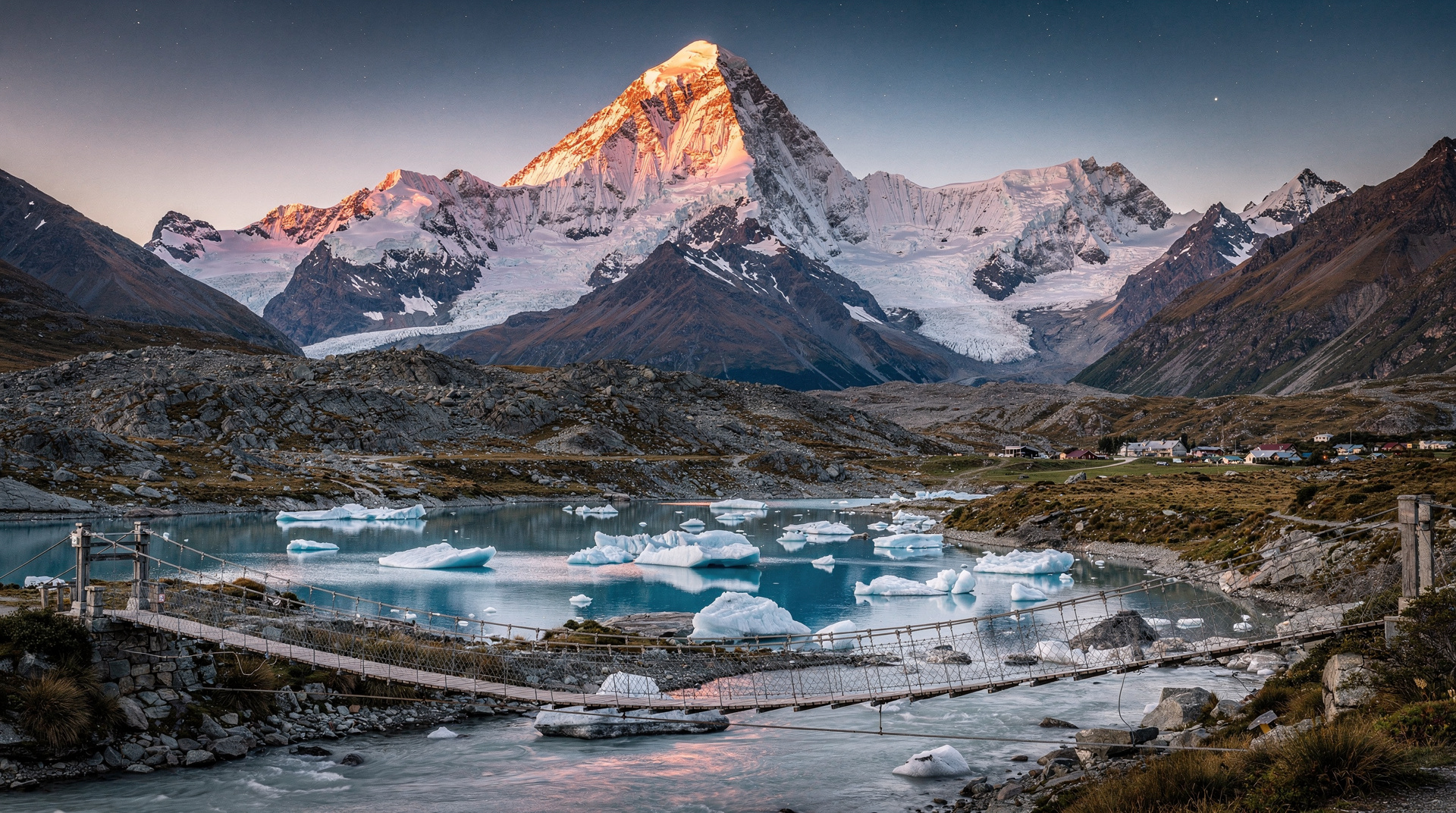
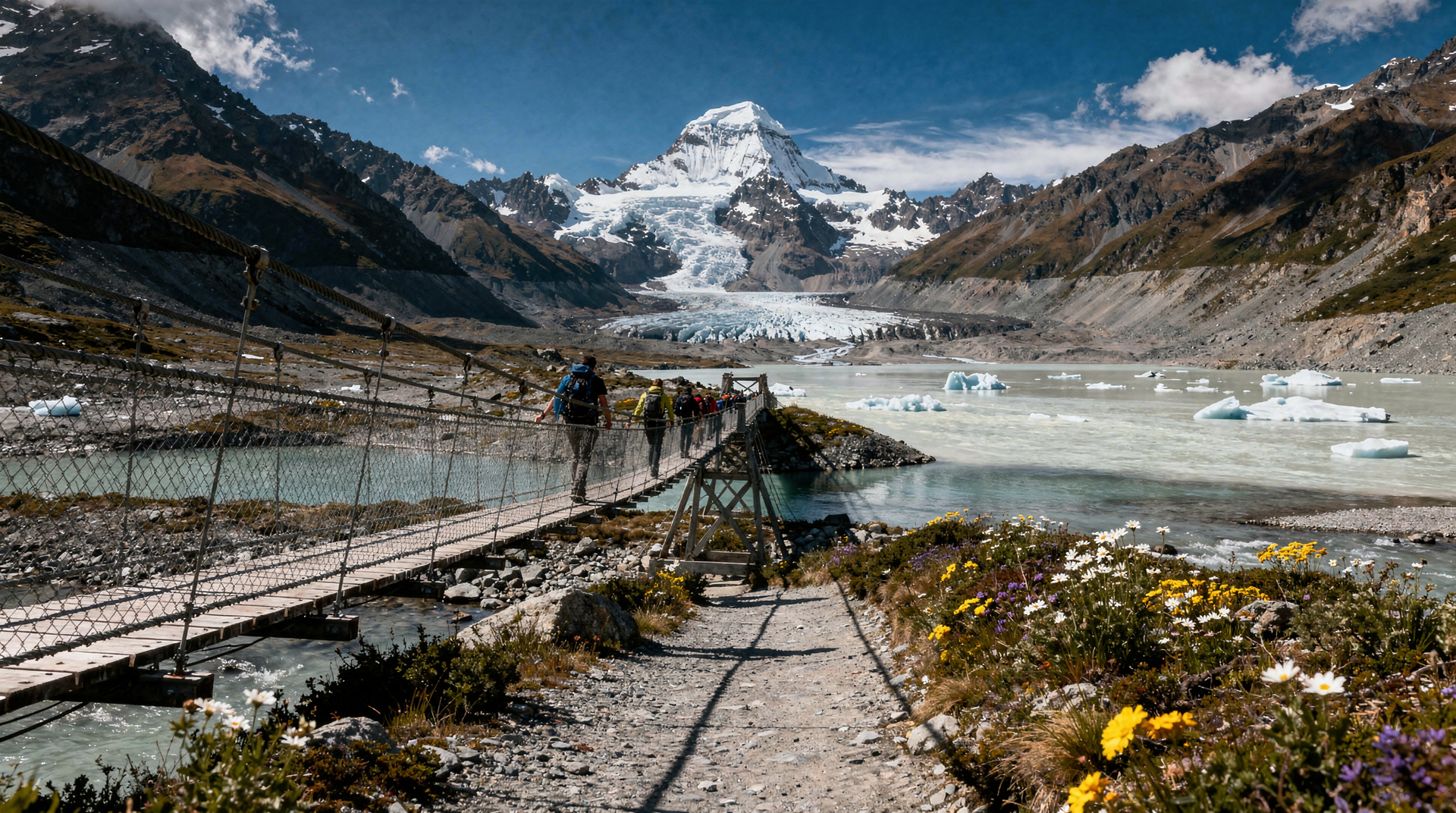
The Hooker Valley Track (10 km return from Mt Cook Village, 3-4 hours, free) provides the most direct engagement with the high-alpine environment for non-climbers. Combined with a helicopter experience, it constitutes a complete Southern Alps day. See the Aoraki/Mt Cook complete guide.
Related guides and reading
Related guides
Aoraki/Mt Cook — complete visitor guide
Aoraki/Mt Cook complete guide: Hooker Valley Track, Tasman Glacier heli-hike, stargazing, accommodation. NZ's highest peak 3724m. Plan your visit.
Hooker Valley Track — Aoraki/Mt Cook day walk
Hooker Valley Track: 10km return, easy-moderate, three swing bridges, glacial lake, Aoraki/Mt Cook views. Honest guide with logistics and safety.
Franz Josef vs Fox Glacier
Honest Franz Josef vs Fox Glacier comparison: heli-hike options, town facilities, Lake Matheson, and which glacier to choose. Prices in NZD/USD/EUR.
Milford Track — the world's finest walk
Milford Track: 53.5km, 4 days, one direction only, NZD 102/night huts. Book 6 months ahead. The most famous Great Walk in NZ — worth every step.
Aoraki / Mount Cook
Honest Aoraki / Mount Cook guide: Hooker Valley Track, Tasman Glacier, scenic flights — real NZD/USD/EUR prices and what to expect in all seasons.
West Coast
Honest West Coast guide: Franz Josef and Fox Glacier heli-hikes, Punakaiki Pancake Rocks, Hokitika, Greymouth. NZD/USD/EUR prices, what's worth it.
Last reviewed: