Lake Pukaki — the turquoise gateway to Aoraki/Mt Cook
Where is the best viewpoint for Lake Pukaki and Aoraki/Mt Cook?
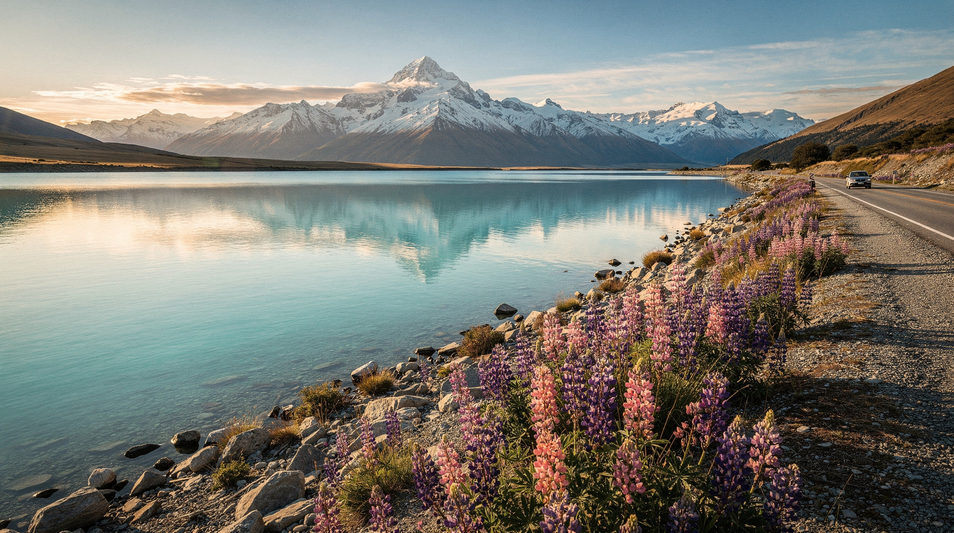
The Lake Pukaki dam wall on SH8 (the junction where you turn onto SH80 toward Mt Cook) gives the classic view: turquoise lake foreground, the Mt Cook range in the distance. On clear mornings, Aoraki/Mt Cook (3724m) is directly visible 90km away. Pull in at the dam car park — about 1 minute off the main road. Free.
The road that leads to New Zealand’s highest peak
Lake Pukaki is the gateway lake to Aoraki/Mt Cook — not in a generic tourism-brochure sense, but literally: the 55-kilometre road along its western shore (SH80) is the only land route to Mt Cook Village. Every visitor to Aoraki approaches across Lake Pukaki’s turquoise expanse, with the mountain growing larger at the end of the valley as they drive.
The lake itself is 101 square kilometres, 71m deep, and fed by the glacial melt from the Tasman Glacier. Like Lake Tekapo (25 km north), the colour is produced by glacial flour — rock ground fine by glacier action and suspended in the water. Pukaki’s colour tends slightly more vivid than Tekapo’s, particularly in late summer when glacial melt is highest.
The dam at the north end of the lake was raised in 1979 as part of the Meridian Energy hydroelectric system — this raised the lake level by 35m and flooded the original township of Pukaki (a historic site now occasionally visible when the lake level is low). The modern lakeside is a managed reservoir rather than a purely natural lake, though the visual result is unchanged.
The key viewpoint
The dam viewpoint is where SH8 meets the start of SH80. At the car park beside the dam structure, the classic Lake Pukaki composition is available:
- Turquoise lake extending south
- On clear days, Aoraki/Mt Cook visible at the end of the valley (90 km distant)
- The Liebig Range on the left horizon
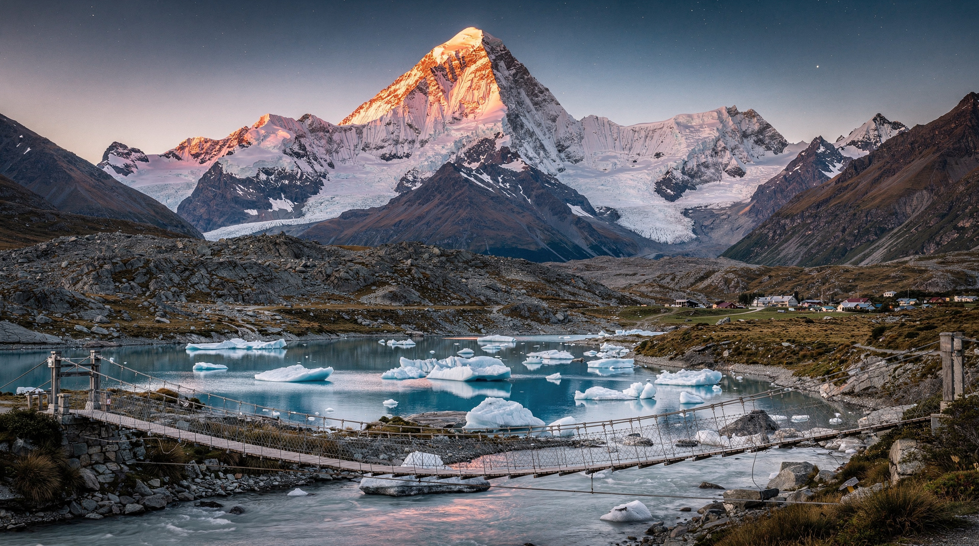
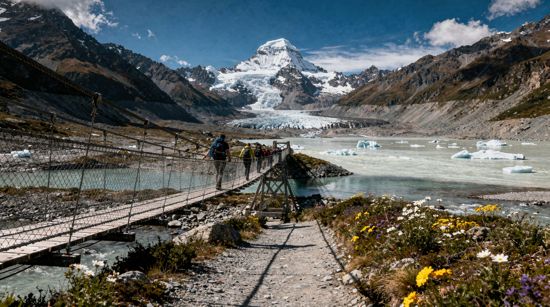
This view has been reproduced in so many tourism materials that it may feel familiar before you see it. The reality is that the photograph doesn’t fully convey the scale — the lake occupies your entire horizontal field of view, and the mountain at the end is nearly 3,800m of actual rock and ice, not a small decorative element.
Morning light: The mountains at the valley’s head catch sun from the east — morning viewing provides the best clarity and colour contrast. By midday, the mountains often accumulate cloud cap.
Autumn and winter: After fresh snowfall on the surrounding ranges, the contrast between the turquoise lake and white mountains becomes even more pronounced. Winter photography (July-September) produces some of the most dramatic images of any season.
The drive along SH80
The 55-kilometre road from the dam to Mt Cook Village is one of New Zealand’s great drives. The road follows the western shore of the lake, then continues up the Tasman valley.
Key points along SH80:
- Lake Pukaki dam (km 0): The view described above.
- Glentanner Station (km 35): Working high-country sheep and cattle station, camping available (NZD 20-30/night / USD 12-18 / EUR 11-17). The station is also a base for scenic flights.
- Lake Pukaki/Tasman confluence (km 40): Where the lake narrows and the Tasman River enters. The braided river pattern begins here.
- Aoraki/Mt Cook Village (km 55): The destination.
Driving time: 50-60 minutes from the dam to the village, including a few photo stops. Allow 30 minutes extra if you stop at Glentanner and photograph the river braids.
Salmon farm and lakeside dining
The Mt Cook Salmon farm at the southern end of the lake (accessible from the SH80 junction) produces fresh New Zealand salmon in the glacial water. Visitors can view the farm and purchase salmon direct.
Salmon from the farm: The water temperature (typically 7-10°C year-round) and the glacial mineral content produce a distinctive pale-fleshed salmon popular in high-end New Zealand restaurants. Buying direct from the farm (NZD 15-25 / USD 9-15 / EUR 8-14 per fillet) is significantly cheaper than purchasing in Christchurch or Queenstown.
The Mt Cook Station cafe adjacent to the salmon farm serves salmon dishes with lake views. An extremely good lunch stop — the salmon is as fresh as it gets.
Getting to Lake Pukaki
From Christchurch: 3 hours via SH1 south to Tekapo junction, then SH8 west. The dam viewpoint is passed before turning onto SH80.
From Queenstown: 3 hours via Cromwell, Omarama, and SH8 east. The viewpoint is the first lake visible approaching from this direction.
From Lake Tekapo: 25 km south on SH8. A 30-minute side trip from the Tekapo-Mt Cook route.
For those without a car, the Tekapo Shuttle: Mt Cook Day Tour via Pukaki & Tasman Lake passes through the Lake Pukaki dam viewpoint en route. NZD 65-85 / USD 39-51 / EUR 36-47.
The From Queenstown: Mount Cook and Hooker Valley Day Trip (from Cromwell) offers a Queenstown-based day trip covering Mt Cook and Lake Pukaki. NZD 185-235 / USD 111-141 / EUR 102-129.
Photography guide
Classic composition: Foreground water with mountain in distance. Polarising filter significantly enhances the turquoise colour by reducing surface glare.
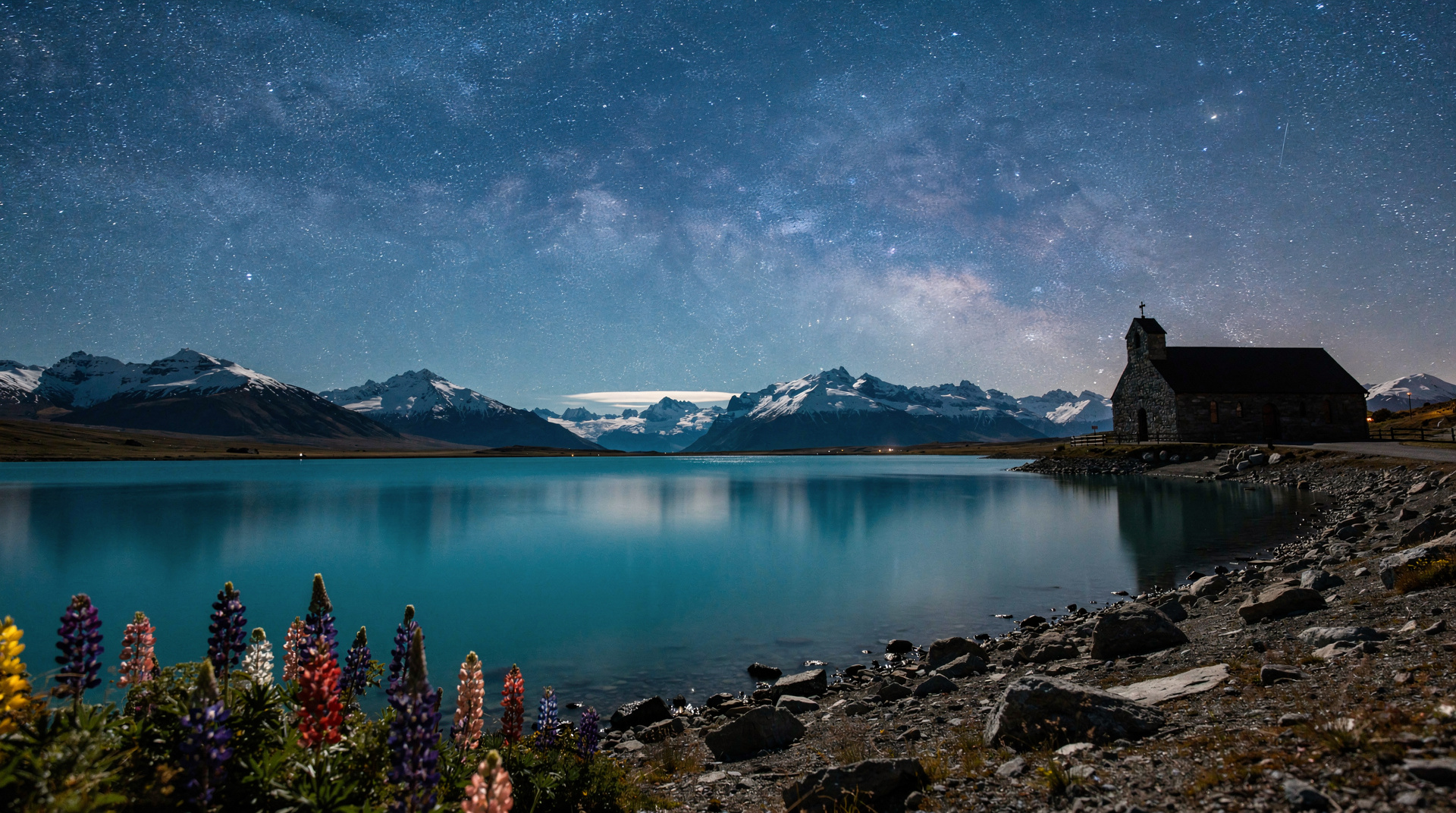
Lupins in season: November-December, the same invasive lupin species as Lake Tekapo blooms pink and purple along the lake margins. The lupin-and-mountain composition is one of the most-shared New Zealand images.
Drone: DOC allows drone use in the Mackenzie Basin but requires notification for flights within national park boundaries. The SH80 lake corridor (outside Mt Cook National Park) generally allows drone photography.
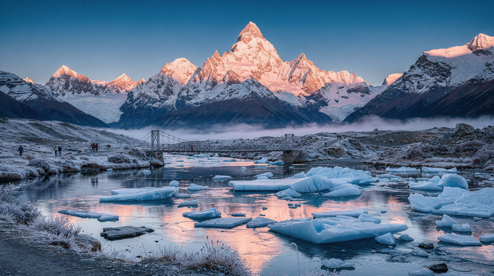
Ice floes: In mid-winter, ice can form at the shallow northern end of the lake and creates extraordinary abstract photographs.
Braemar Station: luxury high-country
Braemar Station (adjacent to the southern lake shore) is a working high-country sheep station with luxury accommodation. Stays here — typically NZD 450-800/night / USD 270-480 / EUR 248-440 — include farm activities, guided walks on station land, and exceptional mountain views across the lake.
Not for budget travellers, but as a New Zealand high-country experience, Braemar is one of the most authentic options in the South Island. Book directly with the station.
Cost breakdown (NZD / USD / EUR)
| Experience | NZD | USD | EUR |
|---|---|---|---|
| Dam viewpoint | Free | Free | Free |
| SH80 drive along the lake | Cost of fuel | — | — |
| Glentanner campsite | 20-30/night | 12-18 | 11-17 |
| Salmon from farm | 15-25/fillet | 9-15 | 8-14 |
| Tekapo-Mt Cook shuttle (passes lake) | 65-85 | 39-51 | 36-47 |
| Braemar Station accommodation | 450-800/night | 270-480 | 248-440 |
Frequently asked questions
Is Lake Pukaki more impressive than Lake Tekapo?
They’re different experiences. Tekapo has more tourism infrastructure (restaurants, stargazing, hot springs), the famous church, and is a destination in itself. Pukaki has the better mountain view (direct Aoraki/Mt Cook sightline), a more isolated character, and the 55 km lakeside drive to Mt Cook. Most visitors see both — they’re 25 km apart.
Can I swim in Lake Pukaki?
The lake is cold (7-12°C year-round) but swimmable in summer. The main entry point is at the northern end, near the dam. There is no supervised swimming beach — this is glacial water in an open landscape. Short dips in hot weather: yes. Extended swimming: cold and potentially risky.
Why was the original Pukaki township flooded?
The Meridian Energy hydro-electric scheme raised the lake level by 35m in 1979, requiring the relocation of the Pukaki farming community. The historic township (originally established in the 1880s) is submerged but periodically visible during low water levels — the foundations of buildings and fence lines have been seen in dry years.
Is there anything to do near the lake besides the drive?
The salmon farm, Braemar Station, and Glentanner Station camping are the main non-driving experiences. For activity from the lake area, helicopter flights from Glentanner Airport provide direct access to Aoraki/Mt Cook and the glacier system.
Related guides and reading
Related guides
Lake Pukaki — the turquoise gateway to Aoraki/Mt Cook
Lake Pukaki guide: turquoise glacial lake on the road to Aoraki/Mt Cook. The dam viewpoint, SH80 drive, Braemar Station salmon farm, photography guide.
Aoraki / Mount Cook
Honest Aoraki / Mount Cook guide: Hooker Valley Track, Tasman Glacier, scenic flights — real NZD/USD/EUR prices and what to expect in all seasons.
Lake Tekapo
Honest Lake Tekapo guide: stargazing, Church of the Good Shepherd, hot pools — real NZD/USD/EUR costs and how long you actually need here.
Lake Tekapo — turquoise lake and stargazing guide
Lake Tekapo complete guide: the turquoise glacial lake, International Dark Sky Reserve stargazing, Church of Good Shepherd, hot springs, Mt Cook day trip.
Aoraki/Mt Cook — complete visitor guide
Aoraki/Mt Cook complete guide: Hooker Valley Track, Tasman Glacier heli-hike, stargazing, accommodation. NZ's highest peak 3724m. Plan your visit.
Hooker Valley Track — Aoraki/Mt Cook day walk
Hooker Valley Track: 10km return, easy-moderate, three swing bridges, glacial lake, Aoraki/Mt Cook views. Honest guide with logistics and safety.
Last reviewed: