Otago Central Rail Trail — complete guide for 2026
How hard is the Otago Central Rail Trail?
The trail is rated easy to moderate. It follows a disused railway line with a maximum gradient of 1 in 50 — never steep, but persistent. The surface is mostly compacted gravel. Most fit recreational cyclists complete it in 4 days (Clyde to Middlemarch); a relaxed pace with rest stops and side trips takes 5-6 days. E-bikes are now widely available and make the trail accessible to almost anyone.
The Rail Trail in five honest sentences
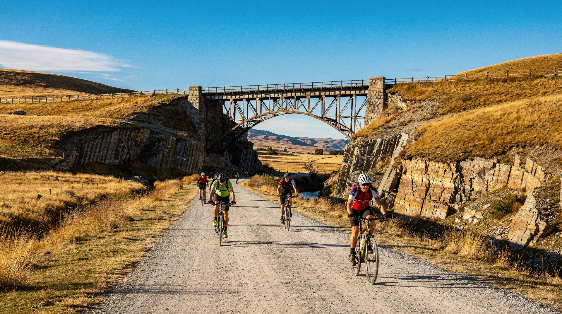
The Otago Central Rail Trail is 152 km of disused railway line converted into a cycling and walking track through the heartland of Central Otago. You cycle through the driest, most dramatic interior of the South Island — schist rock formations, golden tussock, gorges cut by the Manuhirikia River, and a string of small towns that look exactly like they did a century ago. The gradient never exceeds 1:50, the surface is compacted gravel, and the scenery is consistently extraordinary. You don’t need to be a serious cyclist. And it’s one of the best ways to understand why Central Otago feels different from the rest of New Zealand.
Why do this trail — and why it’s not for everyone
The case for it
The Rail Trail succeeds where many adventure activities don’t: it’s genuinely accessible. If you can ride a bike for 30-40 km a day, you can do this trail. The route is self-supporting (accommodation, food, and luggage transport operators are well-established), the weather in Central Otago is more reliable than almost anywhere else in the South Island, and the freedom of choosing your own pace along an empty rail corridor is something urban cyclists rarely experience.
The autumn light on Central Otago is extraordinary — golden poplars lining irrigation channels, the schist tors glowing in afternoon sun, the vineyards turning red. October (spring) brings wildflowers. December-February brings heat (Central Otago is NZ’s driest region) and full services. March-April is the sweet spot: warm, uncrowded, visually dramatic.
The honest caveats
This is not a spectacular alpine trail. The scenery is rolling and interior — think high desert rather than fiordland drama. If you’re hoping for glaciers, dramatic peaks, or ocean views, look elsewhere. The towns along the route are small (some have populations under 50) and facilities are basic between them. And summer temperatures can exceed 35°C / 95°F, which is unusually hot for New Zealand — carry more water than you think you need.
The route: Clyde to Middlemarch
The trail runs 152 km between Clyde (near Alexandra, connected to Queenstown and Wanaka) and Middlemarch (connected by the Taieri Gorge Railway to Dunedin). The conventional direction is west-to-east (Clyde to Middlemarch), which puts the prevailing westerly wind at your back and delivers a slight overall descent. However, operators run it in both directions.
Day 1 — Clyde to Lauder (42 km)
Starting point: Clyde is a small, appealing gold-rush-era town 17 km from Alexandra and 45 minutes from Wanaka or 1h 15min from Queenstown. Most cyclists start here after a night in Alexandra or Clyde itself.
The first day is the most immediately rewarding: you leave Clyde, cross the Clutha River (Mata-Au), and enter the Cromwell Gorge — a dramatic limestone/schist canyon with the emerald-green waters of Lake Dunstan below. The old rail tunnels are particularly atmospheric; bring lights (mandatory, several are 100m+ long). After the gorge, the landscape opens into the Ida Valley.
Lauder: Population approximately 30. The Lauder Store and Café (the social hub of the valley) is the main refuelling point. Basic but comfortable accommodation at Lauder Hotel (NZD 90-120 / USD 54-72 / EUR 50-66 per room).
Day 2 — Lauder to Oturehua (28 km)
A shorter day, allowing time to explore the Manuhirikia Valley. The trail passes through Omakau (a slightly larger town with a pub, store, and accommodation) and continues to Ophir, one of the best-preserved 19th-century gold-rush towns in New Zealand — the old stone post office, hotel, and courthouse create a streetscape that looks unchanged from 1890.
The climb to Oturehua is the most sustained ascent of the whole trail (still gentle by any standard). Oturehua is a tiny farming community with one key attraction: Hayes Engineering Workshop (DOC-managed), a historic farm workshop containing the extraordinarily complex machinery built by Ernest Hayes in the early 20th century — water-powered tools, lathes, and mills that he designed and built himself. Worth 30-45 minutes.
Stay: Oturehua has basic accommodation at the Rail Station Cottages (self-contained, NZD 120-160 / USD 72-96 / EUR 66-88). Book ahead in peak season.
Day 3 — Oturehua to Ranfurly (29 km)
The route crosses the summit (618 m at the Wedderburn Saddle) — the highest point of the trail — before descending gently to Ranfurly. The Maniototo Plain stretches to the horizon in all directions: flat, treeless, and vast in a way that feels strangely moving. On clear days, the snow-capped Hawkduns range sits to the north.
Ranfurly is the largest town on the trail (population ~800) and the Art Deco capital of Central Otago — the 1930s rebuild after a fire left the town with a remarkable collection of Art Deco commercial buildings. The Ranfurly Museum covers the gold rush, the railway history, and the farming era. There are several accommodation options including the Ranfurly Hotel (NZD 85-110 / USD 51-66 / EUR 47-61 for a pub room) and the Ranfurly Holiday Park.
Day 4 — Ranfurly to Middlemarch (54 km)
The longest day, but through largely flat terrain. The trail passes Hyde (a ghost town that once had 1,000 residents during railway construction) and Rock and Pillar Range lookouts before the final descent into the Strath Taieri valley. Middlemarch sits at the edge of the Taieri Plain, surrounded by farmland.
Middlemarch: Population ~120. There are several accommodation options (Middlemarch Lodge is the most popular, NZD 110-150 / USD 66-90 / EUR 61-83), a café-pub, and the train station where the Taieri Gorge Railway departs for Dunedin.
5-day option: Split day 4 at Hyde or at the Kokonga Woolshed (a rest stop with a DOC shelter). Day 5 is then a relaxed final 30 km.
Logistics: the pieces you need to organise
Direction: Clyde to Middlemarch or reverse?
Clyde to Middlemarch (recommended): slight overall descent, prevailing tailwind more often than headwind, ends with the Taieri Gorge Railway connection to Dunedin.
Middlemarch to Clyde: More scenic tunnel approach at Cromwell Gorge on the last day (you see it coming rather than leaving it behind). Ends near Queenstown/Wanaka.
Getting to the start
Clyde via Queenstown: Queenstown to Clyde by rental car is 1h 15min — leave the car in Clyde (paid secure storage available, ask your operator) or use a transfer service.
Clyde via Wanaka: 45 minutes.
Middlemarch via Dunedin (Taieri Gorge Railway): The heritage train runs from Dunedin’s historic railway station. It’s a spectacular journey and a natural start to the trail.
Getting from the finish
Middlemarch to Dunedin: Taieri Gorge Railway (see below) or shuttle transfer (Trail Journeys and similar operators provide luggage/rider transfers).
Clyde to Queenstown: Shuttle or rental car.
Luggage transfers
No one wants to cycle 150 km with a full pack. Multiple operators offer luggage-forwarding services — your bags are driven between accommodation stops daily while you ride with a daypack only. This is strongly recommended.
Operators: who to book with
The Rail Trail has a well-developed operator ecosystem. The following are established and consistently reviewed:
Trail Journeys (Clyde): The most comprehensive operator on the trail. Offers guided tours, self-guided packages, bike rental (including e-bikes), luggage transfers, and accommodation booking. The self-guided 4-day package with luggage transfer and accommodation bookings costs approximately NZD 600-900 / USD 360-540 / EUR 330-495 per person (bike not included).
Cycle Surgery (Alexandra): Excellent bike hire including high-quality e-bikes. Also does airport/accommodation shuttles. If you’re renting a bike only, this is a well-regarded option.
Adventure South: Runs guided multi-day tours on the Rail Trail with a support vehicle. Good for groups and those who want daily route briefings and pre-booked accommodation. Expect to pay NZD 1,600-2,200 / USD 960-1,320 / EUR 880-1,210 for a fully guided 4-day package including accommodation and most meals.
Bikes: standard vs e-bike
Standard mountain bike: Appropriate for fit cyclists comfortable with 35-45 km days on gravel. The climbs are gentle; the challenge is duration rather than gradient.
E-bike: The trail has been transformed by e-bikes. A 45 km day on an e-bike feels like a 20 km day on a conventional bike. Operators have dramatically expanded their e-bike fleets — availability is now good even in peak season, but book 2-4 weeks ahead for December-January. E-bikes typically add NZD 30-50 / USD 18-30 / EUR 17-28 per day to standard bike rental costs.
Bike rental rates: Standard bike NZD 40-60 / USD 24-36 / EUR 22-33 per day. E-bike NZD 75-110 / USD 45-66 / EUR 41-61 per day. Helmets are mandatory in New Zealand and are included in rental fees.
Own bike option: If you’re bringing a road bike or touring bike, the compacted gravel surface is manageable but a mountain bike (26mm+ tyre) is noticeably more comfortable. The loose rock sections through the gorge tunnels are easier with wider tyres.
Accommodation along the trail
The towns on the trail are small but accommodation options are well-developed for cyclists. Booking ahead is essential in December-January and the Easter weekend.
| Town | Options | Price range (double) |
|---|---|---|
| Alexandra/Clyde | Holiday park, motel, B&B | NZD 80-200 / USD 48-120 |
| Lauder | Lauder Hotel, cottage | NZD 90-130 / USD 54-78 |
| Omakau | Omakau Commercial Hotel, camper | NZD 75-120 / USD 45-72 |
| Ophir | Historic guesthouse | NZD 120-160 / USD 72-96 |
| Oturehua | Rail Station Cottages | NZD 120-160 / USD 72-96 |
| Ranfurly | Hotel, holiday park | NZD 80-150 / USD 48-90 |
| Middlemarch | Middlemarch Lodge, pub | NZD 110-160 / USD 66-96 |
DOC campsites: Basic camping exists at several points along the trail for those travelling light. No facilities beyond a toilet at some sites. NZD 8-15 / USD 5-9 / EUR 4.40-8.25 per night.
Real costs
| Item | NZD | USD | EUR |
|---|---|---|---|
| E-bike rental (4 days) | 300-440 | 180-264 | 165-242 |
| Standard bike rental (4 days) | 160-240 | 96-144 | 88-132 |
| Luggage transfer (4 days) | 80-120 | 48-72 | 44-66 |
| Accommodation per night (budget) | 75-100 | 45-60 | 41-55 |
| Accommodation per night (mid) | 120-160 | 72-96 | 66-88 |
| Food/day (self-catering + café) | 40-70 | 24-42 | 22-39 |
| Taieri Gorge Railway (Middlemarch to Dunedin) | 100-120 | 60-72 | 55-66 |
| Total (4 days, e-bike, mid accommodation) | ~1,100-1,500 | 660-900 | 605-825 |
Full package operators (self-guided with accommodation and luggage): NZD 850-1,200 / USD 510-720 / EUR 468-660 per person for 4 days (bike extra).
When to go
March to May (autumn): The best season — visually extraordinary with golden poplars and vines, cooler temperatures, fewer other cyclists on the trail. The days are still long enough for comfortable riding.
October to November (spring): Wildflowers on the Maniototo Plain, lambs in the paddocks, reliable weather. Can be cold in the mornings (temperatures near 0°C / 32°F at night in September) but warms quickly. The trail is typically quieter than summer.
December to February (summer): Peak season. Facilities are fully open, but temperatures can exceed 35°C. Carry a minimum of 2 litres of water at all times — shade is minimal on the Maniototo section. Book accommodation and bike hire well in advance (3-4 months for e-bikes in January).
June to August (winter): Not recommended. Several accommodation options close, morning frost makes the gravel surface slippery, and the days are short (5:30 p.m. sunset in June). Some cyclists do it, but it’s a different experience.
Connecting the Rail Trail to a South Island trip
The Rail Trail sits neatly at the eastern end of a Central Otago circuit:
From Queenstown: Drive to Clyde (1h 15min), cycle the trail to Middlemarch, take the Taieri Gorge Railway to Dunedin, explore Otago Peninsula for a day (see day trips from Dunedin), then either fly back to Queenstown or continue south via The Catlins.
Wine pairing: The Clyde/Alexandra end of the trail is within the Central Otago wine region. Spending a rest day in Cromwell or Gibbston Valley before or after the ride is a natural combination — and the pinot noir here is New Zealand’s best. A guided wine tour from Queenstown is the easiest way to combine both:
Queenstown: Central Otago wine tourSee the Central Otago wine tour guide for vineyard recommendations.
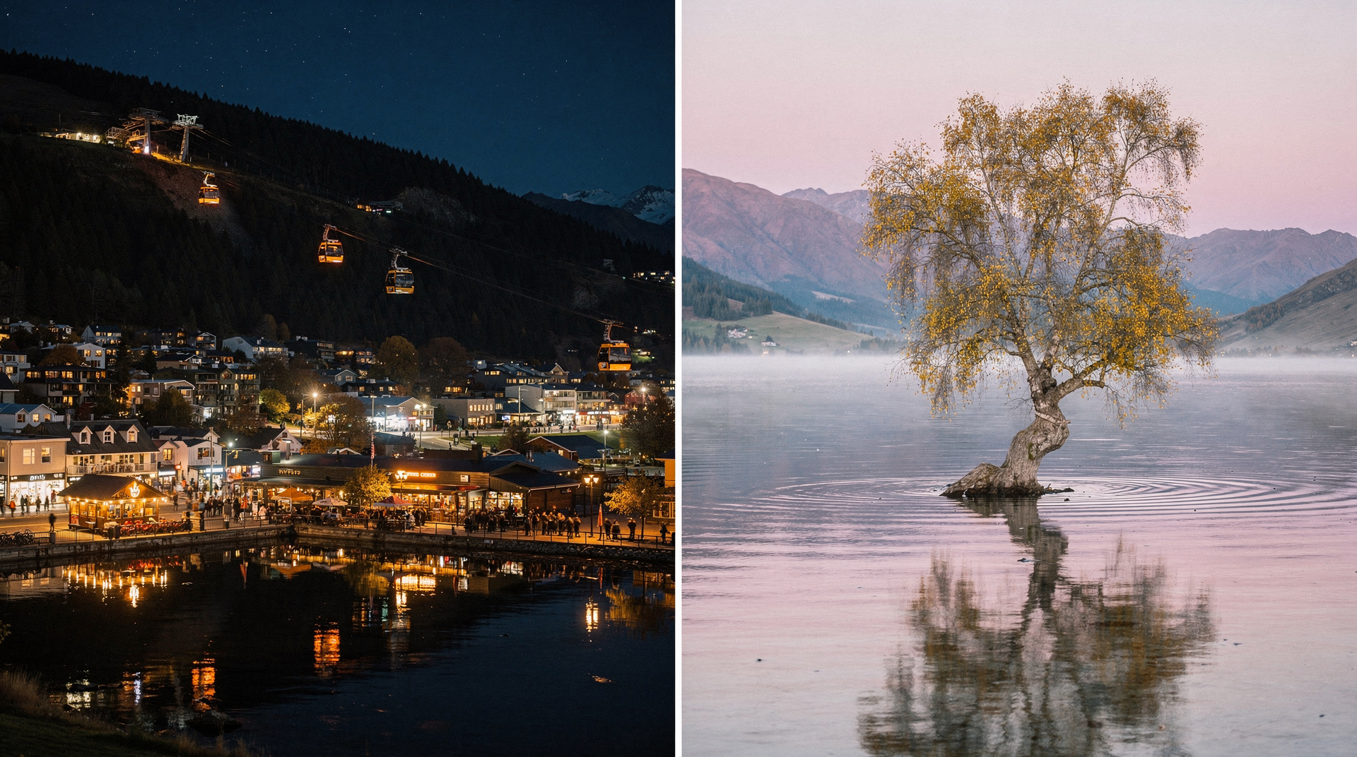
Adding Wanaka: Wanaka is 45 minutes from Clyde. Tacking on 2 nights in Wanaka before the rail trail gives you time for Roy’s Peak and some of the best day hikes in Wanaka before switching into cycling mode.
The Taieri Gorge Railway — the most scenic connection
Dunedin: scenic railway tour through the Taieri GorgeThe Taieri Gorge Railway runs between Dunedin and Middlemarch (and/or Pukerangi, a shorter service). The heritage diesel train crosses 10 iron viaducts and passes through 2 tunnels in the gorge — it’s a genuinely spectacular journey that looks like something from a different era of travel. Rail trail cyclists can book the one-way Middlemarch-to-Dunedin service at the end of their ride. Bikes are transported in the luggage van (book bike space at the same time as your ticket). The journey takes approximately 3.5-4 hours.
Common mistakes
Not booking bikes early: E-bike availability in December-January is tight. Book 6-8 weeks ahead for peak summer. January school holidays in NZ (mid-January to end of January) push demand to the limit.
Underestimating the sun: Central Otago is the driest region in New Zealand with very low humidity and high UV. Sunscreen, a wide-brimmed hat, and at least 2 litres of water per person per day are non-negotiable on summer days.
Ignoring the tunnel lights rule: Helmets and lights (front and rear) are mandatory for cycling through the trail tunnels. Tunnels are long, dark, and uneven underfoot. Lights must be mounted on the bike, not held in your hand.
Skipping Ophir: Most cyclists push straight from Omakau to Oturehua and miss Ophir’s 1 km detour. This is a mistake — the stone township is one of the most photogenic in New Zealand and the road into it adds perhaps 20 minutes.
Not checking accommodation at Oturehua: There are only a handful of beds at this trail stop. It books out completely in peak season. If Oturehua is full, your alternative is a longer day to Ranfurly — doable but hard if you’re not conditioned for 60 km days.
FAQ
Do I need to be a regular cyclist to do this trail?
No. The maximum gradient is 1:50 (2%) — this is the specification required for railway operations, which means even heavily loaded freight trains could traverse it. If you’re on an e-bike, the sustained gentle uphill sections become trivial. The physical challenge is primarily endurance (spending 5-7 hours per day on a bike) rather than fitness. Most operators recommend that you’ve done at least a few 30 km rides on a non-motorised bike before attempting the trail without an e-bike.
Can I walk the trail instead of cycling?
Yes. The trail is open to walkers, and some sections (particularly near Clyde and the gorge) are extremely popular on foot. However, walking the full 152 km would take 8-12 days — most walking visitors do one or two sections rather than the full route.
Is the trail suitable for children?
For confident cyclists aged 10 and above, yes. E-bikes are available from age 16 (most operators) or with parental supervision. The flat terrain makes it genuinely child-friendly. Several families do the trail together with luggage transport. Very young children in bike trailers are not recommended due to the gravel surface.
What happens if my bike breaks down?
The operators all provide emergency phone contact and basic repair support. The trail has enough traffic (other cyclists, farm vehicles) that you’re unlikely to be stranded for long. Most bike hire includes a basic toolkit. Serious mechanical failures: the towns along the trail have varying levels of bike repair availability; Trail Journeys and Cycle Surgery are your best support options.
Is there mobile coverage on the trail?
Intermittent. Vodafone and Spark have coverage in Alexandra, Ranfurly, and Middlemarch. Between towns, coverage drops significantly. Satellite emergency locators (personal locator beacons / PLBs) can be hired from DOC offices in Alexandra — recommended for solo travellers. Tell someone your itinerary before you leave.
How does the Rail Trail compare to the Alps 2 Ocean Cycle Trail?
The Alps 2 Ocean (from Aoraki/Mt Cook to Oamaru, 308 km) is longer and more scenically dramatic at the Aoraki end but less historically interesting along the route. The Rail Trail has more character in the small towns and a better-developed accommodation/operator ecosystem. Most cyclists who’ve done both rate the Rail Trail as the better experience overall; Alps 2 Ocean is more appropriate if dramatic mountain scenery is your priority.
Related guides
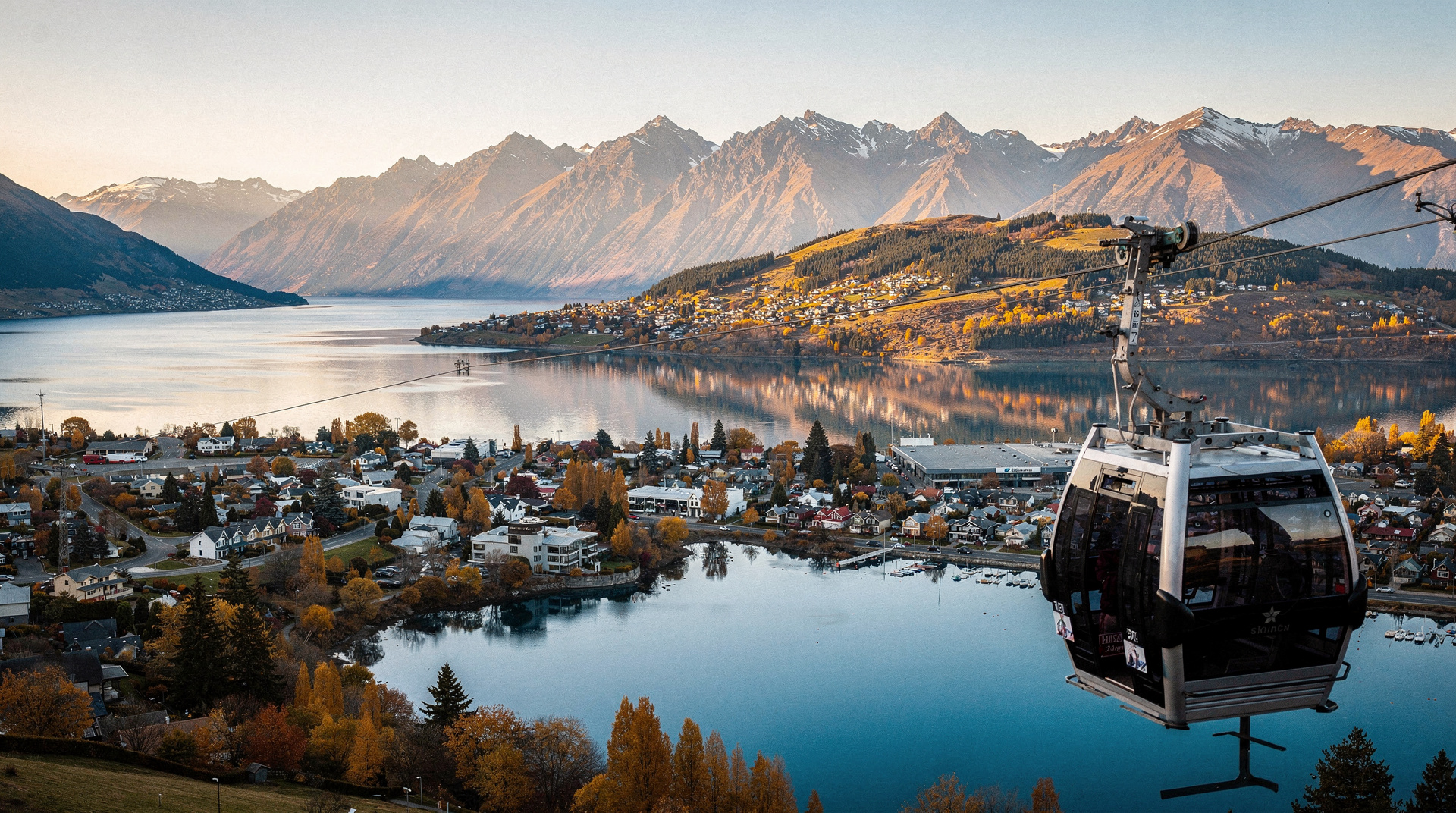
Queenstown
The honest Queenstown planner: bungy, jet boat, ski, scenic flights — real prices in NZD/USD/EUR, what to skip and what's worth your money.
Wanaka
Honest Wanaka guide: Roy's Peak, Cardrona ski, lake kayaking — real NZD/USD/EUR costs and the honest Queenstown vs Wanaka verdict.
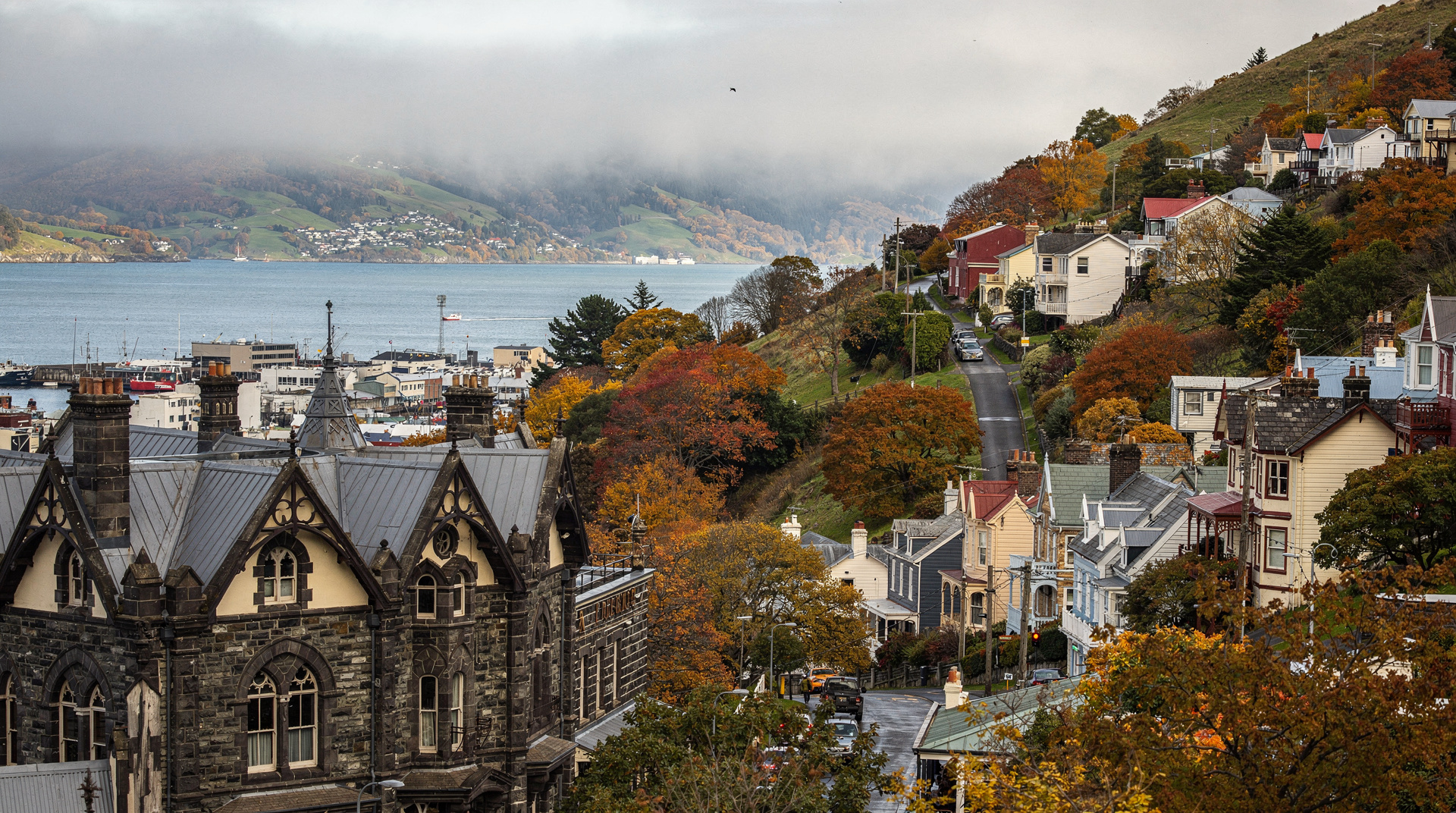
Dunedin
Honest Dunedin guide: Otago Peninsula wildlife, Larnach Castle, Baldwin Street — real NZD/USD/EUR prices and 2 days done right in NZ's Edinburgh.
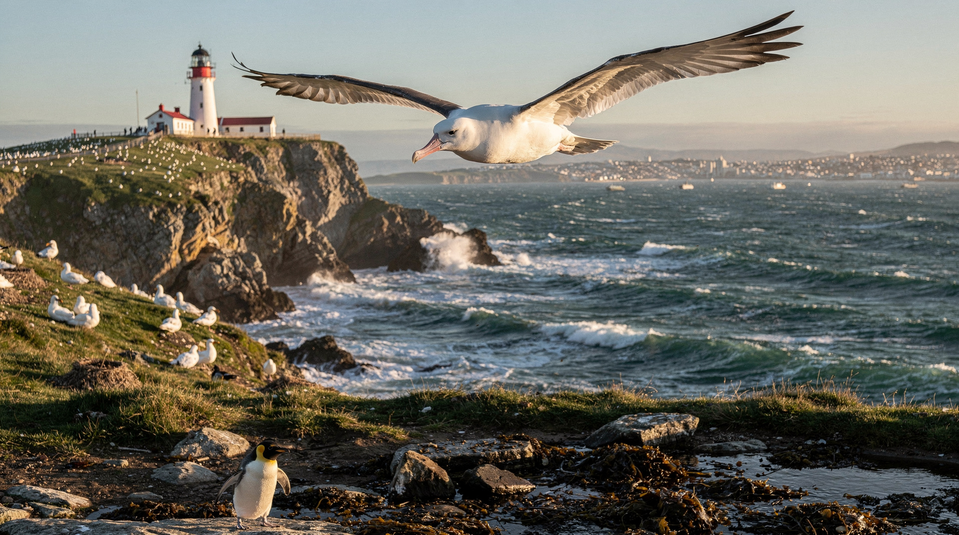
Otago Peninsula
Honest Otago Peninsula guide: albatross colony, yellow-eyed penguins, Larnach Castle — real NZD/USD/EUR prices and the best wildlife timing advice.
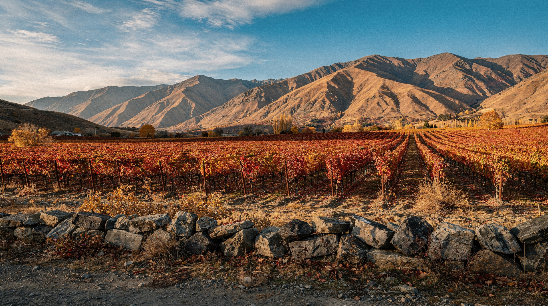
Central Otago wine tour guide
Central Otago is the world's southernmost wine region and NZ's pinot noir capital. Cromwell Basin, Bannockburn, Gibbston — tours and prices NZD/USD/EUR.
Queenstown vs Wanaka
The honest Queenstown vs Wanaka comparison: prices, crowds, ski, hikes, vibe — with a clear verdict for adventure, families, couples and budget travelers.
Last reviewed: